
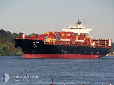
TORRANCE
Container Ship
Current Trip
MY PKG
| Time Travelled | 3 days |
|---|---|
| Remaining Time | --- |
| Distance Travelled | 1304.76 nm |
| Remaining Distance | --- |
| AVG Speed | 15.1 Knopen |
| MAX Speed | 18.8 Knopen |
| AVG Wind | 11.9 knots |
| MAX Wind | 19 knots |
| MIN Temp | 25.1°C / 77.18°F |
| MAX Temp | 28.4°C / 83.12°F |
| Diepgang | 14.1 M |
| Positie ontvangen | 9 m geleden |
Current Position
| Lengtegraad | --- |
|---|---|
| Breedtegraat | --- |
| Status | Under way using engine |
| Snelheid | 13.6 Knopen |
| Koers | 267° |
| Gebied | Singapore Strait |
| Station | T-AIS |
| Positie ontvangen | 9 m geleden |
Info
Information
The current position of TORRANCE is in Singapore Strait with coordinates 5.79671° / 80.53767° as reported on 2025-02-02 08:43 by AIS to our vessel tracker app. The vessel's current speed is 13.6 Knopen
The vessel TORRANCE (IMO: 9218650, MMSI: 636020351) is a Container Ship that was built in 2001 ( 24 Jaar oud ). It's sailing under the flag of [LR] Liberia.
In this page you can find informations about the vessels current position, last detected port calls, and current voyage information. If the vessels is not in coverage by AIS you will find the latest position.
The current position of TORRANCE is detected by our AIS receivers and we are not responsible for the reliability of the data. The last position was recorded while the vessel was in Coverage by the Ais receivers of our vessel tracking app.
The current draught of TORRANCE as reported by AIS is 14.1 meters
Weather
| Temperature | 27.9°C / 82.22°F |
|---|---|
| Wind Speed | 17 knots |
| Direction | 79° E |
| Pressure | 1008.3 hPa |
| Humidity | 74.7 % |
| Cloud Coverage | 45 % |
Featured Company
Last Port Calls
| Port | Arrival | Departure | Time In Port |
|---|---|---|---|
| 2025-01-29 07:57 | 2025-01-29 18:25 | 10 h | |
| 2025-01-23 21:09 | 2025-01-24 10:05 | 12 h | |
| 2025-01-20 21:49 | 2025-01-21 20:05 | 22 h | |
| 2025-01-17 07:16 | 2025-01-18 08:01 | 1 d | |
| 2024-12-31 17:25 | 2025-01-01 09:45 | 16 h | |
| 2024-12-26 13:33 | 2024-12-27 03:09 | 13 h | |
| 2024-12-21 06:53 | 2024-12-22 12:01 | 1 d | |
| 2024-12-17 14:17 | 2024-12-18 17:45 | 1 d | |
| 2024-12-10 17:49 | 2024-12-11 12:00 | 18 h | |
| 2024-12-04 10:52 | 2024-12-04 20:44 | 9 h |
Most Visited Ports (Last year)
| Port | Arrivals | |
|---|---|---|
| 7 | ||
| 5 | ||
| 4 | ||
| 4 | ||
| 4 | ||
| 3 |
Last Trips
| Origin | Departure | Destination | Arrival | Distance | |
|---|---|---|---|---|---|
| 2025-01-24 18:05 | 2025-01-29 15:57 | 1688.11 nm | |||
| 2025-01-22 04:05 | 2025-01-24 05:09 | 780.98 nm | |||
| 2025-01-18 16:01 | 2025-01-21 05:49 | 225.40 nm | |||
| 2025-01-01 17:45 | 2025-01-17 15:16 | 2691.67 nm | |||
| 2024-12-27 08:39 | 2025-01-01 01:25 | 1436.79 nm | |||
| 2024-12-22 17:31 | 2024-12-26 19:03 | 1254.91 nm | |||
| 2024-12-18 23:15 | 2024-12-21 12:23 | 543.13 nm | |||
| 2024-12-11 20:00 | 2024-12-17 19:47 | 2301.55 nm | |||
| 2024-12-05 04:44 | 2024-12-11 01:49 | 1664.47 nm | |||
| 2024-12-02 13:12 | 2024-12-04 18:52 | 782.87 nm |
Events
| Tijd | Evenement | Details | Positie / Bestemming | Info |
|---|---|---|---|---|
| 2025-02-02 08:43 | Gevonden in zee | Sri Lankan part of the Indian Ocean |
5.79671 / 80.53767
Indian Ocean
|
Snelheid: 13.6 kn Koers: 267° |
| 2025-02-02 08:43 | Status Changed | Under way using engine Default |
5.79671 / 80.53767
MY PKG
|
Snelheid: 13.5 kn Koers: 268° |
| 2025-02-02 08:43 | Binnenbereik |
5.79671 / 80.53767
Indian Ocean
|
Snelheid: 13.6 kn Koers: 267° |
|
| 2025-01-29 18:25 | Vertrekhaven |
|
2.90110 / 101.26563
MY PKG
|
Snelheid: 12 kn Koers: 221° |
| 2025-01-29 18:13 | Start beweging |
2.93211 / 101.28859
[MY] PORT KLANG
|
Snelheid: 8.4 kn Koers: 220° |
|
| 2025-01-29 08:29 | Stop beweging |
2.93357 / 101.29312
[MY] PORT KLANG
|
Snelheid: 0.3 kn Koers: 31° |
|
| 2025-01-29 07:57 | Aankomsthaven |
|
2.91017 / 101.27584
[MY] PORT KLANG
|
Snelheid: 10.3 kn Koers: 40° |
| 2025-01-29 02:25 | Start beweging | 14.94 nm, South West of PORT KLANG |
2.82697 / 101.16569
MY PKG
|
Snelheid: 5.9 kn Koers: 352° |
| 2025-01-29 01:57 | Stop beweging | 15.27 nm, South West of PORT KLANG |
2.81968 / 101.16502
MY PKG
|
Snelheid: 0.2 kn Koers: 127° |
| 2025-01-28 11:48 | Buitenbereik |
1.21501 / 103.47111
Singapore Strait
MY PKG
|
Snelheid: 20.7 kn Koers: 281.1° |