
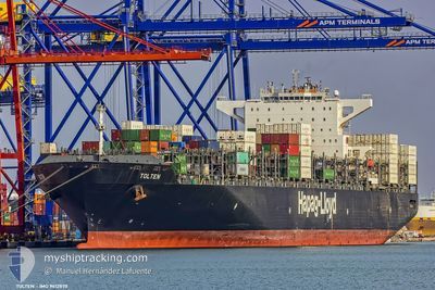
TOLTEN
Cargo
Current Trip
| Time Travelled | 12 days |
|---|---|
| Remaining Time | 14 days |
| Distance Travelled | 5271.65 nm |
| Remaining Distance | 6263.05 nm |
| AVG Speed | 18.2 Knopen |
| MAX Speed | 21.9 Knopen |
| AVG Wind | 10 knots |
| MAX Wind | 21 knots |
| MIN Temp | 20.2°C / 68.36°F |
| MAX Temp | 29.2°C / 84.56°F |
| Diepgang | 13 M |
| Positie ontvangen | 20 h, 5 m geleden |
Current Position
| Lengtegraad | --- |
|---|---|
| Breedtegraat | --- |
| Status | Under way using engine |
| Snelheid | 17.2 Knopen |
| Koers | 302.1° |
| Gebied | South Atlantic Ocean |
| Station | T-AIS |
| Positie ontvangen | 20 h, 5 m geleden |
Information
The current position of TOLTEN is in South Atlantic Ocean with coordinates -32.74598° / 14.89430° as reported on 2025-02-17 23:03 by AIS to our vessel tracker app. The vessel's current speed is 17.2 Knopen and is heading at the port of NEW YORK. The estimated time of arrival as calculated by MyShipTracking vessel tracking app is 2025-03-05 17:48 LT
The vessel TOLTEN (MMSI: 636092678) is a Cargo It's sailing under the flag of [LR] Liberia.
In this page you can find informations about the vessels current position, last detected port calls, and current voyage information. If the vessels is not in coverage by AIS you will find the latest position.
The current position of TOLTEN is detected by our AIS receivers and we are not responsible for the reliability of the data. The last position was recorded while the vessel was in Coverage by the Ais receivers of our vessel tracking app.
The current draught of TOLTEN as reported by AIS is 13 meters
Weather
| Temperature | 21.3°C / 70.34°F |
|---|---|
| Wind Speed | 16 knots |
| Direction | 138° SE |
| Pressure | 1018.3 hPa |
| Humidity | 80.1 % |
| Cloud Coverage | 100 % |
Featured Company
Last Port Calls
| Port | Arrival | Departure | Time In Port |
|---|---|---|---|
| 2025-02-04 23:01 | 2025-02-06 16:41 | 1 d | |
| 2025-02-02 09:25 | 2025-02-03 21:13 | 1 d | |
| 2025-01-30 03:52 | 2025-01-31 04:45 | 1 d | |
| 2024-12-27 23:08 | 2024-12-28 19:08 | 20 h | |
| 2024-12-26 05:51 | 2024-12-27 14:05 | 1 d | |
| 2024-12-21 08:21 | 2024-12-22 12:59 | 1 d | |
| 2024-12-18 09:37 | 2024-12-20 08:50 | 1 d |
Most Visited Ports (Last year)
| Port | Arrivals | |
|---|---|---|
| 6 | ||
| 5 | ||
| 4 | ||
| 4 | ||
| 4 | ||
| 4 |
Last Trips
| Origin | Departure | Destination | Arrival | Distance | |
|---|---|---|---|---|---|
| 2025-02-04 02:43 | 2025-02-05 04:31 | 438.79 nm | |||
| 2025-01-31 09:45 | 2025-02-02 14:55 | 584.25 nm | |||
| 2024-12-28 14:08 | 2025-01-30 08:52 | 11634.46 nm | |||
| 2024-12-27 09:05 | 2024-12-27 18:08 | 124.52 nm | |||
| 2024-12-22 07:59 | 2024-12-26 00:51 | 582.86 nm | |||
| 2024-12-20 03:50 | 2024-12-21 03:21 | 309.05 nm | |||
| 2024-11-22 04:03 | 2024-12-18 04:37 | 11506.97 nm |
Events
| Tijd | Evenement | Details | Positie / Bestemming | Info |
|---|---|---|---|---|
| 2025-02-17 23:06 | Status Changed | Default Under way using engine |
-32.73806 / 14.88004
USNYC
|
Snelheid: 17.2 kn Koers: 302.1° |
| 2025-02-17 23:03 | Status Changed | Under way using engine Default |
-32.74598 / 14.89430
USNYC
|
Snelheid: 17.4 kn Koers: 303° |
| 2025-02-17 23:03 | Buitenbereik |
-32.74598 / 14.89430
South Atlantic Ocean
|
Snelheid: 17.2 kn Koers: 302.1° |
|
| 2025-02-17 22:55 | Binnenbereik |
-32.74598 / 14.89430
South Atlantic Ocean
|
Snelheid: 17.2 kn Koers: 302.1° |
|
| 2025-02-17 13:18 | Status Changed | Default Under way using engine |
-34.41944 / 17.84125
USNYC
|
Snelheid: 18.5 kn Koers: 310° |
| 2025-02-17 13:09 | Buitenbereik |
-34.44764 / 17.88230
South Atlantic Ocean
|
Snelheid: 18.5 kn Koers: 310° |
|
| 2025-02-17 12:55 | Status Changed | Under way using engine Default |
-34.49735 / 17.95154
USNYC
|
Snelheid: 18.6 kn Koers: 309° |
| 2025-02-17 12:52 | Status Changed | Default Under way using engine |
-34.50724 / 17.96526
USNYC
|
Snelheid: 18.4 kn Koers: 307° |
| 2025-02-17 12:22 | Draught Changed | 13 13.6 |
-34.58537 / 18.14352
USNYC
|
Snelheid: 18.1 kn Koers: 298° |
| 2025-02-17 11:34 | Status Changed | Under way using engine Default |
-34.68453 / 18.39607
USNYC
|
Snelheid: 18.4 kn Koers: 295° |