
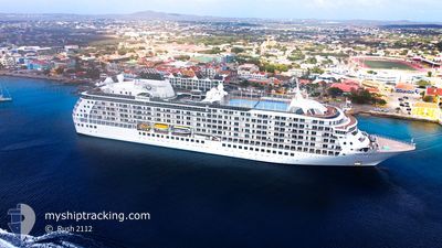
THE WORLD
Passengers Ship
Current Trip
COSMR
| Time Travelled | 2 days |
|---|---|
| Remaining Time | --- |
| Distance Travelled | 275.86 nm |
| Remaining Distance | --- |
| AVG Speed | 7.9 Knopen |
| MAX Speed | 9.4 Knopen |
| AVG Wind | 17.7 knots |
| MAX Wind | 25.7 knots |
| MIN Temp | 25°C / 77°F |
| MAX Temp | 26.2°C / 79.16°F |
| Diepgang | 7 M |
| Positie ontvangen | 2 d geleden |
Current Position
| Lengtegraad | --- |
|---|---|
| Breedtegraat | --- |
| Status | Moored |
| Snelheid | |
| Koers | 25° |
| Gebied | Caribbean Sea |
| Station | T-AIS |
| Positie ontvangen | 2 d geleden |
Info
Information
The current position of THE WORLD is in Caribbean Sea with coordinates 11.25032° / -74.21587° as reported on 2025-02-27 23:35 by AIS to our vessel tracker app. The vessel's current speed is 0 Knopen
The vessel THE WORLD (IMO: 9219331, MMSI: 311213000) is a Passengers Ship that was built in 2002 ( 23 Jaar oud ). It's sailing under the flag of [BS] Bahamas.
In this page you can find informations about the vessels current position, last detected port calls, and current voyage information. If the vessels is not in coverage by AIS you will find the latest position.
The current position of THE WORLD is detected by our AIS receivers and we are not responsible for the reliability of the data. The last position was recorded while the vessel was in Coverage by the Ais receivers of our vessel tracking app.
The current draught of THE WORLD as reported by AIS is 7 meters
Weather
| Temperature | 25.9°C / 78.62°F |
|---|---|
| Wind Speed | 19 knots |
| Direction | 93° E |
| Pressure | 1013.8 hPa |
| Humidity | 81.7 % |
| Cloud Coverage | 15 % |
Featured Company
Last Port Calls
| Port | Arrival | Departure | Time In Port |
|---|---|---|---|
| 2025-02-27 12:15 | 2025-02-28 01:11 | 12 h | |
| 2025-02-24 15:09 | 2025-02-26 22:58 | 2 d | |
| 2025-02-17 16:19 | 2025-02-18 23:53 | 1 d | |
| 2025-02-12 13:49 | 2025-02-14 04:52 | 1 d | |
| 2025-02-09 13:31 | 2025-02-12 02:15 | 2 d | |
| 2025-02-01 22:55 | 2025-02-04 04:51 | 2 d | |
| 2025-01-23 05:19 | 2025-01-23 06:35 | 1 h | |
| 2025-01-15 15:40 | 2025-01-17 07:07 | 1 d | |
| 2025-01-12 15:35 | 2025-01-15 07:04 | 2 d | |
| 2025-01-06 16:06 | 2025-01-09 07:14 | 2 d |
Most Visited Ports (Last year)
| Port | Arrivals | |
|---|---|---|
| 2 | ||
| 2 | ||
| 2 | ||
| 2 | ||
| 2 | ||
| 2 |
Last Trips
| Origin | Departure | Destination | Arrival | Distance | |
|---|---|---|---|---|---|
| 2025-02-26 17:58 | 2025-02-27 07:15 | 142.40 nm | |||
| 2025-02-18 17:53 | 2025-02-24 10:09 | 863.71 nm | |||
| 2025-02-13 22:52 | 2025-02-17 10:19 | 451.57 nm | |||
| 2025-02-11 20:15 | 2025-02-12 07:49 | 78.72 nm | |||
| 2025-02-03 22:51 | 2025-02-09 07:31 | 1047.65 nm | |||
| 2025-01-22 23:35 | 2025-02-01 16:55 | 1216.33 nm | |||
| 2025-01-16 23:07 | 2025-01-22 22:19 | 1020.47 nm | |||
| 2025-01-14 23:04 | 2025-01-15 07:40 | 90.16 nm | |||
| 2025-01-08 23:14 | 2025-01-12 07:35 | 449.25 nm | |||
| 2024-12-30 17:59 | 2025-01-06 08:06 | 1319.04 nm |
Events
| Tijd | Evenement | Details | Positie / Bestemming | Info |
|---|---|---|---|---|
| 2025-03-01 12:03 | Stop beweging |
12.52217 / -70.04633
COSMR
|
Snelheid: 0.3 kn Koers: 129° |
|
| 2025-02-28 01:12 | Start beweging | 0.35 nm, North West of SANTA MARTA |
11.24762 / -74.22498
COSMR
|
Snelheid: 6.9 kn Koers: 255° |
| 2025-02-28 01:11 | Vertrekhaven |
|
11.24762 / -74.22498
COSMR
|
Snelheid: 2.1 kn Koers: 20° |
| 2025-02-27 23:41 | Status Changed | Default Moored |
11.25028 / -74.21587
[CO] SANTA MARTA
|
Snelheid: Koers: 25° |
| 2025-02-27 23:35 | Buitenbereik |
11.25032 / -74.21587
Caribbean Sea
[CO] SANTA MARTA
|
Snelheid: Koers: 301.9° |
|
| 2025-02-27 23:32 | Status Changed | Moored Default |
11.25032 / -74.21587
[CO] SANTA MARTA
|
Snelheid: Koers: 25° |
| 2025-02-27 23:26 | Status Changed | Default Moored |
11.25032 / -74.21587
[CO] SANTA MARTA
|
Snelheid: Koers: 25° |
| 2025-02-27 23:20 | Status Changed | Moored Default |
11.25032 / -74.21587
[CO] SANTA MARTA
|
Snelheid: Koers: 25° |
| 2025-02-27 23:11 | Binnenbereik |
11.25032 / -74.21587
Caribbean Sea
[CO] SANTA MARTA
|
Snelheid: Koers: 9.8° |
|
| 2025-02-27 12:28 | Stop beweging |
11.25027 / -74.21588
[CO] SANTA MARTA
|
Snelheid: 0.1 kn Koers: 26° |