
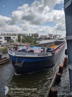
STUDIUM
Cargo
Current Trip
INGEN
| Time Travelled | 8 h, 54 mins |
|---|---|
| Remaining Time | --- |
| Distance Travelled | 44.33 nm |
| Remaining Distance | --- |
| AVG Speed | 6.5 Knopen |
| MAX Speed | 7.5 Knopen |
| AVG Wind | 11.9 knots |
| MAX Wind | 16 knots |
| MIN Temp | 8.8°C / 47.84°F |
| MAX Temp | 14.6°C / 58.28°F |
| Diepgang | 3.7 M |
| Positie ontvangen | Nu |
Current Position
| Lengtegraad | --- |
|---|---|
| Breedtegraat | --- |
| Status | Under way using engine |
| Snelheid | |
| Koers | --- |
| Gebied | North Sea |
| Station | T-AIS |
| Positie ontvangen | Nu |
Info
Information
The current position of STUDIUM is in North Sea with coordinates 52.53627° / 5.43650° as reported on 2026-02-27 00:46 by AIS to our vessel tracker app. The vessel's current speed is 0 Knopen
The vessel STUDIUM (MMSI: 244650868) is a Cargo It's sailing under the flag of [NL] Netherlands.
In this page you can find informations about the vessels current position, last detected port calls, and current voyage information. If the vessels is not in coverage by AIS you will find the latest position.
The current position of STUDIUM is detected by our AIS receivers and we are not responsible for the reliability of the data. The last position was recorded while the vessel was in Coverage by the Ais receivers of our vessel tracking app.
The current draught of STUDIUM as reported by AIS is 3.7 meters
Weather
| Temperature | 9°C / 48.2°F |
|---|---|
| Wind Speed | 12 knots |
| Direction | 202° SSW |
| Pressure | 1015.6 hPa |
| Humidity | 89.7 % |
| Cloud Coverage | 100 % |
Featured Company
Last Port Calls
| Port | Arrival | Departure | Time In Port |
|---|---|---|---|
| 2026-02-26 16:00 | 2026-02-26 16:53 | 52 m | |
| 2026-02-25 22:58 | 2026-02-26 10:40 | 11 h | |
| 2026-02-25 19:01 | 2026-02-25 19:24 | 22 m | |
| 2026-02-20 14:46 | 2026-02-20 15:53 | 1 h | |
| 2026-02-19 18:56 | 2026-02-20 08:35 | 13 h | |
| 2026-02-18 18:50 | 2026-02-18 19:56 | 1 h | |
| 2026-02-18 09:59 | 2026-02-18 10:16 | 16 m | |
| 2026-02-17 18:17 | 2026-02-17 18:46 | 28 m | |
| 2026-02-16 17:47 | 2026-02-16 18:24 | 36 m | |
| 2026-02-15 13:58 | 2026-02-16 15:52 | 1 d |
Most Visited Ports (Last year)
| Port | Arrivals | |
|---|---|---|
| 39 | ||
| 28 | ||
| 23 | ||
| 18 | ||
| 13 | ||
| 12 |
Last Trips
| Origin | Departure | Destination | Arrival | Distance | |
|---|---|---|---|---|---|
| 2026-02-26 10:40 | 2026-02-26 16:00 | 30.25 nm | |||
| 2026-02-25 19:24 | 2026-02-25 22:58 | 31.99 nm | |||
| 2026-02-20 15:53 | 2026-02-25 19:01 | 153.48 nm | |||
| 2026-02-20 08:35 | 2026-02-20 14:46 | 30.19 nm | |||
| 2026-02-18 19:56 | 2026-02-19 18:56 | 55.13 nm | |||
| 2026-02-18 10:16 | 2026-02-18 18:50 | 56.33 nm | |||
| 2026-02-17 18:46 | 2026-02-18 09:59 | 30.71 nm | |||
| 2026-02-16 18:24 | 2026-02-17 18:17 | 11.53 nm | |||
| 2026-02-16 15:52 | 2026-02-16 17:47 | 11.11 nm | |||
| 2026-02-14 07:44 | 2026-02-15 13:58 | 101.42 nm |
Events
| Tijd | Evenement | Details | Positie / Bestemming | Info |
|---|---|---|---|---|
| 2026-02-26 22:44 | Stop beweging | --- |
52.53615 / 5.43675
INGEN
|
Snelheid: 0.3 kn Koers: 511° |
| 2026-02-26 22:36 | Start beweging | --- |
52.52927 / 5.43493
INGEN
|
Snelheid: 3.3 kn Koers: 5.2° |
| 2026-02-26 22:30 | Stop beweging | --- |
52.52710 / 5.43470
INGEN
|
Snelheid: Koers: 511° |
| 2026-02-26 19:29 | Start beweging | --- |
52.38071 / 4.96248
INGEN
|
Snelheid: 3.9 kn Koers: 136.4° |
| 2026-02-26 19:17 | Stop beweging | --- |
52.38192 / 4.95998
INGEN
|
Snelheid: 0.3 kn Koers: 511° |
| 2026-02-26 15:53 | Vertrekhaven |
|
52.04622 / 5.10745
INGEN
|
Snelheid: 7.2 kn Koers: 344.6° |
| 2026-02-26 15:00 | Aankomsthaven |
|
52.00794 / 5.10825
[NL] NIEUWEGEIN
|
Snelheid: 5.2 kn Koers: 50.6° |
| 2026-02-26 14:56 | Binnenbereik |
52.00434 / 5.10511
North Sea
|
Snelheid: 5.2 kn Koers: 50.6° |
|
| 2026-02-26 12:04 | Buitenbereik |
51.91613 / 4.77191
North Sea
|
Snelheid: 5.9 kn Koers: 86.8° |
|
| 2026-02-26 09:40 | Vertrekhaven |
|
51.89705 / 4.37634
INGEN
|
Snelheid: 7.7 kn Koers: 104.8° |