
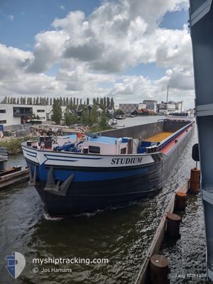
STUDIUM
Cargo
Current Trip
| Time Travelled | 4 days |
|---|---|
| Remaining Time | 1 h, 11 mins |
| Distance Travelled | 116.77 nm |
| Remaining Distance | 13.27 nm |
| AVG Speed | 6.8 Noeuds |
| MAX Speed | 9.5 Noeuds |
| AVG Wind | 11.6 knots |
| MAX Wind | 15.8 knots |
| MIN Temp | 6.5°C / 43.7°F |
| MAX Temp | 14.5°C / 58.1°F |
| Tirant d eau | 3.7 m |
| Position reçue | Maintenant |
Current Position
| Longitude | --- |
|---|---|
| Latitude | --- |
| Etat | Under way using engine |
| Vitesse | 9.2 Noeuds |
| Parcours | 238.4° |
| Zone | North Sea |
| Station | T-AIS |
| Position reçue | Maintenant |
Info
Information
The current position of STUDIUM is in North Sea with coordinates 52.44145° / 5.20407° as reported on 2026-02-25 13:40 by AIS to our vessel tracker app. The vessel's current speed is 9.2 Noeuds and is heading at the port of AMSTERDAM. The estimated time of arrival as calculated by MyShipTracking vessel tracking app is 2026-02-25 15:52 LT
The vessel STUDIUM (MMSI: 244650868) is a Cargo It's sailing under the flag of [NL] Netherlands.
In this page you can find informations about the vessels current position, last detected port calls, and current voyage information. If the vessels is not in coverage by AIS you will find the latest position.
The current position of STUDIUM is detected by our AIS receivers and we are not responsible for the reliability of the data. The last position was recorded while the vessel was in Coverage by the Ais receivers of our vessel tracking app.
The current draught of STUDIUM as reported by AIS is 3.7 meters
Weather
| Temperature | 10.7°C / 51.26°F |
|---|---|
| Wind Speed | 10 knots |
| Direction | 180° S |
| Pressure | 1018.4 hPa |
| Humidity | 83.9 % |
| Cloud Coverage | 20 % |
Featured Company
Last Port Calls
| Port | Arrival | Departure | Time In Port |
|---|---|---|---|
| 2026-02-20 14:46 | 2026-02-20 15:53 | 1 h | |
| 2026-02-19 18:56 | 2026-02-20 08:35 | 13 h | |
| 2026-02-18 18:50 | 2026-02-18 19:56 | 1 h | |
| 2026-02-18 09:59 | 2026-02-18 10:16 | 16 m | |
| 2026-02-17 18:17 | 2026-02-17 18:46 | 28 m | |
| 2026-02-16 17:47 | 2026-02-16 18:24 | 36 m | |
| 2026-02-15 13:58 | 2026-02-16 15:52 | 1 d | |
| 2026-02-13 20:44 | 2026-02-14 07:44 | 11 h | |
| 2026-02-12 22:38 | 2026-02-13 13:33 | 14 h | |
| 2026-02-11 16:33 | 2026-02-12 16:17 | 23 h |
Most Visited Ports (Last year)
| Port | Arrivals | |
|---|---|---|
| 39 | ||
| 26 | ||
| 23 | ||
| 18 | ||
| 12 | ||
| 12 |
Last Trips
| Origin | Departure | Destination | Arrival | Distance | |
|---|---|---|---|---|---|
| 2026-02-20 08:35 | 2026-02-20 14:46 | 30.19 nm | |||
| 2026-02-18 19:56 | 2026-02-19 18:56 | 55.13 nm | |||
| 2026-02-18 10:16 | 2026-02-18 18:50 | 56.33 nm | |||
| 2026-02-17 18:46 | 2026-02-18 09:59 | 30.71 nm | |||
| 2026-02-16 18:24 | 2026-02-17 18:17 | 11.53 nm | |||
| 2026-02-16 15:52 | 2026-02-16 17:47 | 11.11 nm | |||
| 2026-02-14 07:44 | 2026-02-15 13:58 | 101.42 nm | |||
| 2026-02-13 13:33 | 2026-02-13 20:44 | 33.42 nm | |||
| 2026-02-12 16:17 | 2026-02-12 22:38 | 43.47 nm | |||
| 2026-02-11 14:03 | 2026-02-11 16:33 | 11.69 nm |
Events
| Heure | Evenement | Détails | Position/ Destination | Info |
|---|---|---|---|---|
| 2026-02-25 12:32 | Démarrage | --- |
52.52629 / 5.43389
INGEN
|
Vitesse: 5.5 kn Parcours: 187.5° |
| 2026-02-25 12:24 | Arret | --- |
52.52832 / 5.43407
INGEN
|
Vitesse: 0.3 kn Parcours: 511° |
| 2026-02-25 11:31 | Tirant d'eau modifié | 3.7 0 |
52.60538 / 5.57590
INGEN
|
Vitesse: 9.1 kn Parcours: 252.5° |
| 2026-02-25 11:31 | Changement d'ETA | 2027/01/12 12:00 |
52.60538 / 5.57590
INGEN
|
Vitesse: 9.1 kn Parcours: 252.5° |
| 2026-02-25 11:28 | Tirant d'eau modifié | 0 3.7 |
52.60769 / 5.58707
INGEN
|
Vitesse: 9.2 kn Parcours: 250.6° |
| 2026-02-25 11:19 | Tirant d'eau modifié | 3.7 0 |
52.61410 / 5.62488
INGEN
|
Vitesse: 9.2 kn Parcours: 256.8° |
| 2026-02-25 11:19 | Changement d'ETA | 2027/01/12 12:00 |
52.61410 / 5.62488
INGEN
|
Vitesse: 9.2 kn Parcours: 256.8° |
| 2026-02-25 11:15 | Tirant d'eau modifié | 0 3.7 |
52.61521 / 5.64012
INGEN
|
Vitesse: 9.3 kn Parcours: 275.8° |
| 2026-02-25 11:13 | Tirant d'eau modifié | 3.7 0 |
52.61316 / 5.64709
INGEN
|
Vitesse: 9.5 kn Parcours: 313.1° |
| 2026-02-25 11:13 | Changement d'ETA | 2027/01/12 12:00 |
52.61316 / 5.64709
INGEN
|
Vitesse: 9.5 kn Parcours: 313.1° |