
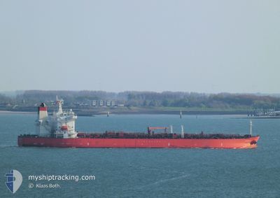
ST.NIKOLAI
Tanker
Current Trip
| Time Travelled | 15 days |
|---|---|
| Remaining Time | --- |
| Distance Travelled | 4625.68 nm |
| Remaining Distance | --- |
| AVG Speed | 12.3 Knopen |
| MAX Speed | 16 Knopen |
| AVG Wind | 10.8 knots |
| MAX Wind | 25 knots |
| MIN Temp | 13.9°C / 57.02°F |
| MAX Temp | 29.6°C / 85.28°F |
| Diepgang | 11 M |
| Positie ontvangen | 7 d geleden |
Current Position
| Lengtegraad | -62.79008° |
|---|---|
| Breedtegraat | 35.03807° |
| Status | Under way using engine |
| Snelheid | 12 Knopen |
| Koers | 65.3° |
| Gebied | North Atlantic Ocean |
| Station | T-AIS |
| Positie ontvangen | 7 d geleden |
Info
Information
The current position of ST.NIKOLAI is in North Atlantic Ocean with coordinates 35.03807° / -62.79008° as reported on 2024-05-20 13:14 by AIS to our vessel tracker app. The vessel's current speed is 12 Knopen and is heading at the port of AMSTERDAM. The estimated time of arrival as calculated by MyShipTracking vessel tracking app is 2024-05-31 05:00 LT
The vessel ST.NIKOLAI (IMO: 9788485, MMSI: 563065100) is a Tanker It's sailing under the flag of [SG] Singapore.
In this page you can find informations about the vessels current position, last detected port calls, and current voyage information. If the vessels is not in coverage by AIS you will find the latest position.
The current position of ST.NIKOLAI is detected by our AIS receivers and we are not responsible for the reliability of the data. The last position was recorded while the vessel was in Coverage by the Ais receivers of our vessel tracking app.
The current draught of ST.NIKOLAI as reported by AIS is 11 meters
Weather
| Temperature | 14°C / 57.2°F |
|---|---|
| Wind Speed | 18 knots |
| Direction | 237° WSW |
| Pressure | 1016.8 hPa |
| Humidity | 96.1 % |
| Cloud Coverage | 100 % |
Featured Company
Last Port Calls
| Port | Arrival | Departure | Time In Port |
|---|---|---|---|
| 2024-05-11 09:51 | 2024-05-13 04:10 | 1 d | |
| 2024-04-26 11:31 | 2024-04-27 21:08 | 1 d | |
| 2024-04-05 07:33 | 2024-04-05 16:30 | 8 h | |
| 2024-03-01 07:53 | 2024-03-03 03:41 | 1 d |
Last Trips
| Origin | Departure | Destination | Arrival | Distance | |
|---|---|---|---|---|---|
| 2024-04-27 21:08 | 2024-05-11 09:51 | 2285.26 nm | |||
| 2024-03-03 03:41 | 2024-04-26 11:31 | 8561.73 nm | |||
| 2024-03-03 03:41 | 2024-04-05 07:33 | 3148.33 nm | |||
| 2024-02-18 10:45 | 2024-03-01 07:53 | 986.54 nm |
Events
| Tijd | Evenement | Details | Positie / Bestemming | Info |
|---|---|---|---|---|
| 2024-05-20 13:19 | Status Changed | Default Under way using engine |
35.04333 / -62.77167
AMSTERDAM
|
Snelheid: 12 kn Koers: 65.3° |
| 2024-05-20 13:14 | Buitenbereik |
35.03807 / -62.79008
North Atlantic Ocean
AMSTERDAM
|
Snelheid: 12 kn Koers: 65.3° |
|
| 2024-05-20 13:03 | Status Changed | Under way using engine Default |
35.02351 / -62.82852
AMSTERDAM
|
Snelheid: 12 kn Koers: 64° |
| 2024-05-20 13:01 | Status Changed | Default Under way using engine |
35.01833 / -62.83667
AMSTERDAM
|
Snelheid: 12.3 kn Koers: 74° |
| 2024-05-20 11:46 | Status Changed | Under way using engine Default |
34.93943 / -63.13976
AMSTERDAM
|
Snelheid: 12.5 kn Koers: 71° |
| 2024-05-20 11:41 | Status Changed | Default Under way using engine |
34.93396 / -63.15847
AMSTERDAM
|
Snelheid: 12.4 kn Koers: 70.1° |
| 2024-05-20 11:02 | Status Changed | Under way using engine Default |
34.88671 / -63.31016
AMSTERDAM
|
Snelheid: 12 kn Koers: 69° |
| 2024-05-20 10:55 | Status Changed | Default Under way using engine |
34.87667 / -63.33500
AMSTERDAM
|
Snelheid: 12 kn Koers: 69.2° |
| 2024-05-20 10:54 | Status Changed | Under way using engine Default |
34.87657 / -63.34166
AMSTERDAM
|
Snelheid: 12 kn Koers: 70° |
| 2024-05-20 10:54 | Wijzig zee gebeid | Bermudian part of the North Atlantic Ocean Bahamas part of the North Atlantic Ocean |
34.87657 / -63.34166
North Atlantic Ocean
AMSTERDAM
|
Snelheid: 12 kn Koers: 69.2° |