

STARVIP
General Cargo

Current Trip
| Time Travelled | 1 day |
|---|---|
| Remaining Time | 3 days |
| Distance Travelled | 219.10 nm |
| Remaining Distance | 1208.87 nm |
| AVG Speed | 10.3 Knopen |
| MAX Speed | 11.1 Knopen |
| AVG Wind | 10.1 knots |
| MAX Wind | 21.7 knots |
| MIN Temp | 12.5°C / 54.5°F |
| MAX Temp | 18.6°C / 65.48°F |
| Diepgang | 8.7 M |
| Positie ontvangen | 1 d geleden |
Current Position
| Lengtegraad | --- |
|---|---|
| Breedtegraat | --- |
| Status | Under way using engine |
| Snelheid | 9.9 Knopen |
| Koers | 214.5° |
| Gebied | Aegean Sea |
| Station | T-AIS |
| Positie ontvangen | 1 d geleden |
Information
The current position of STARVIP is in Aegean Sea with coordinates 37.32347° / 23.94853° as reported on 2025-03-29 04:03 by AIS to our vessel tracker app. The vessel's current speed is 9.9 Knopen and is heading at the port of SAGUNTO. The estimated time of arrival as calculated by MyShipTracking vessel tracking app is 2025-04-02 23:24 LT
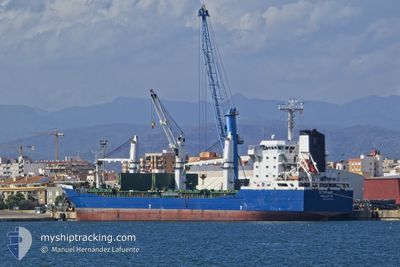
The vessel STARVIP (IMO: 9326495, MMSI: 256007000) is a General Cargo that was built in 2007 ( 18 Jaar oud ). It's sailing under the flag of [MT] Malta.
In this page you can find informations about the vessels current position, last detected port calls, and current voyage information. If the vessels is not in coverage by AIS you will find the latest position.
The current position of STARVIP is detected by our AIS receivers and we are not responsible for the reliability of the data. The last position was recorded while the vessel was in Coverage by the Ais receivers of our vessel tracking app.
The current draught of STARVIP as reported by AIS is 8.7 meters
Weather
| Temperature | 15.6°C / 60.08°F |
|---|---|
| Wind Speed | 15 knots |
| Direction | 252° WSW |
| Pressure | 1003.7 hPa |
| Humidity | 73.5 % |
| Cloud Coverage | 100 % |


Featured Company
Last Port Calls
| Port | Arrival | Departure | Time In Port |
|---|---|---|---|
| 2025-03-19 22:22 | 2025-03-28 11:17 | 8 d | |
| 2025-02-13 13:07 | 2025-02-14 19:38 | 1 d | |
| 2025-01-28 15:53 | 2025-02-01 15:57 | 4 d |
Last Trips
| Origin | Departure | Destination | Arrival | Distance | |
|---|---|---|---|---|---|
| 2025-02-14 20:38 | 2025-03-20 01:22 | 2978.62 nm | |||
| 2025-02-01 17:57 | 2025-02-13 14:07 | 2627.56 nm | |||
| 2024-12-27 17:05 | 2025-01-28 17:53 | 1280.98 nm |
Events
| Tijd | Evenement | Details | Positie / Bestemming | Info |
|---|---|---|---|---|
| 2025-03-29 04:07 | Status Changed | Default Under way using engine |
37.31420 / 23.94056
ESSAG
|
Snelheid: 9.9 kn Koers: 214.5° |
| 2025-03-29 04:03 | Buitenbereik |
37.32347 / 23.94853
Aegean Sea
ESSAG
|
Snelheid: 9.9 kn Koers: 214.5° |
|
| 2025-03-29 03:46 | Status Changed | Under way using engine Default |
37.36206 / 23.97964
ESSAG
|
Snelheid: 10.1 kn Koers: 210° |
| 2025-03-29 03:28 | Status Changed | Default Under way using engine |
37.40472 / 24.01221
ESSAG
|
Snelheid: 10.2 kn Koers: 209.5° |
| 2025-03-28 23:34 | Status Changed | Under way using engine Default |
37.92808 / 24.55953
ESSAG
|
Snelheid: 10.5 kn Koers: 209° |
| 2025-03-28 23:34 | Binnenbereik |
37.92808 / 24.55953
Aegean Sea
ESSAG
|
Snelheid: 10.5 kn Koers: 233° |
|
| 2025-03-28 19:13 | Status Changed | Default Under way using engine |
38.35160 / 25.34446
ESSAG
|
Snelheid: 11 kn Koers: 245.9° |
| 2025-03-28 19:00 | Buitenbereik |
38.36800 / 25.39165
Aegean Sea
ESSAG
|
Snelheid: 11 kn Koers: 245.9° |
|
| 2025-03-28 18:04 | Status Changed | Under way using engine Default |
38.44442 / 25.58434
ESSAG
|
Snelheid: 10.7 kn Koers: 215° |
| 2025-03-28 17:48 | Status Changed | Default Under way using engine |
38.48475 / 25.62053
ESSAG
|
Snelheid: 10.6 kn Koers: 214.8° |