
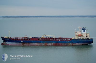
SONGA BREEZE
Oil/Chemical Tanker
Current Trip
| Time Travelled | 7 days |
|---|---|
| Remaining Time | --- |
| Distance Travelled | 1791.73 nm |
| Remaining Distance | --- |
| AVG Speed | 9.7 Knopen |
| MAX Speed | 13.8 Knopen |
| AVG Wind | 3.7 knots |
| MAX Wind | 13 knots |
| MIN Temp | 25°C / 77°F |
| MAX Temp | 30.4°C / 86.72°F |
| Diepgang | 9.5 M |
| Positie ontvangen | 6 d geleden |
Current Position
| Lengtegraad | 103.46663° |
|---|---|
| Breedtegraat | 1.22988° |
| Status | Under way using engine |
| Snelheid | 12.1 Knopen |
| Koers | 284° |
| Gebied | Malacca Strait |
| Station | T-AIS |
| Positie ontvangen | 6 d geleden |
Info
Information
The current position of SONGA BREEZE is in Malacca Strait with coordinates 1.22988° / 103.46663° as reported on 2024-06-04 04:54 by AIS to our vessel tracker app. The vessel's current speed is 12.1 Knopen and is heading at the port of LAS PALMAS. The estimated time of arrival as calculated by MyShipTracking vessel tracking app is 2024-07-10 02:00 LT
The vessel SONGA BREEZE (IMO: 9423645, MMSI: 538005523) is a Oil/Chemical Tanker that was built in 2009 ( 15 Jaar oud ). It's sailing under the flag of [MH] Marshall Is.
In this page you can find informations about the vessels current position, last detected port calls, and current voyage information. If the vessels is not in coverage by AIS you will find the latest position.
The current position of SONGA BREEZE is detected by our AIS receivers and we are not responsible for the reliability of the data. The last position was recorded while the vessel was in Coverage by the Ais receivers of our vessel tracking app.
The current draught of SONGA BREEZE as reported by AIS is 9.5 meters
Weather
| Temperature | 28.6°C / 83.48°F |
|---|---|
| Wind Speed | 10 knots |
| Direction | 156° SSE |
| Pressure | 1010.6 hPa |
| Humidity | 74.4 % |
| Cloud Coverage | 37 % |
Featured Company
Last Port Calls
| Port | Arrival | Departure | Time In Port |
|---|---|---|---|
| 2024-06-02 22:53 | 2024-06-03 14:54 | 16 h | |
| 2024-05-28 13:57 | 2024-05-30 07:38 | 1 d | |
| 2024-05-23 01:32 | 2024-05-24 03:31 | 1 d | |
| 2024-05-14 23:12 | 2024-05-16 18:06 | 1 d | |
| 2024-04-27 08:49 | 2024-04-28 09:33 | 1 d | |
| 2024-04-25 13:10 | 2024-04-26 05:04 | 15 h | |
| 2024-04-24 09:38 | 2024-04-25 12:38 | 1 d | |
| 2024-04-14 13:03 | 2024-04-14 21:08 | 8 h |
Last Trips
| Origin | Departure | Destination | Arrival | Distance | |
|---|---|---|---|---|---|
| 2024-05-30 07:38 | 2024-06-02 22:53 | 794.73 nm | |||
| 2024-05-24 03:31 | 2024-05-28 13:57 | 1231.00 nm | |||
| 2024-05-16 18:06 | 2024-05-23 01:32 | 1254.03 nm | |||
| 2024-04-28 09:33 | 2024-05-14 23:12 | 4162.98 nm | |||
| 2024-04-26 05:04 | 2024-04-27 08:49 | 129.28 nm | |||
| 2024-04-25 12:38 | 2024-04-25 13:10 | 1.94 nm | |||
| 2024-04-14 21:08 | 2024-04-24 09:38 | 1415.59 nm | |||
| 2024-03-24 17:34 | 2024-04-14 13:03 | 5438.13 nm |
Events
| Tijd | Evenement | Details | Positie / Bestemming | Info |
|---|---|---|---|---|
| 2024-06-04 05:00 | Status Changed | Default Under way using engine |
1.23497 / 103.44805
ESLPA
|
Snelheid: 12.1 kn Koers: 284° |
| 2024-06-04 04:54 | Wijzig zee gebeid | Malaysian part of the Malacca Strait Malaysian part of the Singapore Strait |
1.22988 / 103.46663
Malacca Strait
|
Snelheid: 12.1 kn Koers: 284° |
| 2024-06-04 04:54 | Buitenbereik |
1.22988 / 103.46663
Malacca Strait
|
Snelheid: 12.1 kn Koers: 284° |
|
| 2024-06-04 04:17 | Wijzig zee gebeid | Malaysian part of the Singapore Strait Indonesian part of the Singapore Strait |
1.19352 / 103.58380
Singapore Strait
|
Snelheid: 11.7 kn Koers: 279° |
| 2024-06-04 03:50 | Wijzig zee gebeid | Indonesian part of the Singapore Strait Singaporean part of the Singapore Strait |
1.17837 / 103.66980
Singapore Strait
|
Snelheid: 11.3 kn Koers: 285° |
| 2024-06-04 03:02 | Start beweging | 3.37 nm, South of BUKOM ISLAND |
1.18018 / 103.75492
ESLPA
|
Snelheid: 3.1 kn Koers: 156° |
| 2024-06-04 02:50 | Status Changed | Under way using engine At anchor |
1.18397 / 103.75412
ESLPA
|
Snelheid: 0.1 kn Koers: 152° |
| 2024-06-04 02:30 | Status Changed | At anchor Default |
1.18405 / 103.75407
ESLPA
|
Snelheid: Koers: 147° |
| 2024-06-04 02:24 | Status Changed | Default At anchor |
1.18405 / 103.75408
ESLPA
|
Snelheid: Koers: 149° |
| 2024-06-04 01:00 | Status Changed | At anchor Default |
1.18358 / 103.75377
ESLPA
|
Snelheid: Koers: 118° |