

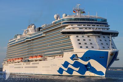
SKY PRINCESS
Passenger

Current Trip
BS RSD
| Time Travelled | 18 h, 15 mins |
|---|---|
| Remaining Time | --- |
| Distance Travelled | 329.87 nm |
| Remaining Distance | --- |
| AVG Speed | 18.5 Knopen |
| MAX Speed | 19.5 Knopen |
| AVG Wind | 17.2 knots |
| MAX Wind | 19 knots |
| MIN Temp | 23.7°C / 74.66°F |
| MAX Temp | 24.7°C / 76.46°F |
| Diepgang | 8.6 M |
| Positie ontvangen | 14 h, 18 m geleden |
Current Position
| Lengtegraad | --- |
|---|---|
| Breedtegraat | --- |
| Status | Under way using engine |
| Snelheid | 19.4 Knopen |
| Koers | 102.8° |
| Gebied | North Atlantic Ocean |
| Station | T-AIS |
| Positie ontvangen | 14 h, 18 m geleden |
Information
The current position of SKY PRINCESS is in North Atlantic Ocean with coordinates 23.98858° / -75.09306° as reported on 2025-03-04 01:14 by AIS to our vessel tracker app. The vessel's current speed is 19.4 Knopen
The vessel SKY PRINCESS (IMO: 9802396, MMSI: 310780000) is a Passenger It's sailing under the flag of [BM] Bermuda.
In this page you can find informations about the vessels current position, last detected port calls, and current voyage information. If the vessels is not in coverage by AIS you will find the latest position.
The current position of SKY PRINCESS is detected by our AIS receivers and we are not responsible for the reliability of the data. The last position was recorded while the vessel was in Coverage by the Ais receivers of our vessel tracking app.
The current draught of SKY PRINCESS as reported by AIS is 8.6 meters
Weather
| Temperature | 24.4°C / 75.92°F |
|---|---|
| Wind Speed | 17 knots |
| Direction | 73° ENE |
| Pressure | 1017.6 hPa |
| Humidity | 78.4 % |
| Cloud Coverage | 18 % |


Featured Company
Last Port Calls
| Port | Arrival | Departure | Time In Port |
|---|---|---|---|
| 2025-03-03 08:09 | 2025-03-03 16:17 | 8 h | |
| 2025-03-02 05:23 | 2025-03-02 15:22 | 9 h | |
| 2025-02-28 09:15 | 2025-02-28 19:09 | 9 h | |
| 2025-02-26 06:49 | 2025-02-26 16:03 | 9 h | |
| 2025-02-24 08:04 | 2025-02-24 15:57 | 7 h | |
| 2025-02-23 05:12 | 2025-02-23 17:27 | 12 h | |
| 2025-02-20 07:08 | 2025-02-20 17:15 | 10 h | |
| 2025-02-19 08:06 | 2025-02-19 22:05 | 13 h | |
| 2025-02-17 08:11 | 2025-02-17 15:58 | 7 h | |
| 2025-02-16 05:06 | 2025-02-16 15:36 | 10 h |
Most Visited Ports (Last year)
| Port | Arrivals | |
|---|---|---|
| 22 | ||
| 13 | ||
| 11 | ||
| 9 | ||
| 6 | ||
| 5 |
Last Trips
| Origin | Departure | Destination | Arrival | Distance | |
|---|---|---|---|---|---|
| 2025-03-02 15:22 | 2025-03-03 08:09 | 278.15 nm | |||
| 2025-02-28 19:09 | 2025-03-02 05:23 | 561.47 nm | |||
| 2025-02-26 16:03 | 2025-02-28 09:15 | 546.66 nm | |||
| 2025-02-24 15:57 | 2025-02-26 06:49 | 557.62 nm | |||
| 2025-02-23 17:27 | 2025-02-24 08:04 | 278.08 nm | |||
| 2025-02-20 17:15 | 2025-02-23 05:12 | 985.30 nm | |||
| 2025-02-19 22:05 | 2025-02-20 07:08 | 84.42 nm | |||
| 2025-02-17 15:58 | 2025-02-19 08:06 | 678.60 nm | |||
| 2025-02-16 15:36 | 2025-02-17 08:11 | 279.81 nm | |||
| 2025-02-14 19:01 | 2025-02-16 05:06 | 562.10 nm |
Events
| Tijd | Evenement | Details | Positie / Bestemming | Info |
|---|---|---|---|---|
| 2025-03-04 01:21 | Status Changed | Default Under way using engine |
23.97948 / -75.04734
BS RSD
|
Snelheid: 19.4 kn Koers: 102.8° |
| 2025-03-04 01:14 | Buitenbereik |
23.98858 / -75.09306
North Atlantic Ocean
|
Snelheid: 19.4 kn Koers: 102.8° |
|
| 2025-03-04 01:03 | Status Changed | Under way using engine Default |
23.99237 / -75.15238
BS RSD
|
Snelheid: 19.1 kn Koers: 91° |
| 2025-03-04 00:50 | Status Changed | Default Under way using engine |
23.99352 / -75.22893
BS RSD
|
Snelheid: 18.9 kn Koers: 90.6° |
| 2025-03-03 22:51 | Status Changed | Under way using engine Default |
24.24075 / -75.80464
BS RSD
|
Snelheid: 19.4 kn Koers: 136° |
| 2025-03-03 22:25 | Status Changed | Default Under way using engine |
24.34174 / -75.90984
BS RSD
|
Snelheid: 19.4 kn Koers: 136.3° |
| 2025-03-03 22:03 | Status Changed | Under way using engine Default |
24.42602 / -75.99810
BS RSD
|
Snelheid: 19.5 kn Koers: 136° |
| 2025-03-03 21:58 | Binnenbereik |
24.42602 / -75.99810
North Atlantic Ocean
|
Snelheid: 19.5 kn Koers: 136° |
|
| 2025-03-03 21:17 | Vertrekhaven |
|
24.53980 / -76.11673
BS RSD
|
Snelheid: 15.9 kn Koers: 154° |
| 2025-03-03 20:59 | Buitenbereik |
24.63372 / -76.18394
North Atlantic Ocean
|
Snelheid: 0.9 kn Koers: 139° |