
SHUN FU
Cargo
Current Trip
CN LSN
| Time Travelled | 17 h, 10 mins |
|---|---|
| Remaining Time | --- |
| Distance Travelled | 126.33 nm |
| Remaining Distance | --- |
| AVG Speed | 11.4 Knopen |
| MAX Speed | 13.3 Knopen |
| AVG Wind | 18.7 knots |
| MAX Wind | 23 knots |
| MIN Temp | 11.3°C / 52.34°F |
| MAX Temp | 12.2°C / 53.96°F |
| Diepgang | 12.5 M |
| Positie ontvangen | 27 d geleden |
Current Position
| Lengtegraad | --- |
|---|---|
| Breedtegraat | --- |
| Status | Under way using engine |
| Snelheid | 11.2 Knopen |
| Koers | 74.7° |
| Gebied | Singapore Strait |
| Station | T-AIS |
| Positie ontvangen | 27 d geleden |
Info
Information
The current position of SHUN FU is in Singapore Strait with coordinates 1.24419° / 104.10136° as reported on 2025-11-10 02:17 by AIS to our vessel tracker app. The vessel's current speed is 11.2 Knopen
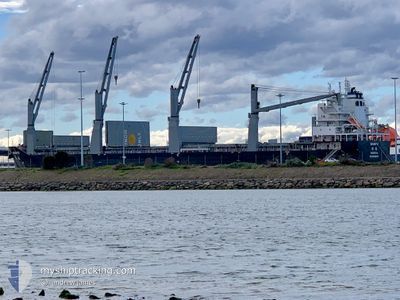
The vessel SHUN FU (IMO: 9998107, MMSI: 636023639) is a Cargo It's sailing under the flag of [LR] Liberia.
In this page you can find informations about the vessels current position, last detected port calls, and current voyage information. If the vessels is not in coverage by AIS you will find the latest position.
The current position of SHUN FU is detected by our AIS receivers and we are not responsible for the reliability of the data. The last position was recorded while the vessel was in Coverage by the Ais receivers of our vessel tracking app.
The current draught of SHUN FU as reported by AIS is 12.5 meters
Weather
| Temperature | 11.4°C / 52.52°F |
|---|---|
| Wind Speed | 16 knots |
| Direction | 23° NNE |
| Pressure | 1029.1 hPa |
| Humidity | 50.4 % |
| Cloud Coverage | 66 % |
Featured Company
Last Port Calls
| Port | Arrival | Departure | Time In Port |
|---|---|---|---|
| 2025-12-01 19:25 | 2025-12-07 16:05 | 5 d | |
| 2025-11-19 20:44 | 2025-11-27 10:40 | 7 d | |
| 2025-10-17 14:48 | 2025-10-23 22:43 | 6 d | |
| 2025-10-10 15:19 |
Last Trips
| Origin | Departure | Destination | Arrival | Distance | |
|---|---|---|---|---|---|
| 2025-11-27 10:40 | 2025-12-01 19:25 | 133.34 nm | |||
| 2025-10-23 22:43 | 2025-11-19 20:44 | 7565.95 nm | |||
| 2025-10-10 15:19 | 2025-10-17 14:48 | 65.98 nm |
Events
| Tijd | Evenement | Details | Positie / Bestemming | Info |
|---|---|---|---|---|
| 2025-12-07 08:05 | Vertrekhaven |
|
34.74449 / 119.52685
CN LSN
|
Snelheid: 11.6 kn Koers: 92° |
| 2025-12-07 07:29 | Start beweging |
34.75212 / 119.40139
[CN] LIANYUNGANG
|
Snelheid: 5.8 kn Koers: 85° |
|
| 2025-12-01 11:25 | Stop beweging |
34.75005 / 119.38928
[CN] LIANYUNGANG
|
Snelheid: 0.3 kn Koers: 273° |
|
| 2025-12-01 11:25 | Aankomsthaven |
|
34.75005 / 119.38928
[CN] LIANYUNGANG
|
Snelheid: 1.1 kn Koers: 258° |
| 2025-12-01 08:29 | Start beweging | 20.77 nm, North East of LIANYUNGANG |
34.91444 / 119.85268
CN LSN
|
Snelheid: 3.4 kn Koers: 102° |
| 2025-11-30 18:22 | Stop beweging | 20.48 nm, North East of LIANYUNGANG |
34.90826 / 119.85023
CN LSN
|
Snelheid: 0.2 kn Koers: 359° |
| 2025-11-30 15:06 | Start beweging |
34.99348 / 120.44532
CN LSN
|
Snelheid: 8.8 kn Koers: 271° |