
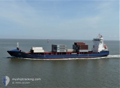
SELFOSS
Container Ship
Current Trip
| Time Travelled | 2 days |
|---|---|
| Remaining Time | --- |
| Distance Travelled | 578.68 nm |
| Remaining Distance | 206.19 nm |
| AVG Speed | 16.9 Knopen |
| MAX Speed | 18.7 Knopen |
| AVG Wind | 22.2 knots |
| MAX Wind | 31 knots |
| MIN Temp | 5.5°C / 41.9°F |
| MAX Temp | 9°C / 48.2°F |
| Diepgang | 7.7 M |
| Positie ontvangen | 1 d geleden |
Current Position
| Lengtegraad | --- |
|---|---|
| Breedtegraat | --- |
| Status | Under way using engine |
| Snelheid | 16.5 Knopen |
| Koers | 312.4° |
| Gebied | North Sea |
| Station | T-AIS |
| Positie ontvangen | 1 d geleden |
Info
Information
The current position of SELFOSS is in North Sea with coordinates 59.36266° / 2.99414° as reported on 2025-12-06 21:25 by AIS to our vessel tracker app. The vessel's current speed is 16.5 Knopen and is heading at the port of TORSHAVN. The estimated time of arrival as calculated by MyShipTracking vessel tracking app is 2025-12-07 21:01 LT
The vessel SELFOSS (IMO: 9433456, MMSI: 231123000) is a Container Ship that was built in 2008 ( 17 Jaar oud ). It's sailing under the flag of [FO] Faroe Is.
In this page you can find informations about the vessels current position, last detected port calls, and current voyage information. If the vessels is not in coverage by AIS you will find the latest position.
The current position of SELFOSS is detected by our AIS receivers and we are not responsible for the reliability of the data. The last position was recorded while the vessel was in Coverage by the Ais receivers of our vessel tracking app.
The current draught of SELFOSS as reported by AIS is 7.7 meters
Weather
| Temperature | 8.6°C / 47.48°F |
|---|---|
| Wind Speed | 21 knots |
| Direction | 102° ESE |
| Pressure | 994.2 hPa |
| Humidity | 85.2 % |
| Cloud Coverage | 100 % |
Featured Company
Last Port Calls
| Port | Arrival | Departure | Time In Port |
|---|---|---|---|
| 2025-12-05 10:03 | 2025-12-05 20:42 | 10 h | |
| 2025-12-04 06:30 | 2025-12-04 19:14 | 12 h | |
| 2025-12-02 10:20 | 2025-12-02 14:53 | 4 h | |
| 2025-12-01 00:51 | 2025-12-01 17:15 | 16 h | |
| 2025-11-28 23:56 | 2025-11-29 05:04 | 5 h | |
| 2025-11-27 01:40 | 2025-11-27 07:57 | 6 h | |
| 2025-11-25 08:21 | 2025-11-26 17:23 | 1 d | |
| 2025-11-23 16:14 | 2025-11-23 20:54 | 4 h | |
| 2025-11-20 14:59 | 2025-11-21 14:23 | 23 h | |
| 2025-11-19 14:26 | 2025-11-19 21:43 | 7 h |
Most Visited Ports (Last year)
| Port | Arrivals | |
|---|---|---|
| 34 | ||
| 24 | ||
| 20 | ||
| 20 | ||
| 20 | ||
| 20 |
Last Trips
| Origin | Departure | Destination | Arrival | Distance | |
|---|---|---|---|---|---|
| 2025-12-04 19:14 | 2025-12-05 10:03 | 238.25 nm | |||
| 2025-12-02 14:53 | 2025-12-04 06:30 | 523.34 nm | |||
| 2025-12-01 17:15 | 2025-12-02 10:20 | 202.18 nm | |||
| 2025-11-29 05:04 | 2025-12-01 00:51 | 582.70 nm | |||
| 2025-11-27 07:57 | 2025-11-28 23:56 | 394.51 nm | |||
| 2025-11-26 17:23 | 2025-11-27 01:40 | 124.78 nm | |||
| 2025-11-23 20:54 | 2025-11-25 08:21 | 511.96 nm | |||
| 2025-11-21 14:23 | 2025-11-23 16:14 | 773.19 nm | |||
| 2025-11-19 21:43 | 2025-11-20 14:59 | 238.06 nm | |||
| 2025-11-18 03:51 | 2025-11-19 14:26 | 523.83 nm |
Events
| Tijd | Evenement | Details | Positie / Bestemming | Info |
|---|---|---|---|---|
| 2025-12-06 21:31 | Status Changed | Default Under way using engine |
59.38069 / 2.95686
FOTHO
|
Snelheid: 16.5 kn Koers: 312.4° |
| 2025-12-06 21:25 | Buitenbereik |
59.36266 / 2.99414
North Sea
FOTHO
|
Snelheid: 16.5 kn Koers: 312.4° |
|
| 2025-12-06 11:13 | Wijzig zee gebeid | Norwegian part of the North Sea Norwegian part of the Skaggerak |
57.77857 / 7.38122
North Sea
FOTHO
|
Snelheid: 17.9 kn Koers: 270.9° |
| 2025-12-06 08:00 | Wijzig zee gebeid | Norwegian part of the Skaggerak Danish part of the Skaggerak |
57.83364 / 9.10546
Skaggerak
FOTHO
|
Snelheid: 16.3 kn Koers: 266° |
| 2025-12-06 06:38 | Status Changed | Under way using engine Default |
57.83642 / 9.78839
FOTHO
|
Snelheid: 16.5 kn Koers: 264° |
| 2025-12-06 06:29 | Status Changed | Default Under way using engine |
57.84118 / 9.86704
FOTHO
|
Snelheid: 16.3 kn Koers: 264.8° |
| 2025-12-06 06:02 | Status Changed | Under way using engine Default |
57.84533 / 10.09600
FOTHO
|
Snelheid: 16.5 kn Koers: 269° |
| 2025-12-06 06:01 | Status Changed | Default Under way using engine |
57.84538 / 10.10457
FOTHO
|
Snelheid: 16.5 kn Koers: 269.4° |
| 2025-12-06 05:35 | Status Changed | Under way using engine Default |
57.84682 / 10.32948
FOTHO
|
Snelheid: 16.7 kn Koers: 270° |
| 2025-12-06 05:33 | Status Changed | Default Under way using engine |
57.84684 / 10.34580
FOTHO
|
Snelheid: 16.7 kn Koers: 267.7° |