

SEAPOWER II
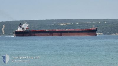
Bulk Carrier
Current Trip
| Time Travelled | --- |
|---|---|
| Remaining Time | --- |
| Distance Travelled | 2833.44 nm |
| Remaining Distance | --- |
| AVG Speed | 9.7 Knopen |
| MAX Speed | 12.3 Knopen |
| AVG Wind | 12.2 knots |
| MAX Wind | 29 knots |
| MIN Temp | 6°C / 42.8°F |
| MAX Temp | 26.8°C / 80.24°F |
| Diepgang | 7.5 M |
| Positie ontvangen | Nu |
Current Position
| Lengtegraad | --- |
|---|---|
| Breedtegraat | --- |
| Status | Under way using engine |
| Snelheid | 11.3 Knopen |
| Koers | 319.9° |
| Gebied | Aegean Sea |
| Station | T-AIS |
| Positie ontvangen | Nu |
Information
The current position of SEAPOWER II is in Aegean Sea with coordinates 36.85883° / 26.33390° as reported on 2025-02-22 11:29 by AIS to our vessel tracker app. The vessel's current speed is 11.3 Knopen and is heading at the port of KAVKAZ. The estimated time of arrival as calculated by MyShipTracking vessel tracking app is 2025-02-26 13:00 LT
The vessel SEAPOWER II (IMO: 9269233, MMSI: 352003527) is a Bulk Carrier that was built in 2007 ( 18 Jaar oud ). It's sailing under the flag of [PA] Panama.
In this page you can find informations about the vessels current position, last detected port calls, and current voyage information. If the vessels is not in coverage by AIS you will find the latest position.
The current position of SEAPOWER II is detected by our AIS receivers and we are not responsible for the reliability of the data. The last position was recorded while the vessel was in Coverage by the Ais receivers of our vessel tracking app.
The current draught of SEAPOWER II as reported by AIS is 7.5 meters
Weather
| Temperature | 6.1°C / 42.98°F |
|---|---|
| Wind Speed | 22 knots |
| Direction | 12° NNE |
| Pressure | 1029.8 hPa |
| Humidity | 59.8 % |
| Cloud Coverage | 6 % |
Featured Company
Last Port Calls
| Port | Arrival | Departure | Time In Port |
|---|---|---|---|
| 2025-02-20 05:20 | |||
| 2024-12-20 06:55 | 2025-01-28 14:51 | ||
| 2024-12-03 19:01 |
Most Visited Ports (Last year)
| Port | Arrivals | |
|---|---|---|
| 10 | ||
| 2 | ||
| 1 | ||
| 1 | ||
| 1 | ||
| 1 |
Last Trips
| Origin | Departure | Destination | Arrival | Distance | |
|---|---|---|---|---|---|
| 2024-12-03 22:01 | 2025-02-20 07:20 | 2312.63 nm | |||
| 2024-12-03 22:01 | 2024-12-20 08:55 | 1865.58 nm |
Events
| Tijd | Evenement | Details | Positie / Bestemming | Info |
|---|---|---|---|---|
| 2025-02-22 03:25 | Wijzig zee gebeid | Greek part of the Aegean Sea Greek part of the Mediterranean Sea - Eastern Basin |
35.76175 / 27.50256
Aegean Sea
RU KZP
|
Snelheid: 10.7 kn Koers: 318.8° |
| 2025-02-22 01:10 | Binnenbereik |
35.47477 / 27.86144
Mediterranean Sea - Eastern Basin
RU KZP
|
Snelheid: 10.7 kn Koers: 315° |
|
| 2025-02-22 00:03 | Buitenbereik |
35.32785 / 28.04095
Mediterranean Sea - Eastern Basin
RU KZP
|
Snelheid: 11.1 kn Koers: 314.3° |
|
| 2025-02-21 23:52 | Gevonden in zee | Greek part of the Mediterranean Sea - Eastern Basin |
35.30413 / 28.07028
Mediterranean Sea - Eastern Basin
RU KZP
|
Snelheid: 10.9 kn Koers: 316.6° |
| 2025-02-21 23:52 | Binnenbereik |
35.30413 / 28.07028
Mediterranean Sea - Eastern Basin
RU KZP
|
Snelheid: 10.9 kn Koers: 316.6° |
|
| 2025-02-20 07:04 | Buitenbereik |
30.17927 / 32.56862
Gulf of Suez
[EG] SUEZ CANAL
|
Snelheid: 7.3 kn Koers: 356.2° |
|
| 2025-02-20 05:20 | Aankomsthaven |
|
29.94771 / 32.57935
[EG] SUEZ CANAL
|
Snelheid: 8 kn Koers: 31.8° |
| 2025-02-20 04:38 | Wijzig zee gebeid | Egyptian part of the Gulf of Suez Egyptian part of the Red Sea |
29.87662 / 32.54981
Gulf of Suez
RU KZP
|
Snelheid: 8.5 kn Koers: 351.3° |
| 2025-02-20 04:35 | Binnenbereik |
29.87662 / 32.54981
Gulf of Suez
RU KZP
|
Snelheid: 8.5 kn Koers: 351.3° |
|
| 2025-02-18 14:49 | Buitenbereik |
27.32730 / 34.30628
Red Sea
RU KZP
|
Snelheid: 11.2 kn Koers: 321.7° |