

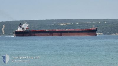
SEAPOWER II
Bulk Carrier

Current Trip
SA JED
| Time Travelled | --- |
|---|---|
| Remaining Time | --- |
| Distance Travelled | --- |
| Remaining Distance | --- |
| AVG Speed | --- |
| MAX Speed | --- |
| AVG Wind | --- |
| MAX Wind | --- |
| MIN Temp | --- |
| MAX Temp | --- |
| Dybgang | 13.5 m |
| Position Modtaget | 4 m siden |
Current Position
| Longitude | --- |
|---|---|
| Latitude | --- |
| Status | At anchor |
| Fart | |
| Kurs | 177° |
| Område | Red Sea |
| Station | T-AIS |
| Position Modtaget | 4 m siden |
Information
The current position of SEAPOWER II is in Red Sea with coordinates 21.29336° / 39.04602° as reported on 2025-03-29 20:01 by AIS to our vessel tracker app. The vessel's current speed is 0 Knots
The vessel SEAPOWER II (IMO: 9269233, MMSI: 352003527) is a Bulk Carrier that was built in 2007 ( 18 år gamle ). It's sailing under the flag of [PA] Panama.
In this page you can find informations about the vessels current position, last detected port calls, and current voyage information. If the vessels is not in coverage by AIS you will find the latest position.
The current position of SEAPOWER II is detected by our AIS receivers and we are not responsible for the reliability of the data. The last position was recorded while the vessel was in Coverage by the Ais receivers of our vessel tracking app.
The current draught of SEAPOWER II as reported by AIS is 13.5 meters
Weather
| Temperature | 26.7°C / 80.06°F |
|---|---|
| Wind Speed | 13 knots |
| Direction | 183° S |
| Pressure | 1006.4 hPa |
| Humidity | 85.1 % |
| Cloud Coverage | --- |


Featured Company
Last Port Calls
| Port | Arrival | Departure | Time In Port |
|---|---|---|---|
| 2025-02-20 07:20 | 2025-03-24 16:18 | ||
| 2025-01-28 16:51 |
Most Visited Ports (Last year)
| Port | Arrivals | |
|---|---|---|
| 10 | ||
| 2 | ||
| 1 | ||
| 1 | ||
| 1 | ||
| 1 |
Last Trips
| Origin | Departure | Destination | Arrival | Distance | |
|---|---|---|---|---|---|
| 2024-12-03 22:01 | 2025-02-20 07:20 | 2312.63 nm |
Events
| Tid | Hændelsen | Detaljer | Position / Dest | Info |
|---|---|---|---|---|
| 2025-03-29 17:46 | Indenfor Dækning |
21.29333 / 39.04586
Red Sea
|
Fart: Kurs: 19° |
|
| 2025-03-29 16:22 | Udenfor Dækning |
21.29339 / 39.04580
Red Sea
|
Fart: Kurs: 227.7° |
|
| 2025-03-29 14:04 | Indenfor Dækning |
21.29342 / 39.04580
Red Sea
|
Fart: Kurs: 265.7° |
|
| 2025-03-29 10:58 | Udenfor Dækning |
21.29337 / 39.04574
Red Sea
|
Fart: Kurs: 305.3° |
|
| 2025-03-29 10:37 | Indenfor Dækning |
21.29336 / 39.04583
Red Sea
|
Fart: Kurs: 103.9° |
|
| 2025-03-28 14:10 | Udenfor Dækning |
21.29320 / 39.04596
Red Sea
|
Fart: Kurs: 117.3° |
|
| 2025-03-28 14:10 | Indenfor Dækning |
21.29320 / 39.04596
Red Sea
|
Fart: Kurs: 117.3° |
|
| 2025-03-27 15:34 | Udenfor Dækning |
21.29320 / 39.04641
Red Sea
|
Fart: Kurs: 289.6° |
|
| 2025-03-27 15:07 | Indenfor Dækning |
21.29321 / 39.04648
Red Sea
|
Fart: Kurs: 115.8° |
|
| 2025-03-27 05:43 | Udenfor Dækning |
21.45705 / 38.91151
Red Sea
|
Fart: 2.5 kn Kurs: 197.8° |