
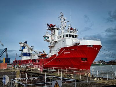
SARTOR
Multi Purpose Offshore Vessel
Current Trip
| Time Travelled | 13 days |
|---|---|
| Remaining Time | --- |
| Distance Travelled | 2771.52 nm |
| Remaining Distance | --- |
| AVG Speed | 10.9 Knopen |
| MAX Speed | 14 Knopen |
| AVG Wind | 11 knots |
| MAX Wind | 18.5 knots |
| MIN Temp | 2.2°C / 35.96°F |
| MAX Temp | 16.2°C / 61.16°F |
| Diepgang | 4.6 M |
| Positie ontvangen | 1 d geleden |
Current Position
| Lengtegraad | --- |
|---|---|
| Breedtegraat | --- |
| Status | Restricted manoeuverability |
| Snelheid | 9.1 Knopen |
| Koers | 84.9° |
| Gebied | Mediterranean Sea - Eastern Basin |
| Station | T-AIS |
| Positie ontvangen | 1 d geleden |
Info
Information
The current position of SARTOR is in Mediterranean Sea - Eastern Basin with coordinates 36.02657° / 14.77631° as reported on 2025-02-26 09:58 by AIS to our vessel tracker app. The vessel's current speed is 9.1 Knopen and is heading at the port of MIDIA. The estimated time of arrival as calculated by MyShipTracking vessel tracking app is 2025-03-05 12:00 LT
The vessel SARTOR (IMO: 9087312, MMSI: 372633000) is a Multi Purpose Offshore Vessel that was built in 1994 ( 31 Jaar oud ). It's sailing under the flag of [PA] Panama.
In this page you can find informations about the vessels current position, last detected port calls, and current voyage information. If the vessels is not in coverage by AIS you will find the latest position.
The current position of SARTOR is detected by our AIS receivers and we are not responsible for the reliability of the data. The last position was recorded while the vessel was in Coverage by the Ais receivers of our vessel tracking app.
The current draught of SARTOR as reported by AIS is 4.6 meters
Weather
| Temperature | 15.8°C / 60.44°F |
|---|---|
| Wind Speed | 14 knots |
| Direction | 228° SW |
| Pressure | 1020.8 hPa |
| Humidity | 75.4 % |
| Cloud Coverage | 100 % |
Featured Company
Most Visited Ports (Last year)
| Port | Arrivals | |
|---|---|---|
| 64 | ||
| 6 | ||
| 2 | ||
| 1 | ||
| 1 | ||
| 1 |
Events
| Tijd | Evenement | Details | Positie / Bestemming | Info |
|---|---|---|---|---|
| 2025-02-26 09:58 | Buitenbereik |
36.02657 / 14.77631
Mediterranean Sea - Eastern Basin
MIDIA ROMANIA
|
Snelheid: 9.1 kn Koers: 84.9° |
|
| 2025-02-26 09:43 | Wijzig zee gebeid | Maltese part of the Mediterranean Sea - Eastern Basin Spanish part of the Alboran Sea |
36.02204 / 14.74343
Mediterranean Sea - Eastern Basin
MIDIA ROMANIA
|
Snelheid: 1.2 kn Koers: 14.8° |
| 2025-02-26 09:43 | Binnenbereik |
36.02204 / 14.74343
Mediterranean Sea - Eastern Basin
MIDIA ROMANIA
|
Snelheid: 1.2 kn Koers: 14.8° |
|
| 2025-02-22 06:20 | Buitenbereik |
36.19173 / -3.52441
Alboran Sea
MIDIA ROMANIA
|
Snelheid: 9.3 kn Koers: 80.6° |
|
| 2025-02-22 06:14 | Binnenbereik |
36.18987 / -3.53775
Alboran Sea
MIDIA ROMANIA
|
Snelheid: 9.3 kn Koers: 80.2° |
|
| 2025-02-22 01:17 | Buitenbereik |
36.06592 / -4.57839
Alboran Sea
MIDIA ROMANIA
|
Snelheid: 10.3 kn Koers: 78.4° |
|
| 2025-02-21 22:07 | Gevonden in zee | Spanish part of the Alboran Sea |
35.97617 / -5.27185
Alboran Sea
MIDIA ROMANIA
|
Snelheid: 12.2 kn Koers: 81.6° |
| 2025-02-21 21:43 | Wijzig zee gebeid | Spanish part of the Strait of Gibraltar Moroccan part of the Strait of Gibraltar |
35.96379 / -5.37209
Strait of Gibraltar
MIDIA ROMANIA
|
Snelheid: 12.1 kn Koers: 81.2° |
| 2025-02-21 21:06 | Gevonden in zee | Moroccan part of the Strait of Gibraltar |
35.94193 / -5.52229
Strait of Gibraltar
MIDIA ROMANIA
|
Snelheid: 11.7 kn Koers: 76.2° |
| 2025-02-21 21:06 | Binnenbereik |
35.94193 / -5.52229
Strait of Gibraltar
MIDIA ROMANIA
|
Snelheid: 11.7 kn Koers: 76.2° |