

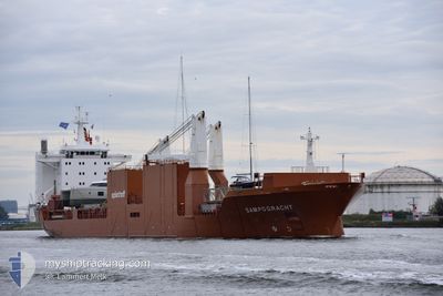
SAMPOGRACHT
General Cargo

Current Trip
| Time Travelled | 1 h, 30 mins |
|---|---|
| Remaining Time | --- |
| Distance Travelled | 14.90 nm |
| Remaining Distance | --- |
| AVG Speed | 12.1 Knopen |
| MAX Speed | 14.1 Knopen |
| AVG Wind | 6.4 knots |
| MAX Wind | 8.7 knots |
| MIN Temp | -5.1°C / 22.82°F |
| MAX Temp | -4.2°C / 24.44°F |
| Diepgang | 8 M |
| Positie ontvangen | 1 m geleden |
Current Position
| Lengtegraad | --- |
|---|---|
| Breedtegraat | --- |
| Status | Under way using engine |
| Snelheid | 11.1 Knopen |
| Koers | 194° |
| Gebied | North Atlantic Ocean |
| Station | T-AIS |
| Positie ontvangen | 1 m geleden |
Information
The current position of SAMPOGRACHT is in North Atlantic Ocean with coordinates 39.01148° / -76.37548° as reported on 2025-02-19 16:21 by AIS to our vessel tracker app. The vessel's current speed is 11.1 Knopen and is heading at the port of JACKSONVILLE. The estimated time of arrival as calculated by MyShipTracking vessel tracking app is 2025-02-21 10:30 LT
The vessel SAMPOGRACHT (IMO: 9288071, MMSI: 246396000) is a General Cargo that was built in 2005 ( 20 Jaar oud ). It's sailing under the flag of [NL] Netherlands.
In this page you can find informations about the vessels current position, last detected port calls, and current voyage information. If the vessels is not in coverage by AIS you will find the latest position.
The current position of SAMPOGRACHT is detected by our AIS receivers and we are not responsible for the reliability of the data. The last position was recorded while the vessel was in Coverage by the Ais receivers of our vessel tracking app.
The current draught of SAMPOGRACHT as reported by AIS is 8 meters
Weather
| Temperature | -4.9°C / 23.18°F |
|---|---|
| Wind Speed | 9 knots |
| Direction | 333° NNW |
| Pressure | 1030.5 hPa |
| Humidity | 45.4 % |
| Cloud Coverage | 100 % |


Featured Company
Last Port Calls
| Port | Arrival | Departure | Time In Port |
|---|---|---|---|
| 2025-02-17 09:33 | 2025-02-19 14:53 | 2 d | |
| 2025-02-02 09:03 | 2025-02-04 13:09 | 2 d | |
| 2025-01-22 18:41 | 2025-01-26 19:22 | 4 d | |
| 2025-01-17 07:08 | 2025-01-22 08:16 | 5 d | |
| 2025-01-14 07:28 | 2025-01-15 16:11 | 1 d | |
| 2024-12-30 17:35 | 2024-12-31 04:05 | 10 h | |
| 2024-12-22 12:29 | 2024-12-28 03:46 | 5 d | |
| 2024-12-04 22:48 | 2024-12-07 11:28 | 2 d | |
| 2024-12-02 13:47 | 2024-12-04 13:24 | 1 d | |
| 2024-12-01 09:12 |
Last Trips
| Origin | Departure | Destination | Arrival | Distance | |
|---|---|---|---|---|---|
| 2025-02-04 13:09 | 2025-02-17 04:33 | 4417.55 nm | |||
| 2025-01-26 20:22 | 2025-02-02 09:03 | 2207.98 nm | |||
| 2025-01-22 10:16 | 2025-01-22 19:41 | 153.88 nm | |||
| 2025-01-15 17:11 | 2025-01-17 09:08 | 468.72 nm | |||
| 2024-12-30 23:05 | 2025-01-14 08:28 | 5414.79 nm | |||
| 2024-12-27 22:46 | 2024-12-30 12:35 | 630.88 nm | |||
| 2024-12-07 12:28 | 2024-12-22 07:29 | 5072.45 nm | |||
| 2024-12-04 15:24 | 2024-12-04 23:48 | 154.31 nm | |||
| 2024-12-01 10:12 | 2024-12-02 15:47 | 468.61 nm |
Events
| Tijd | Evenement | Details | Positie / Bestemming | Info |
|---|---|---|---|---|
| 2025-02-19 15:35 | ETA Changed | 2025/02/21 10:30 |
39.17212 / -76.43001
USJAX
|
Snelheid: 8.4 kn Koers: 133.5° |
| 2025-02-19 14:53 | Vertrekhaven |
|
39.23644 / -76.54867
USJAX
|
Snelheid: 8.5 kn Koers: 141° |
| 2025-02-19 14:26 | Start beweging |
39.26159 / -76.59392
[US] BALTIMORE
|
Snelheid: 3.4 kn Koers: 252° |
|
| 2025-02-19 14:18 | Status Changed | Under way using engine Moored |
39.26147 / -76.59123
[US] BALTIMORE
|
Snelheid: Koers: 294° |
| 2025-02-19 11:59 | ETA Changed | 2025/02/21 10:30 2025/02/21 08:30 |
39.26157 / -76.59120
[US] BALTIMORE
|
Snelheid: Koers: 294° |
| 2025-02-18 21:59 | ETA Changed | 2025/02/21 08:30 2025/02/18 21:55 |
39.26152 / -76.59119
[US] BALTIMORE
|
Snelheid: Koers: 294° |
| 2025-02-18 21:56 | Draught Changed | 8 8.2 |
39.26149 / -76.59120
[US] BALTIMORE
|
Snelheid: Koers: 294° |
| 2025-02-18 21:56 | Destination Changed | USJAX USBAL |
39.26149 / -76.59120
[US] BALTIMORE
|
Snelheid: Koers: 294° |
| 2025-02-18 21:56 | ETA Changed | 2025/02/18 21:55 2025/02/17 04:56 |
39.26149 / -76.59120
[US] BALTIMORE
|
Snelheid: Koers: 294° |
| 2025-02-18 15:00 | Draught Changed | 8.2 10.1 |
39.26149 / -76.59123
[US] BALTIMORE
|
Snelheid: Koers: 294° |