

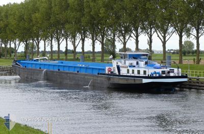
ROMANOS
Cargo

Current Trip
| Time Travelled | 3 days |
|---|---|
| Remaining Time | 1 h, 34 mins |
| Distance Travelled | 213.38 nm |
| Remaining Distance | 17.53 nm |
| AVG Speed | 5.5 Knopen |
| MAX Speed | 10.1 Knopen |
| AVG Wind | 3.9 knots |
| MAX Wind | 12 knots |
| MIN Temp | 5.7°C / 42.26°F |
| MAX Temp | 17.1°C / 62.78°F |
| Diepgang | 0 M |
| Positie ontvangen | 1 m geleden |
Current Position
| Lengtegraad | --- |
|---|---|
| Breedtegraat | --- |
| Status | Under way using engine |
| Snelheid | 8.5 Knopen |
| Koers | 350.9° |
| Gebied | North Sea |
| Station | T-AIS |
| Positie ontvangen | 1 m geleden |
Information
The current position of ROMANOS is in North Sea with coordinates 49.49682° / 8.44142° as reported on 2025-03-31 11:17 by AIS to our vessel tracker app. The vessel's current speed is 8.5 Knopen and is heading at the port of GERMERSHEIM. The estimated time of arrival as calculated by MyShipTracking vessel tracking app is 2025-03-31 14:52 LT
The vessel ROMANOS (MMSI: 244830231) is a Cargo It's sailing under the flag of [NL] Netherlands.
In this page you can find informations about the vessels current position, last detected port calls, and current voyage information. If the vessels is not in coverage by AIS you will find the latest position.
The current position of ROMANOS is detected by our AIS receivers and we are not responsible for the reliability of the data. The last position was recorded while the vessel was in Coverage by the Ais receivers of our vessel tracking app.
Weather
| Temperature | 9.9°C / 49.82°F |
|---|---|
| Wind Speed | 7 knots |
| Direction | 327° NNW |
| Pressure | 1024.7 hPa |
| Humidity | 48.9 % |
| Cloud Coverage | 100 % |


Featured Company
Last Port Calls
| Port | Arrival | Departure | Time In Port |
|---|---|---|---|
| 2025-03-27 15:21 | 2025-03-27 17:54 | 2 h | |
| 2025-03-25 18:44 | 2025-03-26 14:47 | 20 h | |
| 2025-01-06 04:38 |
Last Trips
| Origin | Departure | Destination | Arrival | Distance | |
|---|---|---|---|---|---|
| 2025-03-26 14:47 | 2025-03-27 15:21 | 112.62 nm | |||
| 2025-01-06 04:38 | 2025-03-25 18:44 | 21.50 nm |
Events
| Tijd | Evenement | Details | Positie / Bestemming | Info |
|---|---|---|---|---|
| 2025-03-31 09:20 | Binnenbereik |
49.28379 / 8.46711
North Sea
|
Snelheid: 9.7 kn Koers: 64.6° |
|
| 2025-03-30 08:07 | Buitenbereik |
49.29697 / 8.49011
North Sea
|
Snelheid: 4.8 kn Koers: 174.9° |
|
| 2025-03-30 04:56 | Start beweging | 0.26 nm, West of MANNHEIM |
49.49106 / 8.44448
HAFEN GERMERSHEIM
|
Snelheid: 3.7 kn Koers: 140.7° |
| 2025-03-30 04:53 | Status Changed | Under way using engine Moored |
49.49285 / 8.44167
HAFEN GERMERSHEIM
|
Snelheid: 0.1 kn Koers: 511° |
| 2025-03-29 18:37 | Status Changed | Moored Under way using engine |
49.49342 / 8.44096
HAFEN GERMERSHEIM
|
Snelheid: Koers: 511° |
| 2025-03-29 18:13 | Stop beweging | 0.38 nm, West of MANNHEIM |
49.49217 / 8.44178
HAFEN GERMERSHEIM
|
Snelheid: 0.3 kn Koers: 511° |
| 2025-03-29 06:12 | Binnenbereik |
50.08975 / 7.75589
North Sea
HAFEN GERMERSHEIM
|
Snelheid: 4.5 kn Koers: 146.2° |
|
| 2025-03-29 05:10 | Buitenbereik |
50.15337 / 7.71235
North Sea
HAFEN GERMERSHEIM
|
Snelheid: 4.9 kn Koers: 120.9° |
|
| 2025-03-29 04:35 | Binnenbereik |
50.17602 / 7.65158
North Sea
HAFEN GERMERSHEIM
|
Snelheid: 5.3 kn Koers: 115.8° |
|
| 2025-03-28 15:20 | Buitenbereik |
50.45181 / 7.37819
North Sea
HAFEN GERMERSHEIM
|
Snelheid: 5 kn Koers: 130.1° |