
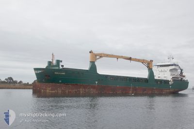
ROGALAND
General Cargo
Current Trip
| Time Travelled | 1 day |
|---|---|
| Remaining Time | --- |
| Distance Travelled | 307.59 nm |
| Remaining Distance | --- |
| AVG Speed | 8.9 Knopen |
| MAX Speed | 14.3 Knopen |
| AVG Wind | 10.1 knots |
| MAX Wind | 18 knots |
| MIN Temp | 8.7°C / 47.66°F |
| MAX Temp | 13.8°C / 56.84°F |
| Diepgang | 8.3 M |
| Positie ontvangen | 4 h, 44 m geleden |
Current Position
| Lengtegraad | 3.96522° |
|---|---|
| Breedtegraat | 52.94611° |
| Status | Under way using engine |
| Snelheid | 11.1 Knopen |
| Koers | 231.1° |
| Gebied | North Sea |
| Station | T-AIS |
| Positie ontvangen | 4 h, 44 m geleden |
Info
Information
The current position of ROGALAND is in North Sea with coordinates 52.94611° / 3.96522° as reported on 2024-05-01 23:23 by AIS to our vessel tracker app. The vessel's current speed is 11.1 Knopen and is heading at the port of BEJAIA. The estimated time of arrival as calculated by MyShipTracking vessel tracking app is 2024-05-09 05:00 LT
The vessel ROGALAND (IMO: 9505596, MMSI: 305677000) is a General Cargo that was built in 2011 ( 13 Jaar oud ). It's sailing under the flag of [AG] Antigua Barbuda.
In this page you can find informations about the vessels current position, last detected port calls, and current voyage information. If the vessels is not in coverage by AIS you will find the latest position.
The current position of ROGALAND is detected by our AIS receivers and we are not responsible for the reliability of the data. The last position was recorded while the vessel was in Coverage by the Ais receivers of our vessel tracking app.
The current draught of ROGALAND as reported by AIS is 8.3 meters
Weather
| Temperature | 12.3°C / 54.14°F |
|---|---|
| Wind Speed | 14 knots |
| Direction | 65° ENE |
| Pressure | 999.3 hPa |
| Humidity | 94.6 % |
| Cloud Coverage | 100 % |
Featured Company
Last Port Calls
| Port | Arrival | Departure | Time In Port |
|---|---|---|---|
| 2024-04-30 15:01 | 2024-04-30 19:02 | 4 h | |
| 2024-04-27 06:12 | 2024-04-28 03:20 | 21 h | |
| 2024-04-26 01:53 | 2024-04-27 02:22 | 1 d | |
| 2024-04-11 07:28 | 2024-04-12 13:45 | 1 d | |
| 2024-04-07 17:11 | 2024-04-09 11:39 | 1 d | |
| 2024-04-05 06:56 | 2024-04-06 10:25 | 1 d | |
| 2024-03-28 15:20 | 2024-03-28 16:33 | 1 h | |
| 2024-03-10 08:02 | 2024-03-11 05:26 | 21 h |
Last Trips
| Origin | Departure | Destination | Arrival | Distance | |
|---|---|---|---|---|---|
| 2024-04-28 05:20 | 2024-04-30 17:01 | 646.78 nm | |||
| 2024-04-27 04:22 | 2024-04-27 08:12 | 38.39 nm | |||
| 2024-04-12 15:45 | 2024-04-26 03:53 | 2945.33 nm | |||
| 2024-04-09 11:39 | 2024-04-11 09:28 | 404.10 nm | |||
| 2024-04-06 10:25 | 2024-04-07 17:11 | 263.03 nm | |||
| 2024-03-28 17:33 | 2024-04-05 06:56 | 1835.28 nm | |||
| 2024-03-11 06:26 | 2024-03-28 16:20 | 2532.75 nm |
Events
| Tijd | Evenement | Details | Positie / Bestemming | Info |
|---|---|---|---|---|
| 2024-05-01 23:28 | Status Changed | Default Under way using engine |
52.93483 / 3.94260
BEJAIA
|
Snelheid: 11.1 kn Koers: 231.1° |
| 2024-05-01 23:23 | Buitenbereik |
52.94611 / 3.96522
North Sea
BEJAIA
|
Snelheid: 11.1 kn Koers: 231.1° |
|
| 2024-05-01 21:37 | Status Changed | Under way using engine Default |
53.16435 / 4.34135
BEJAIA
|
Snelheid: 9.9 kn Koers: 210° |
| 2024-05-01 21:37 | Binnenbereik |
53.16316 / 4.33947
North Sea
BEJAIA
|
Snelheid: 10.1 kn Koers: 225.6° |
|
| 2024-05-01 19:06 | Status Changed | Default Under way using engine |
53.50159 / 4.79355
BEJAIA
|
Snelheid: 12.3 kn Koers: 246.8° |
| 2024-05-01 19:01 | Buitenbereik |
53.50841 / 4.82170
North Sea
BEJAIA
|
Snelheid: 12.3 kn Koers: 246.8° |
|
| 2024-05-01 18:05 | Status Changed | Under way using engine Default |
53.57913 / 5.11912
BEJAIA
|
Snelheid: 12.4 kn Koers: 247° |
| 2024-05-01 17:48 | Status Changed | Default Under way using engine |
53.59826 / 5.21040
BEJAIA
|
Snelheid: 12.5 kn Koers: 250.3° |
| 2024-05-01 16:48 | Status Changed | Under way using engine Default |
53.66481 / 5.54617
BEJAIA
|
Snelheid: 12.3 kn Koers: 255° |
| 2024-05-01 16:24 | Status Changed | Default Under way using engine |
53.68907 / 5.67147
BEJAIA
|
Snelheid: 12 kn Koers: 254.9° |