
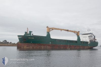
ROGALAND
General Cargo
Current Trip
| Trip Time | 4 days |
|---|---|
| Trip Distance | 974.16 nm |
| AVG Speed | 10.7 Noeuds |
| MAX Speed | 13.1 Noeuds |
| Tirant d eau | 5 m |
| AVG Wind | 13.6 knots |
| MAX Wind | 26.8 knots |
| MIN Temp | -0.6°C / 30.92°F |
| MAX Temp | 4.7°C / 40.46°F |
| Position reçue | 1 d depuis |
Current Position
| Longitude | --- |
|---|---|
| Latitude | --- |
| Etat | Under way using engine |
| Vitesse | 11.4 Noeuds |
| Parcours | 74.1° |
| Zone | Gulf of Bothnia |
| Station | T-AIS |
| Position reçue | 1 d depuis |
Info
Information
The current position of ROGALAND is in Gulf of Bothnia with coordinates 63.57166° / 20.99773° as reported on 2025-01-24 11:20 by AIS to our vessel tracker app. The vessel's current speed is 11.4 Noeuds and is currently inside the port of PIETARSAARI.
The vessel ROGALAND (IMO: 9505596, MMSI: 305677000) is a General Cargo that was built in 2011 ( 14 Age ). It's sailing under the flag of [AG] Antigua Barbuda.
In this page you can find informations about the vessels current position, last detected port calls, and current voyage information. If the vessels is not in coverage by AIS you will find the latest position.
The current position of ROGALAND is detected by our AIS receivers and we are not responsible for the reliability of the data. The last position was recorded while the vessel was in Coverage by the Ais receivers of our vessel tracking app.
The current draught of ROGALAND as reported by AIS is 5 meters
Weather
| Temperature | 2.8°C / 37.04°F |
|---|---|
| Wind Speed | 22 knots |
| Direction | 210° SSW |
| Pressure | 987 hPa |
| Humidity | 82.2 % |
| Cloud Coverage | 100 % |
Featured Company
Last Port Calls
| Port | Arrival | Departure | Time In Port |
|---|---|---|---|
| 2025-01-25 15:21 | |||
| 2025-01-19 18:58 | 2025-01-21 00:01 | 1 d | |
| 2025-01-11 14:53 | 2025-01-12 19:45 | 1 d | |
| 2025-01-02 14:59 | 2025-01-08 23:28 | 6 d | |
| 2024-12-21 09:19 | 2024-12-21 10:31 | 1 h | |
| 2024-12-17 09:15 | 2024-12-19 06:58 | 1 d | |
| 2024-12-15 06:17 | 2024-12-15 23:57 | 17 h | |
| 2024-12-10 18:40 | 2024-12-11 22:00 | 1 d | |
| 2024-11-21 09:56 | 2024-11-22 17:28 | 1 d | |
| 2024-11-10 00:45 | 2024-11-10 02:58 | 2 h |
Last Trips
| Origin | Departure | Destination | Arrival | Distance | |
|---|---|---|---|---|---|
| 2025-01-21 00:01 | 2025-01-25 15:21 | 974.16 nm | |||
| 2025-01-12 19:45 | 2025-01-19 18:58 | 1765.73 nm | |||
| 2025-01-08 23:28 | 2025-01-11 14:53 | 611.17 nm | |||
| 2024-12-21 10:31 | 2025-01-02 14:59 | 2255.42 nm | |||
| 2024-12-19 06:58 | 2024-12-21 09:19 | 437.29 nm | |||
| 2024-12-15 23:57 | 2024-12-17 09:15 | 339.20 nm | |||
| 2024-12-11 22:00 | 2024-12-15 06:17 | 823.78 nm | |||
| 2024-11-22 17:28 | 2024-12-10 18:40 | 3201.77 nm | |||
| 2024-11-10 02:58 | 2024-11-21 09:56 | 2767.34 nm | |||
| 2024-11-07 08:32 | 2024-11-10 00:45 | 711.36 nm |
Events
| Heure | Evenement | Détails | Position/ Destination | Info |
|---|---|---|---|---|
| 2025-01-25 13:37 | Arret |
63.71540 / 22.69097
[FI] PIETARSAARI
|
Vitesse: 0.3 kn Parcours: 357° |
|
| 2025-01-25 13:21 | Port d'arrivée |
|
63.71748 / 22.68759
[FI] PIETARSAARI
|
Vitesse: 2 kn Parcours: 164° |
| 2025-01-25 12:17 | Démarrage | 7.69 nm, North West of PIETARSAARI |
63.76900 / 22.43301
FI PRS
|
Vitesse: 3.6 kn Parcours: 122° |
| 2025-01-24 15:19 | Arret | 7.96 nm, North West of PIETARSAARI |
63.76729 / 22.41992
FI PRS
|
Vitesse: 0.2 kn Parcours: 158° |
| 2025-01-24 11:25 | Etat Changé | Default Under way using engine |
63.57585 / 21.02909
FI PRS
|
Vitesse: 11.4 kn Parcours: 74.1° |
| 2025-01-24 11:20 | Hors de la zone couverte |
63.57166 / 20.99773
Gulf of Bothnia
FI PRS
|
Vitesse: 11.4 kn Parcours: 74.1° |
|
| 2025-01-24 11:20 | Etat Changé | Under way using engine Default |
63.57150 / 20.99647
FI PRS
|
Vitesse: 11.2 kn Parcours: 73° |
| 2025-01-24 11:01 | Etat Changé | Default Under way using engine |
63.55438 / 20.87310
FI PRS
|
Vitesse: 11.5 kn Parcours: 72.4° |
| 2025-01-24 10:55 | Etat Changé | Under way using engine Default |
63.54829 / 20.82955
FI PRS
|
Vitesse: 11.4 kn Parcours: 72° |
| 2025-01-24 10:53 | Etat Changé | Default Under way using engine |
63.54684 / 20.81927
FI PRS
|
Vitesse: 10.3 kn Parcours: 74.8° |