

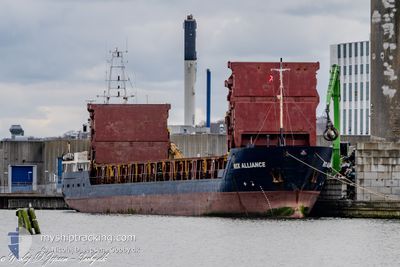
RIX ALLIANCE
General Cargo

Current Trip
| Time Travelled | 7 h, 54 mins |
|---|---|
| Remaining Time | --- |
| Distance Travelled | 66.56 nm |
| Remaining Distance | --- |
| AVG Speed | 8.9 Knopen |
| MAX Speed | 9.2 Knopen |
| AVG Wind | 11.5 knots |
| MAX Wind | 13.7 knots |
| MIN Temp | 4.8°C / 40.64°F |
| MAX Temp | 6.5°C / 43.7°F |
| Diepgang | 5 M |
| Positie ontvangen | Nu |
Current Position
| Lengtegraad | --- |
|---|---|
| Breedtegraat | --- |
| Status | Under way using engine |
| Snelheid | 8.6 Knopen |
| Koers | 327.3° |
| Gebied | Baltic Sea |
| Station | T-AIS |
| Positie ontvangen | Nu |
Information
The current position of RIX ALLIANCE is in Baltic Sea with coordinates 54.93100° / 13.41220° as reported on 2025-03-28 05:00 by AIS to our vessel tracker app. The vessel's current speed is 8.6 Knopen and is heading at the port of LIDKOPING. The estimated time of arrival as calculated by MyShipTracking vessel tracking app is 2025-03-29 19:00 LT
The vessel RIX ALLIANCE (IMO: 9128403, MMSI: 209336000) is a General Cargo that was built in 1995 ( 30 Jaar oud ). It's sailing under the flag of [CY] Cyprus.
In this page you can find informations about the vessels current position, last detected port calls, and current voyage information. If the vessels is not in coverage by AIS you will find the latest position.
The current position of RIX ALLIANCE is detected by our AIS receivers and we are not responsible for the reliability of the data. The last position was recorded while the vessel was in Coverage by the Ais receivers of our vessel tracking app.
The current draught of RIX ALLIANCE as reported by AIS is 5 meters
Weather
| Temperature | 5.1°C / 41.18°F |
|---|---|
| Wind Speed | 13 knots |
| Direction | 203° SSW |
| Pressure | 1014.5 hPa |
| Humidity | 87.6 % |
| Cloud Coverage | 100 % |


Featured Company
Last Port Calls
| Port | Arrival | Departure | Time In Port |
|---|---|---|---|
| 2025-03-27 09:29 | 2025-03-27 22:06 | 12 h | |
| 2025-03-25 09:12 | 2025-03-25 18:36 | 9 h | |
| 2025-03-20 12:53 | 2025-03-21 02:44 | 13 h | |
| 2025-03-19 19:25 | 2025-03-20 11:11 | 15 h | |
| 2025-03-18 21:40 | 2025-03-19 18:49 | 21 h | |
| 2025-03-11 07:14 | 2025-03-11 22:37 | 15 h | |
| 2025-03-10 03:02 | 2025-03-10 16:03 | 13 h | |
| 2025-03-09 12:29 | 2025-03-09 20:10 | 7 h | |
| 2025-03-06 14:41 | 2025-03-07 13:01 | 22 h | |
| 2025-03-04 05:14 | 2025-03-05 14:42 | 1 d |
Most Visited Ports (Last year)
| Port | Arrivals | |
|---|---|---|
| 7 | ||
| 5 | ||
| 4 | ||
| 4 | ||
| 4 | ||
| 3 |
Last Trips
| Origin | Departure | Destination | Arrival | Distance | |
|---|---|---|---|---|---|
| 2025-03-25 18:36 | 2025-03-27 09:29 | 233.24 nm | |||
| 2025-03-21 02:44 | 2025-03-25 09:12 | 698.41 nm | |||
| 2025-03-20 11:11 | 2025-03-20 12:53 | 17.18 nm | |||
| 2025-03-19 18:49 | 2025-03-19 19:25 | 4.60 nm | |||
| 2025-03-11 22:37 | 2025-03-18 21:40 | 694.46 nm | |||
| 2025-03-10 16:03 | 2025-03-11 07:14 | 127.25 nm | |||
| 2025-03-09 20:10 | 2025-03-10 03:02 | 60.69 nm | |||
| 2025-03-07 13:01 | 2025-03-09 12:29 | 245.13 nm | |||
| 2025-03-05 14:42 | 2025-03-06 14:41 | 168.56 nm | |||
| 2025-03-03 03:06 | 2025-03-04 05:14 | 203.89 nm |
Events
| Tijd | Evenement | Details | Positie / Bestemming | Info |
|---|---|---|---|---|
| 2025-03-28 01:51 | Draught Changed | 5 3.3 |
54.53428 / 13.81935
SE LDK
|
Snelheid: 9 kn Koers: 329.1° |
| 2025-03-28 01:51 | Destination Changed | SE LDK PL SWI |
54.53428 / 13.81935
SE LDK
|
Snelheid: 9 kn Koers: 329.1° |
| 2025-03-28 01:51 | ETA Changed | 2025/03/29 18:00 2025/03/27 08:30 |
54.53428 / 13.81935
SE LDK
|
Snelheid: 9 kn Koers: 329.1° |
| 2025-03-28 00:51 | Status Changed | Under way using engine Default |
54.41128 / 13.95920
PL SWI
|
Snelheid: 8.9 kn Koers: 320° |
| 2025-03-28 00:38 | Status Changed | Default Under way using engine |
54.38526 / 13.99653
PL SWI
|
Snelheid: 8.9 kn Koers: 319.6° |
| 2025-03-27 23:51 | Status Changed | Under way using engine Default |
54.30855 / 14.14146
PL SWI
|
Snelheid: 8.8 kn Koers: 309° |
| 2025-03-27 23:45 | Status Changed | Default Under way using engine |
54.29872 / 14.16229
PL SWI
|
Snelheid: 8.8 kn Koers: 319.2° |
| 2025-03-27 23:24 | Status Changed | Under way using engine Default |
54.25533 / 14.19474
PL SWI
|
Snelheid: 9 kn Koers: 354° |
| 2025-03-27 23:20 | Status Changed | Default Under way using engine |
54.24452 / 14.19606
PL SWI
|
Snelheid: 9 kn Koers: 353.8° |
| 2025-03-27 22:46 | Status Changed | Under way using engine Default |
54.16066 / 14.21924
PL SWI
|
Snelheid: 8.9 kn Koers: 350° |