
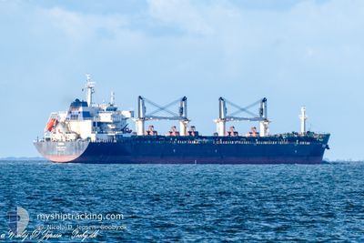
RINIA
Bulk Carrier
Current Trip
| Time Travelled | 12 days |
|---|---|
| Remaining Time | --- |
| Distance Travelled | 1580.44 nm |
| Remaining Distance | --- |
| AVG Speed | 9.5 Knopen |
| MAX Speed | 12.9 Knopen |
| AVG Wind | 12.2 knots |
| MAX Wind | 27 knots |
| MIN Temp | 10.2°C / 50.36°F |
| MAX Temp | 23.5°C / 74.3°F |
| Diepgang | 11.5 M |
| Positie ontvangen | 1 h, 55 m geleden |
Current Position
| Lengtegraad | 21.08388° |
|---|---|
| Breedtegraat | 58.71271° |
| Status | Under way using engine |
| Snelheid | 12.2 Knopen |
| Koers | 212.3° |
| Gebied | Baltic Sea |
| Station | T-AIS |
| Positie ontvangen | 1 h, 55 m geleden |
Info
Information
The current position of RINIA is in Baltic Sea with coordinates 58.71271° / 21.08388° as reported on 2024-05-29 19:45 by AIS to our vessel tracker app. The vessel's current speed is 12.2 Knopen and is heading at the port of DURBAN. The estimated time of arrival as calculated by MyShipTracking vessel tracking app is 2024-07-01 00:00 LT
The vessel RINIA (IMO: 9594406, MMSI: 256308000) is a Bulk Carrier that was built in 2012 ( 12 Jaar oud ). It's sailing under the flag of [MT] Malta.
In this page you can find informations about the vessels current position, last detected port calls, and current voyage information. If the vessels is not in coverage by AIS you will find the latest position.
The current position of RINIA is detected by our AIS receivers and we are not responsible for the reliability of the data. The last position was recorded while the vessel was in Coverage by the Ais receivers of our vessel tracking app.
The current draught of RINIA as reported by AIS is 11.5 meters
Weather
| Temperature | --- |
|---|---|
| Wind Speed | --- |
| Direction | --- |
| Pressure | --- |
| Humidity | --- |
| Cloud Coverage | --- |
Featured Company
Most Visited Ports (Last year)
| Port | Arrivals | |
|---|---|---|
| 1 | ||
| 1 | ||
| 1 | ||
| 1 | ||
| 1 | ||
| 1 |
Last Trips
| Origin | Departure | Destination | Arrival | Distance | |
|---|---|---|---|---|---|
| 2024-05-17 17:26 | 2024-05-17 19:27 | 10.03 nm | |||
| 2024-05-04 14:57 | 2024-05-12 10:24 | 1852.70 nm | |||
| 2024-04-30 20:59 | 2024-05-03 01:35 | 516.96 nm | |||
| 2024-03-23 03:52 | 2024-04-28 18:40 | 5722.69 nm | |||
| 2024-02-18 10:51 | 2024-03-21 04:31 | 1300.49 nm |
Events
| Tijd | Evenement | Details | Positie / Bestemming | Info |
|---|---|---|---|---|
| 2024-05-29 19:50 | Status Changed | Default Under way using engine |
58.69878 / 21.06725
DURBAN
|
Snelheid: 12.2 kn Koers: 212.3° |
| 2024-05-29 19:45 | Status Changed | Under way using engine Default |
58.71271 / 21.08388
DURBAN
|
Snelheid: 12.2 kn Koers: 213° |
| 2024-05-29 19:45 | Buitenbereik |
58.71271 / 21.08388
Baltic Sea
|
Snelheid: 12.2 kn Koers: 212.3° |
|
| 2024-05-29 19:22 | Status Changed | Default Under way using engine |
58.77950 / 21.16201
DURBAN
|
Snelheid: 12.1 kn Koers: 211.8° |
| 2024-05-29 15:19 | Wijzig zee gebeid | Estonian part of the Baltic Sea Finnish part of the Baltic Sea |
59.38200 / 22.21032
Baltic Sea
|
Snelheid: 12.2 kn Koers: 233.5° |
| 2024-05-29 12:49 | Gevonden in zee | Finnish part of the Baltic Sea |
59.59139 / 23.10167
Baltic Sea
|
Snelheid: 12 kn Koers: 253.2° |
| 2024-05-29 11:16 | Status Changed | Under way using engine Default |
59.67807 / 23.70001
DURBAN
|
Snelheid: 12.1 kn Koers: 253° |
| 2024-05-29 11:14 | Status Changed | Default Under way using engine |
59.68038 / 23.71489
DURBAN
|
Snelheid: 12 kn Koers: 252.7° |
| 2024-05-29 08:31 | Gevonden in zee | Finnish part of the Gulf of Finland |
59.82780 / 24.76605
Gulf of Finland
|
Snelheid: 12.1 kn Koers: 257.7° |
| 2024-05-29 07:04 | Wijzig zee gebeid | Estonian part of the Gulf of Finland Finnish part of the Gulf of Finland |
59.88003 / 25.33519
Gulf of Finland
|
Snelheid: 12.1 kn Koers: 259.8° |