
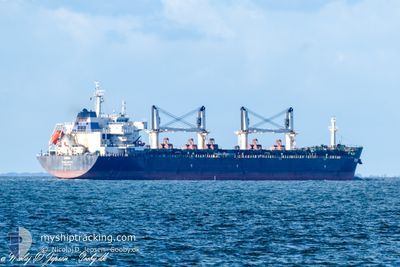
RINIA
Bulk Carrier
Current Trip
| Time Travelled | 3 days |
|---|---|
| Remaining Time | --- |
| Distance Travelled | 740.98 nm |
| Remaining Distance | --- |
| AVG Speed | 9.5 Knots |
| MAX Speed | 11.6 Knots |
| AVG Wind | 14.3 knots |
| MAX Wind | 24.4 knots |
| MIN Temp | 15.5°C / 59.9°F |
| MAX Temp | 25.5°C / 77.9°F |
| Dybgang | 10.2 m |
| Position Modtaget | Nu |
Current Position
| Longitude | -9.84919° |
|---|---|
| Latitude | 39.00908° |
| Status | Under way using engine |
| Fart | 10.4 Knots |
| Kurs | 0.1° |
| Område | North Atlantic Ocean |
| Station | T-AIS |
| Position Modtaget | Nu |
Info
Information
The current position of RINIA is in North Atlantic Ocean with coordinates 39.00908° / -9.84919° as reported on 2024-05-07 23:27 by AIS to our vessel tracker app. The vessel's current speed is 10.4 Knots and is heading at the port of AMSTERDAM. The estimated time of arrival as calculated by MyShipTracking vessel tracking app is 2024-05-11 23:00 LT
The vessel RINIA (IMO: 9594406, MMSI: 256308000) is a Bulk Carrier that was built in 2012 ( 12 år gamle ). It's sailing under the flag of [MT] Malta.
In this page you can find informations about the vessels current position, last detected port calls, and current voyage information. If the vessels is not in coverage by AIS you will find the latest position.
The current position of RINIA is detected by our AIS receivers and we are not responsible for the reliability of the data. The last position was recorded while the vessel was in Coverage by the Ais receivers of our vessel tracking app.
The current draught of RINIA as reported by AIS is 10.2 meters
Weather
| Temperature | 16.3°C / 61.34°F |
|---|---|
| Wind Speed | 13 knots |
| Direction | 22° NNE |
| Pressure | 1019.7 hPa |
| Humidity | 82.9 % |
| Cloud Coverage | 100 % |
Featured Company
Most Visited Ports (Last year)
| Port | Arrivals | |
|---|---|---|
| 1 | ||
| 1 | ||
| 1 | ||
| 1 | ||
| 1 | ||
| 1 |
Events
| Tid | Hændelsen | Detaljer | Position / Dest | Info |
|---|---|---|---|---|
| 2024-05-07 01:56 | Fundet i havområde | Portuguese part of the North Atlantic Ocean |
36.27613 / -7.45513
North Atlantic Ocean
NL AMS
|
Fart: 11.2 kn Kurs: 290.1° |
| 2024-05-07 00:03 | Status er ændret | Under way using engine Default |
36.15963 / -7.05746
NL AMS
|
Fart: 10.7 kn Kurs: 291° |
| 2024-05-06 23:50 | Status er ændret | Default Under way using engine |
36.14562 / -7.01170
NL AMS
|
Fart: 10.7 kn Kurs: 284° |
| 2024-05-06 23:42 | Status er ændret | Under way using engine Default |
36.13807 / -6.98081
NL AMS
|
Fart: 10.8 kn Kurs: 286° |
| 2024-05-06 23:13 | Status er ændret | Default Under way using engine |
36.11377 / -6.88018
NL AMS
|
Fart: 10.9 kn Kurs: 289.1° |
| 2024-05-06 23:06 | Status er ændret | Under way using engine Default |
36.10406 / -6.84718
NL AMS
|
Fart: 11 kn Kurs: 288° |
| 2024-05-06 23:01 | Status er ændret | Default Under way using engine |
36.10141 / -6.83767
NL AMS
|
Fart: 10.9 kn Kurs: 289.2° |
| 2024-05-06 22:53 | Status er ændret | Under way using engine Default |
36.09050 / -6.79881
NL AMS
|
Fart: 10 kn Kurs: 289° |
| 2024-05-06 22:46 | Status er ændret | Default Under way using engine |
36.08664 / -6.78522
NL AMS
|
Fart: 10.9 kn Kurs: 288.5° |
| 2024-05-06 22:40 | Status er ændret | Under way using engine Default |
36.07948 / -6.76023
NL AMS
|
Fart: 10.9 kn Kurs: 290° |