
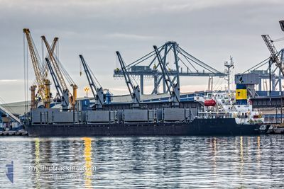
RHINE
Tanker
Current Trip
| Time Travelled | 5 days |
|---|---|
| Remaining Time | --- |
| Distance Travelled | 1683.37 nm |
| Remaining Distance | --- |
| AVG Speed | 12.7 Knopen |
| MAX Speed | 14.7 Knopen |
| AVG Wind | 14.2 knots |
| MAX Wind | 29.6 knots |
| MIN Temp | 20°C / 68°F |
| MAX Temp | 36.8°C / 98.24°F |
| Diepgang | 6.5 M |
| Positie ontvangen | 2 d geleden |
Current Position
| Lengtegraad | 122.26499° |
|---|---|
| Breedtegraat | 25.22916° |
| Status | Under way using engine |
| Snelheid | 14.2 Knopen |
| Koers | 193.1° |
| Gebied | Eastern China Sea |
| Station | T-AIS |
| Positie ontvangen | 2 d geleden |
Info
Information
The current position of RHINE is in Eastern China Sea with coordinates 25.22916° / 122.26499° as reported on 2024-06-21 11:53 by AIS to our vessel tracker app. The vessel's current speed is 14.2 Knopen and is heading at the port of KUNAK. The estimated time of arrival as calculated by MyShipTracking vessel tracking app is 2024-06-26 08:00 LT
The vessel RHINE (IMO: 9356816, MMSI: 312255000) is a Tanker It's sailing under the flag of [BZ] Belize.
In this page you can find informations about the vessels current position, last detected port calls, and current voyage information. If the vessels is not in coverage by AIS you will find the latest position.
The current position of RHINE is detected by our AIS receivers and we are not responsible for the reliability of the data. The last position was recorded while the vessel was in Coverage by the Ais receivers of our vessel tracking app.
The current draught of RHINE as reported by AIS is 6.5 meters
Weather
| Temperature | 29°C / 84.2°F |
|---|---|
| Wind Speed | 5 knots |
| Direction | 188° S |
| Pressure | 1008.8 hPa |
| Humidity | 72.6 % |
| Cloud Coverage | 100 % |
Featured Company
Last Port Calls
| Port | Arrival | Departure | Time In Port |
|---|---|---|---|
| 2024-06-17 07:13 | 2024-06-18 13:21 | 1 d | |
| 2024-06-13 20:41 | 2024-06-16 08:21 | 2 d | |
| 2024-05-18 12:52 | 2024-05-19 13:57 | 1 d | |
| 2024-05-11 00:58 | 2024-05-13 01:50 | 2 d | |
| 2024-04-28 14:48 | 2024-05-01 17:52 | 3 d | |
| 2024-04-17 17:38 |
Most Visited Ports (Last year)
| Port | Arrivals | |
|---|---|---|
| 4 | ||
| 3 | ||
| 3 | ||
| 2 | ||
| 2 | ||
| 1 |
Last Trips
| Origin | Departure | Destination | Arrival | Distance | |
|---|---|---|---|---|---|
| 2024-06-16 08:21 | 2024-06-17 07:13 | 229.89 nm | |||
| 2024-05-19 13:57 | 2024-06-13 20:41 | 6037.72 nm | |||
| 2024-05-13 01:50 | 2024-05-18 12:52 | 458.42 nm | |||
| 2024-05-01 17:52 | 2024-05-11 00:58 | 2438.11 nm | |||
| 2024-03-09 01:09 | 2024-04-17 17:38 | 6628.56 nm |
Events
| Tijd | Evenement | Details | Positie / Bestemming | Info |
|---|---|---|---|---|
| 2024-06-21 11:57 | Status Changed | Default Under way using engine |
25.21171 / 122.26083
KUNAK,MY
|
Snelheid: 14.2 kn Koers: 193.1° |
| 2024-06-21 11:53 | Buitenbereik |
25.22916 / 122.26499
Eastern China Sea
KUNAK,MY
|
Snelheid: 14.2 kn Koers: 193.1° |
|
| 2024-06-21 11:45 | Wijzig zee gebeid | Taiwanese part of the Eastern China Sea Chinese part of the Yellow Sea |
25.25909 / 122.27272
Eastern China Sea
KUNAK,MY
|
Snelheid: 14 kn Koers: 193.6° |
| 2024-06-21 11:45 | Status Changed | Under way using engine Default |
25.25978 / 122.27290
KUNAK,MY
|
Snelheid: 14.5 kn Koers: 198° |
| 2024-06-21 11:30 | Binnenbereik |
25.25909 / 122.27272
Eastern China Sea
KUNAK,MY
|
Snelheid: 14 kn Koers: 193.6° |
|
| 2024-06-19 08:01 | Status Changed | Default Under way using engine |
36.04839 / 123.63615
KUNAK,MY
|
Snelheid: 13.4 kn Koers: 179.3° |
| 2024-06-19 07:57 | Buitenbereik |
36.06522 / 123.63590
Yellow Sea
KUNAK,MY
|
Snelheid: 13.4 kn Koers: 179.3° |
|
| 2024-06-19 07:46 | Status Changed | Under way using engine Default |
36.10415 / 123.63578
KUNAK,MY
|
Snelheid: 13.3 kn Koers: 180° |
| 2024-06-19 07:45 | Status Changed | Default Under way using engine |
36.10780 / 123.63577
KUNAK,MY
|
Snelheid: 13.2 kn Koers: 180.1° |
| 2024-06-19 07:38 | Status Changed | Under way using engine Default |
36.13358 / 123.63560
KUNAK,MY
|
Snelheid: 13.2 kn Koers: 180° |