
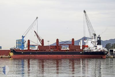
REGIUS
Cargo
Current Trip
| Trip Time | 6 days |
|---|---|
| Trip Distance | 307.49 nm |
| AVG Speed | 9.6 Knopen |
| MAX Speed | 12.2 Knopen |
| Diepgang | 9.7 M |
| AVG Wind | 7.3 knots |
| MAX Wind | 22 knots |
| MIN Temp | 10.5°C / 50.9°F |
| MAX Temp | 16.7°C / 62.06°F |
| Positie ontvangen | 26 d geleden |
Current Position
| Lengtegraad | --- |
|---|---|
| Breedtegraat | --- |
| Status | At anchor |
| Snelheid | 0.3 Knopen |
| Koers | 304° |
| Gebied | Mediterranean Sea - Western Basin |
| Station | T-AIS |
| Positie ontvangen | 26 d geleden |
Info
Information
The current position of REGIUS is in Mediterranean Sea - Western Basin with coordinates 36.80996° / 3.08650° as reported on 2024-11-21 16:21 by AIS to our vessel tracker app. The vessel's current speed is 0.3 Knopen and is currently inside the port of ARZEW.
The vessel REGIUS (IMO: 9737113, MMSI: 538006871) is a Cargo It's sailing under the flag of [MH] Marshall Is.
In this page you can find informations about the vessels current position, last detected port calls, and current voyage information. If the vessels is not in coverage by AIS you will find the latest position.
The current position of REGIUS is detected by our AIS receivers and we are not responsible for the reliability of the data. The last position was recorded while the vessel was in Coverage by the Ais receivers of our vessel tracking app.
The current draught of REGIUS as reported by AIS is 9.7 meters
Weather
| Temperature | 12.5°C / 54.5°F |
|---|---|
| Wind Speed | 4 knots |
| Direction | 231° SW |
| Pressure | 1031.4 hPa |
| Humidity | 29.8 % |
| Cloud Coverage | 68 % |
Featured Company
Last Port Calls
| Port | Arrival | Departure | Time In Port |
|---|---|---|---|
| 2024-12-16 10:21 | |||
| 2024-11-29 11:03 | 2024-12-10 09:39 | 10 d | |
| 2024-11-07 00:17 | 2024-11-11 15:39 | 4 d | |
| 2024-11-01 20:54 | 2024-11-04 16:34 | 2 d | |
| 2024-10-28 15:37 | 2024-10-31 11:09 | 2 d | |
| 2024-10-20 02:21 | 2024-10-21 19:15 | 1 d | |
| 2024-10-08 07:15 | 2024-10-11 04:22 | 2 d |
Last Trips
| Origin | Departure | Destination | Arrival | Distance | |
|---|---|---|---|---|---|
| 2024-12-10 10:39 | 2024-12-16 11:21 | 307.49 nm | |||
| 2024-11-11 16:39 | 2024-11-29 12:03 | 2554.98 nm | |||
| 2024-11-04 16:34 | 2024-11-07 01:17 | 694.44 nm | |||
| 2024-10-31 12:09 | 2024-11-01 20:54 | 272.36 nm | |||
| 2024-10-21 21:15 | 2024-10-28 16:37 | 1687.72 nm | |||
| 2024-10-11 07:22 | 2024-10-20 04:21 | 1815.38 nm | |||
| 2024-09-30 14:09 | 2024-10-08 10:15 | 421.00 nm |
Events
| Tijd | Evenement | Details | Positie / Bestemming | Info |
|---|---|---|---|---|
| 2024-12-16 10:21 | Aankomsthaven |
|
35.85968 / -.30179
[DZ] ARZEW
|
Snelheid: 1 kn Koers: 151° |
| 2024-12-16 04:34 | Start beweging |
36.17836 / -.35581
DZ ALG
|
Snelheid: 3.3 kn Koers: 87° |
|
| 2024-12-15 17:34 | Stop beweging | 18.79 nm, North West of MOSTAGANEM |
36.17293 / -.17700
DZ ALG
|
Snelheid: 0.1 kn Koers: 351° |
| 2024-12-15 13:00 | Start beweging | 16.08 nm, North of KRISTEL |
36.07264 / -.37428
DZ ALG
|
Snelheid: 4 kn Koers: 168° |
| 2024-12-13 01:39 | Stop beweging |
36.25933 / -.21365
DZ ALG
|
Snelheid: 0.3 kn Koers: 4° |
|
| 2024-12-12 14:07 | Start beweging |
36.37345 / -.18683
DZ ALG
|
Snelheid: 3.6 kn Koers: 186° |
|
| 2024-12-11 02:21 | Stop beweging |
36.52513 / -.17042
DZ ALG
|
Snelheid: 0.3 kn Koers: 159° |
|
| 2024-12-10 09:39 | Vertrekhaven |
|
36.76131 / 3.08964
DZ ALG
|
Snelheid: 4 kn Koers: 122° |
| 2024-12-10 09:31 | Start beweging |
36.76409 / 3.07486
[DZ] ALGER
|
Snelheid: 4 kn Koers: 122° |