
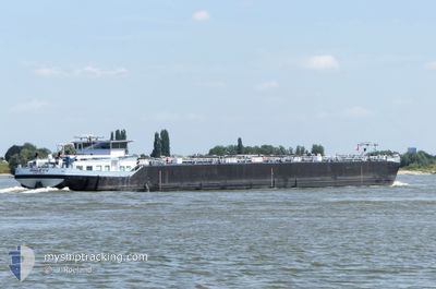
RAILEY V
Tanker
Current Trip
| Time Travelled | 4 h, 17 mins |
|---|---|
| Remaining Time | 5 h, 15 mins |
| Distance Travelled | 24.70 nm |
| Remaining Distance | 64.00 nm |
| AVG Speed | 10 Knopen |
| MAX Speed | 10.6 Knopen |
| AVG Wind | 6.4 knots |
| MAX Wind | 8.2 knots |
| MIN Temp | 0.9°C / 33.62°F |
| MAX Temp | 3.3°C / 37.94°F |
| Diepgang | 0 M |
| Positie ontvangen | 41 m geleden |
Current Position
| Lengtegraad | --- |
|---|---|
| Breedtegraat | --- |
| Status | Under way using engine |
| Snelheid | 0.6 Knopen |
| Koers | --- |
| Gebied | North Sea |
| Station | T-AIS |
| Positie ontvangen | 41 m geleden |
Information
The current position of RAILEY V is in North Sea with coordinates 51.69817° / 4.42208° as reported on 2025-02-15 18:56 by AIS to our vessel tracker app. The vessel's current speed is 0.6 Knopen and is heading at the port of AMSTERDAM. The estimated time of arrival as calculated by MyShipTracking vessel tracking app is 2025-02-16 00:52 LT
The vessel RAILEY V (MMSI: 211782820) is a Tanker It's sailing under the flag of [DE] Germany.
In this page you can find informations about the vessels current position, last detected port calls, and current voyage information. If the vessels is not in coverage by AIS you will find the latest position.
The current position of RAILEY V is detected by our AIS receivers and we are not responsible for the reliability of the data. The last position was recorded while the vessel was in Coverage by the Ais receivers of our vessel tracking app.
Weather
| Temperature | 1.2°C / 34.16°F |
|---|---|
| Wind Speed | 6 knots |
| Direction | 102° ESE |
| Pressure | 1021.7 hPa |
| Humidity | 74.2 % |
| Cloud Coverage | 100 % |
Featured Company
Last Port Calls
| Port | Arrival | Departure | Time In Port |
|---|---|---|---|
| 2025-02-09 05:56 | 2025-02-15 15:20 | 6 d | |
| 2025-02-02 15:02 | 2025-02-02 15:46 | 43 m | |
| 2025-02-01 19:16 | 2025-02-02 05:09 | 9 h | |
| 2025-02-01 04:49 | 2025-02-01 18:41 | 13 h | |
| 2025-01-31 14:32 | 2025-02-01 04:13 | 13 h | |
| 2025-01-31 11:34 | 2025-01-31 12:48 | 1 h | |
| 2025-01-30 12:57 | 2025-01-31 00:03 | 11 h | |
| 2025-01-29 13:50 | 2025-01-29 14:13 | 22 m | |
| 2025-01-28 14:17 | 2025-01-29 07:37 | 17 h | |
| 2025-01-28 12:33 | 2025-01-28 13:10 | 37 m |
Last Trips
| Origin | Departure | Destination | Arrival | Distance | |
|---|---|---|---|---|---|
| 2025-02-02 16:46 | 2025-02-09 06:56 | 570.50 nm | |||
| 2025-02-02 06:09 | 2025-02-02 16:02 | 77.26 nm | |||
| 2025-02-01 19:41 | 2025-02-01 20:16 | 3.99 nm | |||
| 2025-02-01 05:13 | 2025-02-01 05:49 | 3.68 nm | |||
| 2025-01-31 13:48 | 2025-01-31 15:32 | 18.18 nm | |||
| 2025-01-31 01:03 | 2025-01-31 12:34 | 124.93 nm | |||
| 2025-01-29 15:13 | 2025-01-30 13:57 | 163.94 nm | |||
| 2025-01-29 08:37 | 2025-01-29 14:50 | 18.37 nm | |||
| 2025-01-28 14:10 | 2025-01-28 15:17 | 5.68 nm | |||
| 2025-01-28 11:58 | 2025-01-28 13:33 | 3.59 nm |
Events
| Tijd | Evenement | Details | Positie / Bestemming | Info |
|---|---|---|---|---|
| 2025-02-15 18:55 | Stop beweging | 0.71 nm, West of WILLEMSTAD |
51.69797 / 4.42194
AMSTERDAM JAN VAN RI
|
Snelheid: Koers: 511° |
| 2025-02-15 16:24 | Start beweging | 3.21 nm, South West of BERGEN OP ZOOM |
51.44940 / 4.23089
AMSTERDAM JAN VAN RI
|
Snelheid: 4 kn Koers: 351.6° |
| 2025-02-15 16:21 | Status Changed | Under way using engine Moored |
51.44782 / 4.23125
AMSTERDAM JAN VAN RI
|
Snelheid: Koers: 511° |
| 2025-02-15 16:17 | Status Changed | Moored Under way using engine |
51.44761 / 4.23122
AMSTERDAM JAN VAN RI
|
Snelheid: 0.1 kn Koers: 511° |
| 2025-02-15 16:14 | Stop beweging | 3.31 nm, South West of BERGEN OP ZOOM |
51.44747 / 4.23133
AMSTERDAM JAN VAN RI
|
Snelheid: 0.3 kn Koers: 511° |
| 2025-02-15 16:06 | Start beweging | 3.56 nm, South of BERGEN OP ZOOM |
51.44264 / 4.23250
AMSTERDAM JAN VAN RI
|
Snelheid: 3.3 kn Koers: 353.1° |
| 2025-02-15 16:06 | Status Changed | Under way using engine Moored |
51.44234 / 4.23254
AMSTERDAM JAN VAN RI
|
Snelheid: 0.3 kn Koers: 511° |
| 2025-02-15 16:00 | Status Changed | Moored Under way using engine |
51.44159 / 4.23267
AMSTERDAM JAN VAN RI
|
Snelheid: 0.2 kn Koers: 511° |
| 2025-02-15 15:58 | Status Changed | Under way using engine Moored |
51.44127 / 4.23272
AMSTERDAM JAN VAN RI
|
Snelheid: 0.4 kn Koers: 511° |
| 2025-02-15 15:49 | Status Changed | Moored Under way using engine |
51.44074 / 4.23280
AMSTERDAM JAN VAN RI
|
Snelheid: 0.2 kn Koers: 511° |