
PSU SIXTH
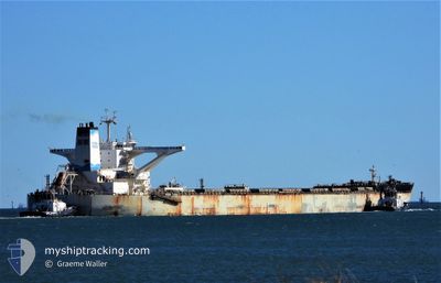
Ore Carrier
Current Trip
| Time Travelled | 10 days |
|---|---|
| Remaining Time | 13 h, 39 mins |
| Distance Travelled | 3175.28 nm |
| Remaining Distance | 166.41 nm |
| AVG Speed | 12.2 Knopen |
| MAX Speed | 15.8 Knopen |
| AVG Wind | 9 knots |
| MAX Wind | 20.1 knots |
| MIN Temp | 16.3°C / 61.34°F |
| MAX Temp | 30.2°C / 86.36°F |
| Diepgang | 10.5 M |
| Positie ontvangen | 5 m geleden |
Current Position
| Lengtegraad | 117.86292° |
|---|---|
| Breedtegraat | -17.66031° |
| Status | Under way using engine |
| Snelheid | 12.5 Knopen |
| Koers | 163° |
| Gebied | Indian Ocean |
| Station | T-AIS |
| Positie ontvangen | 5 m geleden |
Info
Information
The current position of PSU SIXTH is in Indian Ocean with coordinates -17.66031° / 117.86292° as reported on 2024-05-07 17:51 by AIS to our vessel tracker app. The vessel's current speed is 12.5 Knopen and is heading at the port of PORT HEDLAND. The estimated time of arrival as calculated by MyShipTracking vessel tracking app is 2024-05-08 07:35 LT
The vessel PSU SIXTH (IMO: 9488279, MMSI: 566870000) is a Ore Carrier that was built in 2013 ( 11 Jaar oud ). It's sailing under the flag of [SG] Singapore.
In this page you can find informations about the vessels current position, last detected port calls, and current voyage information. If the vessels is not in coverage by AIS you will find the latest position.
The current position of PSU SIXTH is detected by our AIS receivers and we are not responsible for the reliability of the data. The last position was recorded while the vessel was in Coverage by the Ais receivers of our vessel tracking app.
The current draught of PSU SIXTH as reported by AIS is 10.5 meters
Weather
| Temperature | 27.9°C / 82.22°F |
|---|---|
| Wind Speed | 4 knots |
| Direction | 73° ENE |
| Pressure | 1012.7 hPa |
| Humidity | 55.6 % |
| Cloud Coverage | --- |
Featured Company
Last Port Calls
| Port | Arrival | Departure | Time In Port |
|---|---|---|---|
| 2024-04-25 07:55 | 2024-04-27 03:00 | 1 d | |
| 2024-03-31 11:32 | 2024-04-02 06:37 | 1 d | |
| 2024-03-09 03:15 | 2024-03-13 21:00 | 4 d |
Most Visited Ports (Last year)
| Port | Arrivals | |
|---|---|---|
| 9 | ||
| 3 | ||
| 2 | ||
| 1 | ||
| 1 | ||
| 1 |
Last Trips
| Origin | Departure | Destination | Arrival | Distance | |
|---|---|---|---|---|---|
| 2024-04-02 14:37 | 2024-04-25 15:55 | 3510.91 nm | |||
| 2024-03-14 05:00 | 2024-03-31 19:32 | 3919.66 nm | |||
| 2024-02-23 08:56 | 2024-03-09 11:15 | 3880.11 nm |
Events
| Tijd | Evenement | Details | Positie / Bestemming | Info |
|---|---|---|---|---|
| 2024-05-07 16:58 | Status Changed | Under way using engine Default |
-17.48393 / 117.80526
AU PHE
|
Snelheid: 12.3 kn Koers: 162° |
| 2024-05-07 16:47 | Status Changed | Default Under way using engine |
-17.44949 / 117.79389
AU PHE
|
Snelheid: 12.2 kn Koers: 166.7° |
| 2024-05-07 16:01 | Status Changed | Under way using engine Default |
-17.29671 / 117.75491
AU PHE
|
Snelheid: 11.9 kn Koers: 167° |
| 2024-05-07 15:52 | Binnenbereik |
-17.29671 / 117.75491
Indian Ocean
AU PHE
|
Snelheid: 11.9 kn Koers: 168.8° |
|
| 2024-05-07 15:03 | Status Changed | Default Under way using engine |
-17.10895 / 117.71204
AU PHE
|
Snelheid: 11.9 kn Koers: 166.2° |
| 2024-05-07 14:56 | Buitenbereik |
-17.08352 / 117.70578
Indian Ocean
AU PHE
|
Snelheid: 11.9 kn Koers: 166.2° |
|
| 2024-05-07 14:53 | Status Changed | Under way using engine Default |
-17.07647 / 117.70402
AU PHE
|
Snelheid: 11.9 kn Koers: 167° |
| 2024-05-07 14:39 | Binnenbereik |
-17.08352 / 117.70578
Indian Ocean
AU PHE
|
Snelheid: 11.9 kn Koers: 166.2° |
|
| 2024-05-07 12:48 | Status Changed | Default Under way using engine |
-16.66667 / 117.60333
AU PHE
|
Snelheid: 12 kn Koers: 166.7° |
| 2024-05-07 12:45 | Buitenbereik |
-16.65798 / 117.60185
Indian Ocean
AU PHE
|
Snelheid: 12 kn Koers: 166.7° |