
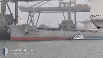
PROGRESS TRADER
Cargo
Current Trip
| Time Travelled | 4 days |
|---|---|
| Remaining Time | --- |
| Distance Travelled | 1258.45 nm |
| Remaining Distance | --- |
| AVG Speed | 12.3 Knopen |
| MAX Speed | 14.5 Knopen |
| AVG Wind | 18.9 knots |
| MAX Wind | 32 knots |
| MIN Temp | 7.9°C / 46.22°F |
| MAX Temp | 16.2°C / 61.16°F |
| Diepgang | 7.8 M |
| Positie ontvangen | 1 d geleden |
Current Position
| Lengtegraad | --- |
|---|---|
| Breedtegraat | --- |
| Status | Under way using engine |
| Snelheid | 11.7 Knopen |
| Koers | 272.7° |
| Gebied | North Atlantic Ocean |
| Station | T-AIS |
| Positie ontvangen | 1 d geleden |
Info
Information
The current position of PROGRESS TRADER is in North Atlantic Ocean with coordinates 35.96036° / -6.02624° as reported on 2026-01-05 21:28 by AIS to our vessel tracker app. The vessel's current speed is 11.7 Knopen and is heading at the port of NORFOLK. The estimated time of arrival as calculated by MyShipTracking vessel tracking app is 2026-01-17 07:00 LT
The vessel PROGRESS TRADER (IMO: 9936769, MMSI: 352001703) is a Cargo It's sailing under the flag of [PA] Panama.
In this page you can find informations about the vessels current position, last detected port calls, and current voyage information. If the vessels is not in coverage by AIS you will find the latest position.
The current position of PROGRESS TRADER is detected by our AIS receivers and we are not responsible for the reliability of the data. The last position was recorded while the vessel was in Coverage by the Ais receivers of our vessel tracking app.
The current draught of PROGRESS TRADER as reported by AIS is 7.8 meters
Weather
| Temperature | 16.1°C / 60.98°F |
|---|---|
| Wind Speed | 9 knots |
| Direction | 18° NNE |
| Pressure | 1033.5 hPa |
| Humidity | 75.3 % |
| Cloud Coverage | 28 % |
Featured Company
Last Port Calls
| Port | Arrival | Departure | Time In Port |
|---|---|---|---|
| 2025-12-23 10:15 | 2026-01-03 14:47 | 11 d | |
| 2025-12-11 21:31 | 2025-12-21 01:04 | 9 d | |
| 2025-11-08 01:32 | 2025-11-12 21:21 | 4 d |
Last Trips
| Origin | Departure | Destination | Arrival | Distance | |
|---|---|---|---|---|---|
| 2025-12-21 01:04 | 2025-12-23 10:15 | 293.84 nm | |||
| 2025-11-12 21:21 | 2025-12-11 21:31 | 6060.21 nm | |||
| 2025-09-26 23:02 | 2025-11-08 01:32 | 9055.67 nm |
Events
| Tijd | Evenement | Details | Positie / Bestemming | Info |
|---|---|---|---|---|
| 2026-01-05 21:30 | Status Changed | Default Under way using engine |
35.96060 / -6.03154
USNNS
|
Snelheid: 11.7 kn Koers: 272.7° |
| 2026-01-05 21:28 | Buitenbereik |
35.96036 / -6.02624
North Atlantic Ocean
USNNS
|
Snelheid: 11.7 kn Koers: 272.7° |
|
| 2026-01-05 21:23 | Wijzig zee gebeid | Spanish part of the North Atlantic Ocean Moroccan part of the North Atlantic Ocean |
35.95936 / -6.00373
North Atlantic Ocean
USNNS
|
Snelheid: 11.7 kn Koers: 272.5° |
| 2026-01-05 21:19 | Gevonden in zee | Moroccan part of the North Atlantic Ocean |
35.95884 / -5.98866
North Atlantic Ocean
USNNS
|
Snelheid: 11.4 kn Koers: 271.6° |
| 2026-01-05 21:16 | Gevonden in zee | Spanish part of the North Atlantic Ocean |
35.95856 / -5.97634
North Atlantic Ocean
USNNS
|
Snelheid: 11.3 kn Koers: 270.6° |
| 2026-01-05 18:17 | Wijzig zee gebeid | Spanish part of the Strait of Gibraltar Gibraltarian part of the Strait of Gibraltar |
36.01885 / -5.35126
Strait of Gibraltar
USNNS
|
Snelheid: 11.2 kn Koers: 248.8° |
| 2026-01-05 18:11 | Wijzig zee gebeid | Gibraltarian part of the Strait of Gibraltar Gibraltarian part of the Alboran Sea |
36.02437 / -5.32907
Strait of Gibraltar
USNNS
|
Snelheid: 11.6 kn Koers: 258.6° |
| 2026-01-05 18:05 | Destination Changed | USNNS GI GIB |
36.02867 / -5.30392
USNNS
|
Snelheid: 11.9 kn Koers: 255° |
| 2026-01-05 18:05 | ETA Changed | 2026/01/17 12:00 2026/01/05 21:00 |
36.02867 / -5.30392
USNNS
|
Snelheid: 11.9 kn Koers: 255° |
| 2026-01-05 17:04 | Status Changed | Under way using engine Default |
36.07377 / -5.06572
GI GIB
|
Snelheid: 12.7 kn Koers: 265° |