
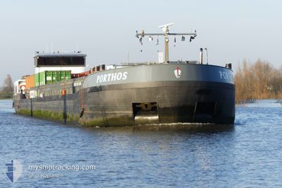
PORTHOS
Cargo
Current Trip
| Time Travelled | 35 mins |
|---|---|
| Remaining Time | 1 h, 30 mins |
| Distance Travelled | 2.79 nm |
| Remaining Distance | 12.06 nm |
| AVG Speed | 6.1 Knopen |
| MAX Speed | 7.3 Knopen |
| AVG Wind | 12.2 knots |
| MAX Wind | 13 knots |
| MIN Temp | 7.2°C / 44.96°F |
| MAX Temp | 8.3°C / 46.94°F |
| Diepgang | 0 M |
| Positie ontvangen | 1 m geleden |
Current Position
| Lengtegraad | --- |
|---|---|
| Breedtegraat | --- |
| Status | Under way using engine |
| Snelheid | 6.9 Knopen |
| Koers | 129.7° |
| Gebied | North Sea |
| Station | T-AIS |
| Positie ontvangen | 1 m geleden |
Info
Information
The current position of PORTHOS is in North Sea with coordinates 51.95262° / 4.16455° as reported on 2025-12-12 05:06 by AIS to our vessel tracker app. The vessel's current speed is 6.9 Knopen and is heading at the port of ROTTERDAM WAALHAVEN. The estimated time of arrival as calculated by MyShipTracking vessel tracking app is 2025-12-12 07:37 LT
The vessel PORTHOS (MMSI: 244740148) is a Cargo It's sailing under the flag of [NL] Netherlands.
In this page you can find informations about the vessels current position, last detected port calls, and current voyage information. If the vessels is not in coverage by AIS you will find the latest position.
The current position of PORTHOS is detected by our AIS receivers and we are not responsible for the reliability of the data. The last position was recorded while the vessel was in Coverage by the Ais receivers of our vessel tracking app.
Weather
| Temperature | 7.1°C / 44.78°F |
|---|---|
| Wind Speed | 8 knots |
| Direction | 146° SE |
| Pressure | 1018.2 hPa |
| Humidity | 89.8 % |
| Cloud Coverage | 99 % |
Featured Company
Last Port Calls
| Port | Arrival | Departure | Time In Port |
|---|---|---|---|
| 2025-12-11 13:07 | 2025-12-12 05:32 | 16 h | |
| 2025-12-11 10:01 | 2025-12-11 11:27 | 1 h | |
| 2025-12-10 22:05 | 2025-12-11 06:13 | 8 h | |
| 2025-12-10 15:56 | 2025-12-10 17:00 | 1 h | |
| 2025-12-09 19:55 | 2025-12-10 12:11 | 16 h | |
| 2025-12-09 17:51 | 2025-12-09 18:23 | 31 m | |
| 2025-12-08 21:31 | 2025-12-09 07:19 | 9 h | |
| 2025-12-07 23:52 | 2025-12-08 19:14 | 19 h | |
| 2025-12-06 17:25 | 2025-12-07 16:43 | 23 h | |
| 2025-12-04 21:10 | 2025-12-06 16:05 | 1 d |
Most Visited Ports (Last year)
| Port | Arrivals | |
|---|---|---|
| 257 | ||
| 131 | ||
| 127 | ||
| 95 | ||
| 37 | ||
| 37 |
Last Trips
| Origin | Departure | Destination | Arrival | Distance | |
|---|---|---|---|---|---|
| 2025-12-11 11:27 | 2025-12-11 13:07 | 14.64 nm | |||
| 2025-12-11 06:13 | 2025-12-11 10:01 | 25.52 nm | |||
| 2025-12-10 17:00 | 2025-12-10 22:05 | 46.94 nm | |||
| 2025-12-10 12:11 | 2025-12-10 15:56 | 15.86 nm | |||
| 2025-12-09 18:23 | 2025-12-09 19:55 | 10.53 nm | |||
| 2025-12-09 07:19 | 2025-12-09 17:51 | 62.85 nm | |||
| 2025-12-08 19:14 | 2025-12-08 21:31 | 16.36 nm | |||
| 2025-12-07 16:43 | 2025-12-07 23:52 | 55.30 nm | |||
| 2025-12-06 16:05 | 2025-12-06 17:25 | 7.15 nm | |||
| 2025-12-04 17:47 | 2025-12-04 21:10 | 11.94 nm |
Events
| Tijd | Evenement | Details | Positie / Bestemming | Info |
|---|---|---|---|---|
| 2025-12-12 04:32 | Vertrekhaven |
|
51.96248 / 4.08322
1E EEMHAVEN
|
Snelheid: 7.4 kn Koers: 97.9° |
| 2025-12-12 03:50 | Start beweging |
51.95799 / 4.00875
[NL] MAASVLAKTE - ROTTERDAM
|
Snelheid: 3.1 kn Koers: 307.9° |
|
| 2025-12-12 03:48 | Status Changed | Under way using engine Moored |
51.95738 / 4.00995
[NL] MAASVLAKTE - ROTTERDAM
|
Snelheid: 0.5 kn Koers: 511° |
| 2025-12-12 03:31 | Status Changed | Moored Default |
51.95684 / 4.01029
[NL] MAASVLAKTE - ROTTERDAM
|
Snelheid: Koers: -1° |
| 2025-12-12 03:25 | Status Changed | Default Moored |
51.95684 / 4.01031
[NL] MAASVLAKTE - ROTTERDAM
|
Snelheid: 0.1 kn Koers: 511° |
| 2025-12-12 03:19 | Status Changed | Moored Default |
51.95685 / 4.01031
[NL] MAASVLAKTE - ROTTERDAM
|
Snelheid: Koers: -1° |
| 2025-12-12 03:07 | Status Changed | Default Moored |
51.95684 / 4.01032
[NL] MAASVLAKTE - ROTTERDAM
|
Snelheid: Koers: 511° |
| 2025-12-12 03:01 | Status Changed | Moored Default |
51.95684 / 4.01033
[NL] MAASVLAKTE - ROTTERDAM
|
Snelheid: Koers: -1° |
| 2025-12-12 02:55 | Status Changed | Default Moored |
51.95683 / 4.01033
[NL] MAASVLAKTE - ROTTERDAM
|
Snelheid: Koers: 511° |
| 2025-12-12 02:43 | Status Changed | Moored Default |
51.95691 / 4.01030
[NL] MAASVLAKTE - ROTTERDAM
|
Snelheid: Koers: -1° |