
PARSIFAL
Vehicles Carrier
Current Trip
| Time Travelled | 1 day |
|---|---|
| Remaining Time | --- |
| Distance Travelled | 673.94 nm |
| Remaining Distance | --- |
| AVG Speed | 16.7 Knopen |
| MAX Speed | 21 Knopen |
| AVG Wind | 12.4 knots |
| MAX Wind | 25.9 knots |
| MIN Temp | 15°C / 59°F |
| MAX Temp | 23.5°C / 74.3°F |
| Diepgang | 11.3 M |
| Positie ontvangen | 1 d geleden |
Current Position
| Lengtegraad | 142.85274° |
|---|---|
| Breedtegraat | 37.47523° |
| Status | Under way using engine |
| Snelheid | 17.4 Knopen |
| Koers | 56.6° |
| Gebied | North Pacific Ocean |
| Station | T-AIS |
| Positie ontvangen | 1 d geleden |
Info
Information
The current position of PARSIFAL is in North Pacific Ocean with coordinates 37.47523° / 142.85274° as reported on 2024-06-15 04:05 by AIS to our vessel tracker app. The vessel's current speed is 17.4 Knopen and is heading at the port of TACOMA. The estimated time of arrival as calculated by MyShipTracking vessel tracking app is 2024-06-25 06:00 LT
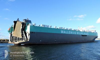
The vessel PARSIFAL (IMO: 9515395, MMSI: 259024000) is a Vehicles Carrier that was built in 2011 ( 13 Jaar oud ). It's sailing under the flag of [NO] Norway.
In this page you can find informations about the vessels current position, last detected port calls, and current voyage information. If the vessels is not in coverage by AIS you will find the latest position.
The current position of PARSIFAL is detected by our AIS receivers and we are not responsible for the reliability of the data. The last position was recorded while the vessel was in Coverage by the Ais receivers of our vessel tracking app.
The current draught of PARSIFAL as reported by AIS is 11.3 meters
Weather
| Temperature | 15.8°C / 60.44°F |
|---|---|
| Wind Speed | 23 knots |
| Direction | 144° SE |
| Pressure | 1009.4 hPa |
| Humidity | 89.2 % |
| Cloud Coverage | 100 % |
Featured Company
Last Port Calls
| Port | Arrival | Departure | Time In Port |
|---|---|---|---|
| 2024-06-13 21:15 | 2024-06-14 20:21 | 23 h | |
| 2024-06-11 22:19 | 2024-06-12 13:59 | 15 h | |
| 2024-06-10 06:53 | 2024-06-11 06:08 | 23 h | |
| 2024-06-08 21:54 | 2024-06-09 16:30 | 18 h | |
| 2024-05-28 10:04 | 2024-05-29 14:53 | 1 d | |
| 2024-05-24 14:53 | 2024-05-26 10:11 | 1 d | |
| 2024-05-16 14:00 | 2024-05-20 11:50 | 3 d | |
| 2024-04-01 18:02 | 2024-04-03 07:57 | 1 d |
Last Trips
| Origin | Departure | Destination | Arrival | Distance | |
|---|---|---|---|---|---|
| 2024-06-12 22:59 | 2024-06-14 06:15 | 195.25 nm | |||
| 2024-06-11 15:08 | 2024-06-12 07:19 | 217.17 nm | |||
| 2024-06-10 01:30 | 2024-06-10 15:53 | 244.07 nm | |||
| 2024-05-30 00:53 | 2024-06-09 06:54 | 4448.46 nm | |||
| 2024-05-26 20:11 | 2024-05-28 20:04 | 607.34 nm | |||
| 2024-05-20 19:50 | 2024-05-25 00:53 | 1712.97 nm | |||
| 2024-04-03 08:57 | 2024-05-16 22:00 | 11226.75 nm | |||
| 2024-03-29 23:57 | 2024-04-01 19:02 | 219.91 nm |
Events
| Tijd | Evenement | Details | Positie / Bestemming | Info |
|---|---|---|---|---|
| 2024-06-15 04:05 | Status Changed | Default Under way using engine |
37.47737 / 142.85683
US TIW
|
Snelheid: 17.4 kn Koers: 56.6° |
| 2024-06-15 04:05 | Buitenbereik |
37.47523 / 142.85274
North Pacific Ocean
US TIW
|
Snelheid: 17.4 kn Koers: 56.6° |
|
| 2024-06-15 03:54 | Status Changed | Under way using engine Default |
37.44611 / 142.80080
US TIW
|
Snelheid: 17.2 kn Koers: 52° |
| 2024-06-15 03:41 | Binnenbereik |
37.44611 / 142.80080
North Pacific Ocean
US TIW
|
Snelheid: 17.2 kn Koers: 53.8° |
|
| 2024-06-15 00:06 | Status Changed | Default Under way using engine |
36.79882 / 141.71481
US TIW
|
Snelheid: 16.1 kn Koers: 55.1° |
| 2024-06-14 23:59 | Status Changed | Under way using engine Default |
36.78217 / 141.68744
US TIW
|
Snelheid: 16.3 kn Koers: 49° |
| 2024-06-14 23:59 | Buitenbereik |
36.78217 / 141.68744
North Pacific Ocean
US TIW
|
Snelheid: 16.1 kn Koers: 55.1° |
|
| 2024-06-14 23:45 | Status Changed | Default Under way using engine |
36.74152 / 141.62520
US TIW
|
Snelheid: 16.7 kn Koers: 54° |
| 2024-06-14 23:37 | Status Changed | Under way using engine Default |
36.71706 / 141.58637
US TIW
|
Snelheid: 16.7 kn Koers: 52° |
| 2024-06-14 23:29 | Status Changed | Default Under way using engine |
36.69517 / 141.54871
US TIW
|
Snelheid: 16.7 kn Koers: 54.3° |