
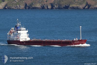
ORANESS
Chemical Tanker
Current Trip
| Time Travelled | 1 day |
|---|---|
| Remaining Time | 3 h, 40 mins |
| Distance Travelled | 323.01 nm |
| Remaining Distance | 38.54 nm |
| AVG Speed | 10.7 Knopen |
| MAX Speed | 11.3 Knopen |
| AVG Wind | 10 knots |
| MAX Wind | 16 knots |
| MIN Temp | 4.3°C / 39.74°F |
| MAX Temp | 8.9°C / 48.02°F |
| Diepgang | 4.6 M |
| Positie ontvangen | Nu |
Current Position
| Lengtegraad | 12.18780° |
|---|---|
| Breedtegraat | 54.51946° |
| Status | Under way using engine |
| Snelheid | 9.7 Knopen |
| Koers | 195° |
| Gebied | Baltic Sea |
| Station | T-AIS |
| Positie ontvangen | Nu |
Info
Information
The current position of ORANESS is in Baltic Sea with coordinates 54.51946° / 12.18780° as reported on 2024-04-27 00:00 by AIS to our vessel tracker app. The vessel's current speed is 9.7 Knopen and is heading at the port of RODBYHAVN. The estimated time of arrival as calculated by MyShipTracking vessel tracking app is 2024-04-27 03:40 LT
The vessel ORANESS (IMO: 8416786, MMSI: 220018000) is a Chemical Tanker that was built in 1985 ( 39 Jaar oud ). It's sailing under the flag of [DK] Denmark.
In this page you can find informations about the vessels current position, last detected port calls, and current voyage information. If the vessels is not in coverage by AIS you will find the latest position.
The current position of ORANESS is detected by our AIS receivers and we are not responsible for the reliability of the data. The last position was recorded while the vessel was in Coverage by the Ais receivers of our vessel tracking app.
The current draught of ORANESS as reported by AIS is 4.6 meters
Weather
| Temperature | 7.1°C / 44.78°F |
|---|---|
| Wind Speed | 10 knots |
| Direction | 195° SSW |
| Pressure | 1008.4 hPa |
| Humidity | 89.6 % |
| Cloud Coverage | 20 % |
Featured Company
Last Port Calls
| Port | Arrival | Departure | Time In Port |
|---|---|---|---|
| 2024-04-25 02:47 | 2024-04-25 17:40 | 14 h | |
| 2024-04-20 19:04 | 2024-04-22 17:08 | 1 d | |
| 2024-04-18 08:56 | 2024-04-19 15:28 | 1 d | |
| 2024-04-17 04:28 | 2024-04-18 00:50 | 20 h | |
| 2024-04-16 08:10 | 2024-04-16 16:56 | 8 h | |
| 2024-04-15 03:46 | 2024-04-15 11:07 | 7 h | |
| 2024-04-13 16:11 | 2024-04-14 10:14 | 18 h | |
| 2024-04-10 11:05 | 2024-04-10 21:31 | 10 h | |
| 2024-04-07 12:32 | 2024-04-07 21:11 | 8 h | |
| 2024-04-04 23:28 | 2024-04-05 00:43 | 1 h |
Last Trips
| Origin | Departure | Destination | Arrival | Distance | |
|---|---|---|---|---|---|
| 2024-04-22 19:08 | 2024-04-25 05:47 | 569.12 nm | |||
| 2024-04-19 17:28 | 2024-04-20 21:04 | 220.15 nm | |||
| 2024-04-18 02:50 | 2024-04-18 10:56 | 74.76 nm | |||
| 2024-04-16 18:56 | 2024-04-17 06:28 | 103.82 nm | |||
| 2024-04-15 13:07 | 2024-04-16 10:10 | 218.25 nm | |||
| 2024-04-14 12:14 | 2024-04-15 05:46 | 106.25 nm | |||
| 2024-04-11 00:31 | 2024-04-13 18:11 | 646.91 nm | |||
| 2024-04-07 23:11 | 2024-04-10 14:05 | 638.06 nm | |||
| 2024-04-05 02:43 | 2024-04-07 14:32 | 286.11 nm | |||
| 2024-04-02 23:22 | 2024-04-05 01:28 | 514.15 nm |
Events
| Tijd | Evenement | Details | Positie / Bestemming | Info |
|---|---|---|---|---|
| 2024-04-26 22:41 | Wijzig zee gebeid | Danish part of the Baltic Sea German part of the Baltic Sea |
54.67271 / 12.42360
Baltic Sea
DKROD
|
Snelheid: 9.8 kn Koers: 238.3° |
| 2024-04-26 22:23 | Gevonden in zee | German part of the Baltic Sea |
54.69947 / 12.49729
Baltic Sea
DKROD
|
Snelheid: 10.3 kn Koers: 236.6° |
| 2024-04-26 21:11 | Wijzig zee gebeid | Danish part of the Baltic Sea German part of the Baltic Sea |
54.79174 / 12.82028
Baltic Sea
DKROD
|
Snelheid: 10.9 kn Koers: 269.6° |
| 2024-04-26 15:50 | Wijzig zee gebeid | German part of the Baltic Sea Danish part of the Kattegat |
54.63558 / 14.45248
Baltic Sea
DKROD
|
Snelheid: 11.4 kn Koers: 267.4° |
| 2024-04-26 13:35 | Gevonden in zee | Danish part of the Kattegat |
54.75489 / 15.12824
Kattegat
DKROD
|
Snelheid: 10.7 kn Koers: 253.5° |
| 2024-04-26 13:11 | ETA Changed | 2024/04/27 04:00 2024/04/27 05:00 |
54.77568 / 15.24555
DKROD
|
Snelheid: 10.7 kn Koers: 251.4° |
| 2024-04-26 09:37 | ETA Changed | 2024/04/27 05:00 2024/04/27 06:00 |
54.98239 / 16.30794
DKROD
|
Snelheid: 11.1 kn Koers: 251.9° |
| 2024-04-26 08:19 | Gevonden in zee | Polish part of the Baltic Sea |
55.05647 / 16.69316
Baltic Sea
DKROD
|
Snelheid: 10.6 kn Koers: 252° |
| 2024-04-26 08:19 | Binnenbereik |
55.05647 / 16.69316
Baltic Sea
DKROD
|
Snelheid: 10.6 kn Koers: 252° |
|
| 2024-04-25 23:25 | Buitenbereik |
55.52184 / 19.32514
Baltic Sea
DKROD
|
Snelheid: 10.5 kn Koers: 253.5° |