
ORANESS
Chemical Tanker
Current Trip
| Time Travelled | 19 h, 28 mins |
|---|---|
| Remaining Time | --- |
| Distance Travelled | 145.29 nm |
| Remaining Distance | --- |
| AVG Speed | 7.2 Noeuds |
| MAX Speed | 11.1 Noeuds |
| AVG Wind | 4.5 knots |
| MAX Wind | 18.8 knots |
| MIN Temp | -1.2°C / 29.84°F |
| MAX Temp | 6.8°C / 44.24°F |
| Tirant d eau | 5 m |
| Position reçue | Maintenant |
Current Position
| Longitude | 12.29572° |
|---|---|
| Latitude | 58.29413° |
| Etat | Under way using engine |
| Vitesse | 4.1 Noeuds |
| Parcours | 44° |
| Zone | Kattegat |
| Station | T-AIS |
| Position reçue | Maintenant |
Info
Information
The current position of ORANESS is in Kattegat with coordinates 58.29413° / 12.29572° as reported on 2024-04-20 10:56 by AIS to our vessel tracker app. The vessel's current speed is 4.1 Noeuds and is heading at the port of OTTERBACKEN. The estimated time of arrival as calculated by MyShipTracking vessel tracking app is 2024-04-20 18:00 LT
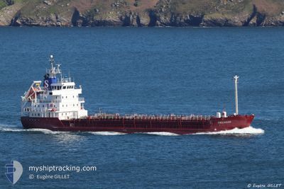
The vessel ORANESS (IMO: 8416786, MMSI: 220018000) is a Chemical Tanker that was built in 1985 ( 39 Age ). It's sailing under the flag of [DK] Denmark.
In this page you can find informations about the vessels current position, last detected port calls, and current voyage information. If the vessels is not in coverage by AIS you will find the latest position.
The current position of ORANESS is detected by our AIS receivers and we are not responsible for the reliability of the data. The last position was recorded while the vessel was in Coverage by the Ais receivers of our vessel tracking app.
The current draught of ORANESS as reported by AIS is 5 meters
Weather
| Temperature | 6.3°C / 43.34°F |
|---|---|
| Wind Speed | 5 knots |
| Direction | 28° NNE |
| Pressure | 1015.1 hPa |
| Humidity | 47.7 % |
| Cloud Coverage | 100 % |
Featured Company
Last Port Calls
| Port | Arrival | Departure | Time In Port |
|---|---|---|---|
| 2024-04-18 08:56 | 2024-04-19 15:28 | 1 d | |
| 2024-04-17 04:28 | 2024-04-18 00:50 | 20 h | |
| 2024-04-16 08:10 | 2024-04-16 16:56 | 8 h | |
| 2024-04-15 03:46 | 2024-04-15 11:07 | 7 h | |
| 2024-04-13 16:11 | 2024-04-14 10:14 | 18 h | |
| 2024-04-10 11:05 | 2024-04-10 21:31 | 10 h | |
| 2024-04-07 12:32 | 2024-04-07 21:11 | 8 h | |
| 2024-04-04 23:28 | 2024-04-05 00:43 | 1 h | |
| 2024-04-01 20:36 | 2024-04-02 21:22 | 1 d | |
| 2024-03-26 19:06 | 2024-03-27 05:35 | 10 h |
Last Trips
| Origin | Departure | Destination | Arrival | Distance | |
|---|---|---|---|---|---|
| 2024-04-18 02:50 | 2024-04-18 10:56 | 74.76 nm | |||
| 2024-04-16 18:56 | 2024-04-17 06:28 | 103.82 nm | |||
| 2024-04-15 13:07 | 2024-04-16 10:10 | 218.25 nm | |||
| 2024-04-14 12:14 | 2024-04-15 05:46 | 106.25 nm | |||
| 2024-04-11 00:31 | 2024-04-13 18:11 | 646.91 nm | |||
| 2024-04-07 23:11 | 2024-04-10 14:05 | 638.06 nm | |||
| 2024-04-05 02:43 | 2024-04-07 14:32 | 286.11 nm | |||
| 2024-04-02 23:22 | 2024-04-05 01:28 | 514.15 nm | |||
| 2024-03-27 06:35 | 2024-04-01 22:36 | 579.31 nm | |||
| 2024-03-26 11:21 | 2024-03-26 20:06 | 97.98 nm |
Events
| Heure | Evenement | Détails | Position/ Destination | Info |
|---|---|---|---|---|
| 2024-04-20 10:53 | Démarrage | 5.64 nm, South of VANERSBORG |
58.29174 / 12.29218
SEOTT
|
Vitesse: 3.4 kn Parcours: 37° |
| 2024-04-20 10:36 | Arret | 5.74 nm, South of VANERSBORG |
58.29020 / 12.29019
SEOTT
|
Vitesse: 0.3 kn Parcours: 32° |
| 2024-04-20 10:07 | Démarrage | 7.29 nm, South of VANERSBORG |
58.26637 / 12.26703
SEOTT
|
Vitesse: 3.1 kn Parcours: 47° |
| 2024-04-20 08:38 | Arret | 7.48 nm, South of VANERSBORG |
58.26501 / 12.25252
SEOTT
|
Vitesse: 0.3 kn Parcours: 88° |
| 2024-04-20 07:34 | Etat Changé | Under way using engine Default |
58.18133 / 12.12495
SEOTT
|
Vitesse: 8.2 kn Parcours: 24° |
| 2024-04-20 07:33 | Dans la zone couverte |
58.18133 / 12.12495
Kattegat
SEOTT
|
Vitesse: 8 kn Parcours: 1.4° |
|
| 2024-04-20 07:13 | Démarrage | 9.05 nm, East of KOLHATTAN |
58.14278 / 12.12669
SEOTT
|
Vitesse: 4.6 kn Parcours: 21° |
| 2024-04-20 06:48 | Arret | 8.78 nm, East of KOLHATTAN |
58.13708 / 12.11848
SEOTT
|
Vitesse: 0.3 kn Parcours: 36° |
| 2024-04-20 05:20 | Etat Changé | Default Under way using engine |
58.00896 / 12.13322
SEOTT
|
Vitesse: 8.2 kn Parcours: 350.6° |
| 2024-04-20 05:13 | Hors de la zone couverte |
57.99448 / 12.12773
Kattegat
SEOTT
|
Vitesse: 8.2 kn Parcours: 350.6° |