
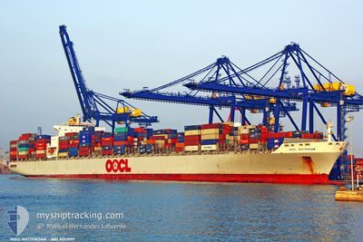
OOCL ROTTERDAM
Container Ship
Current Trip
| Time Travelled | 7 days |
|---|---|
| Remaining Time | --- |
| Distance Travelled | 2572.91 nm |
| Remaining Distance | --- |
| AVG Speed | 14.9 Knopen |
| MAX Speed | 21.5 Knopen |
| AVG Wind | 12.8 knots |
| MAX Wind | 34.9 knots |
| MIN Temp | -1.2°C / 29.84°F |
| MAX Temp | 10.7°C / 51.26°F |
| Diepgang | 11.6 M |
| Positie ontvangen | 7 d geleden |
Current Position
| Lengtegraad | -128.45483° |
|---|---|
| Breedtegraat | 48.49350° |
| Status | Under way using engine |
| Snelheid | 13.7 Knopen |
| Koers | 268.4° |
| Gebied | North Pacific Ocean |
| Station | T-AIS |
| Positie ontvangen | 7 d geleden |
Info
Information
The current position of OOCL ROTTERDAM is in North Pacific Ocean with coordinates 48.49350° / -128.45483° as reported on 2024-05-03 04:29 by AIS to our vessel tracker app. The vessel's current speed is 13.7 Knopen and is heading at the port of YANTIAN. The estimated time of arrival as calculated by MyShipTracking vessel tracking app is 2024-05-21 00:00 LT
The vessel OOCL ROTTERDAM (IMO: 9251999, MMSI: 477946000) is a Container Ship that was built in 2004 ( 20 Jaar oud ). It's sailing under the flag of [HK] Hong Kong.
In this page you can find informations about the vessels current position, last detected port calls, and current voyage information. If the vessels is not in coverage by AIS you will find the latest position.
The current position of OOCL ROTTERDAM is detected by our AIS receivers and we are not responsible for the reliability of the data. The last position was recorded while the vessel was in Coverage by the Ais receivers of our vessel tracking app.
The current draught of OOCL ROTTERDAM as reported by AIS is 11.6 meters
Weather
| Temperature | 2.5°C / 36.5°F |
|---|---|
| Wind Speed | 20 knots |
| Direction | 70° ENE |
| Pressure | 1010.9 hPa |
| Humidity | 81.7 % |
| Cloud Coverage | 100 % |
Featured Company
Last Port Calls
| Port | Arrival | Departure | Time In Port |
|---|---|---|---|
| 2024-04-29 11:08 | 2024-05-02 08:40 | 2 d | |
| 2024-04-28 01:39 | 2024-04-29 01:32 | 23 h | |
| 2024-04-23 05:46 | 2024-04-25 22:49 | 2 d | |
| 2024-04-23 04:58 | 2024-04-23 05:14 | 15 m | |
| 2024-04-11 12:45 | 2024-04-12 07:02 | 18 h | |
| 2024-04-05 10:48 | 2024-04-06 02:41 | 15 h | |
| 2024-04-03 20:00 | 2024-04-05 05:57 | 1 d | |
| 2024-03-17 21:12 | 2024-03-21 15:45 | 3 d | |
| 2024-03-13 11:12 | 2024-03-15 16:20 | 2 d | |
| 2024-03-06 05:09 | 2024-03-10 01:38 | 3 d |
Most Visited Ports (Last year)
| Port | Arrivals | |
|---|---|---|
| 8 | ||
| 7 | ||
| 5 | ||
| 4 | ||
| 4 | ||
| 4 |
Last Trips
| Origin | Departure | Destination | Arrival | Distance | |
|---|---|---|---|---|---|
| 2024-04-28 18:32 | 2024-04-29 04:08 | 158.98 nm | |||
| 2024-04-25 15:49 | 2024-04-27 18:39 | 609.93 nm | |||
| 2024-04-22 22:14 | 2024-04-22 22:46 | 0.69 nm | |||
| 2024-04-12 15:02 | 2024-04-22 21:58 | 4654.30 nm | |||
| 2024-04-06 10:41 | 2024-04-11 20:45 | 946.49 nm | |||
| 2024-04-05 13:57 | 2024-04-05 18:48 | 55.52 nm | |||
| 2024-03-21 08:45 | 2024-04-04 04:00 | 5826.70 nm | |||
| 2024-03-15 09:20 | 2024-03-17 14:12 | 164.58 nm | |||
| 2024-03-09 17:38 | 2024-03-13 04:12 | 628.44 nm | |||
| 2024-03-05 20:39 | 2024-03-05 21:09 | 0.83 nm |
Events
| Tijd | Evenement | Details | Positie / Bestemming | Info |
|---|---|---|---|---|
| 2024-05-03 04:34 | Status Changed | Default Under way using engine |
48.49324 / -128.48282
CNYTN
|
Snelheid: 13.7 kn Koers: 268.4° |
| 2024-05-03 04:29 | Buitenbereik |
48.49350 / -128.45483
North Pacific Ocean
CNYTN
|
Snelheid: 13.7 kn Koers: 268.4° |
|
| 2024-05-02 17:32 | Status Changed | Under way using engine Default |
48.52103 / -124.83781
CNYTN
|
Snelheid: 13.4 kn Koers: 280° |
| 2024-05-02 17:22 | Status Changed | Default Under way using engine |
48.51393 / -124.78577
CNYTN
|
Snelheid: 14.1 kn Koers: 292.1° |
| 2024-05-02 17:13 | Wijzig zee gebeid | Canadian part of the North Pacific Ocean Canadian part of the The Coastal Waters of Southeast Alaska and British Columbia |
48.50303 / -124.73547
North Pacific Ocean
CNYTN
|
Snelheid: 14.1 kn Koers: 290.5° |
| 2024-05-02 16:41 | Status Changed | Under way using engine Default |
48.45824 / -124.56294
CNYTN
|
Snelheid: 14 kn Koers: 291° |
| 2024-05-02 16:12 | Status Changed | Default Under way using engine |
48.41588 / -124.41003
CNYTN
|
Snelheid: 13.6 kn Koers: 293.8° |
| 2024-05-02 16:06 | Status Changed | Under way using engine Default |
48.40617 / -124.37582
CNYTN
|
Snelheid: 13.6 kn Koers: 293° |
| 2024-05-02 15:50 | Status Changed | Default Under way using engine |
48.38357 / -124.29389
CNYTN
|
Snelheid: 13.5 kn Koers: 289.7° |
| 2024-05-02 15:43 | Status Changed | Under way using engine Default |
48.37431 / -124.25794
CNYTN
|
Snelheid: 13.5 kn Koers: 291° |