
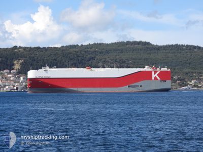
OLYMPIAN HIGHWAY
Cargo
Current Trip
| Time Travelled | 26 days |
|---|---|
| Remaining Time | 7 days |
| Distance Travelled | 9352.87 nm |
| Remaining Distance | 2800.92 nm |
| AVG Speed | 14 Knopen |
| MAX Speed | 18.7 Knopen |
| AVG Wind | 15.4 knots |
| MAX Wind | 35.7 knots |
| MIN Temp | 7.6°C / 45.68°F |
| MAX Temp | 29.3°C / 84.74°F |
| Diepgang | 9.3 M |
| Positie ontvangen | 1 d geleden |
Current Position
| Lengtegraad | 55.71687° |
|---|---|
| Breedtegraat | -20.39310° |
| Status | Under way using engine |
| Snelheid | 17.2 Knopen |
| Koers | 63.9° |
| Gebied | Indian Ocean |
| Station | T-AIS |
| Positie ontvangen | 1 d geleden |
Info
Information
The current position of OLYMPIAN HIGHWAY is in Indian Ocean with coordinates -20.39310° / 55.71687° as reported on 2024-04-26 23:47 by AIS to our vessel tracker app. The vessel's current speed is 17.2 Knopen and is heading at the port of SINGAPORE. The estimated time of arrival as calculated by MyShipTracking vessel tracking app is 2024-05-05 16:10 LT
The vessel OLYMPIAN HIGHWAY (IMO: 9757993, MMSI: 431651000) is a Cargo It's sailing under the flag of [JP] Japan.
In this page you can find informations about the vessels current position, last detected port calls, and current voyage information. If the vessels is not in coverage by AIS you will find the latest position.
The current position of OLYMPIAN HIGHWAY is detected by our AIS receivers and we are not responsible for the reliability of the data. The last position was recorded while the vessel was in Coverage by the Ais receivers of our vessel tracking app.
The current draught of OLYMPIAN HIGHWAY as reported by AIS is 9.3 meters
Weather
| Temperature | 28.1°C / 82.58°F |
|---|---|
| Wind Speed | 11 knots |
| Direction | 76° ENE |
| Pressure | 1012.3 hPa |
| Humidity | 77 % |
| Cloud Coverage | 68 % |
Featured Company
Last Port Calls
| Port | Arrival | Departure | Time In Port |
|---|---|---|---|
| 2024-03-28 09:02 | 2024-04-02 00:47 | 4 d | |
| 2024-03-20 06:11 | 2024-03-21 19:25 | 1 d | |
| 2024-03-14 05:20 | 2024-03-14 15:42 | 10 h | |
| 2024-03-11 18:18 | 2024-03-12 22:51 | 1 d | |
| 2024-03-11 17:54 | 2024-03-11 18:07 | 13 m | |
| 2024-02-08 22:39 | 2024-02-09 08:05 | 9 h | |
| 2024-02-01 03:53 | 2024-02-02 12:47 | 1 d |
Last Trips
| Origin | Departure | Destination | Arrival | Distance | |
|---|---|---|---|---|---|
| 2024-03-21 20:25 | 2024-03-28 10:02 | 2492.61 nm | |||
| 2024-03-14 17:42 | 2024-03-20 07:11 | 944.78 nm | |||
| 2024-03-13 01:51 | 2024-03-14 07:20 | 405.39 nm | |||
| 2024-03-11 21:07 | 2024-03-11 21:18 | 0.30 nm | |||
| 2024-02-09 16:05 | 2024-03-11 20:54 | 12682.87 nm | |||
| 2024-02-02 21:47 | 2024-02-09 06:39 | 2724.30 nm | |||
| 2024-01-31 17:25 | 2024-02-01 12:53 | 279.86 nm |
Events
| Tijd | Evenement | Details | Positie / Bestemming | Info |
|---|---|---|---|---|
| 2024-04-26 23:59 | Status Changed | Default Under way using engine |
-20.36907 / 55.76879
SG SIN
|
Snelheid: 17.2 kn Koers: 63.9° |
| 2024-04-26 23:47 | Status Changed | Under way using engine Default |
-20.39310 / 55.71687
SG SIN
|
Snelheid: 17 kn Koers: 65° |
| 2024-04-26 23:47 | Buitenbereik |
-20.39310 / 55.71687
Indian Ocean
SG SIN
|
Snelheid: 17.2 kn Koers: 63.9° |
|
| 2024-04-26 23:38 | Status Changed | Default Under way using engine |
-20.41234 / 55.67486
SG SIN
|
Snelheid: 17.1 kn Koers: 64° |
| 2024-04-26 19:16 | Wijzig zee gebeid | R�union part of the Indian Ocean South African part of the South Atlantic Ocean |
-21.05118 / 54.49583
Indian Ocean
SG SIN
|
Snelheid: 17.9 kn Koers: 57° |
| 2024-04-26 19:16 | Status Changed | Under way using engine Default |
-21.05118 / 54.49583
SG SIN
|
Snelheid: 17.7 kn Koers: 56° |
| 2024-04-26 18:58 | Binnenbereik |
-21.05118 / 54.49583
Indian Ocean
SG SIN
|
Snelheid: 17.9 kn Koers: 57° |
|
| 2024-04-21 17:22 | Status Changed | Default Under way using engine |
-34.88413 / 19.24494
SG SIN
|
Snelheid: 17.2 kn Koers: 114.5° |
| 2024-04-21 17:16 | Status Changed | Under way using engine Default |
-34.87030 / 19.20984
SG SIN
|
Snelheid: 17.1 kn Koers: 116° |
| 2024-04-21 17:16 | Buitenbereik |
-34.87030 / 19.20984
South Atlantic Ocean
SG SIN
|
Snelheid: 17.2 kn Koers: 114.5° |