
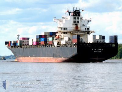
NYK DIANA
Container Ship
Current Trip
| Time Travelled | 1 day |
|---|---|
| Remaining Time | 8 days |
| Distance Travelled | 148.92 nm |
| Remaining Distance | 4173.96 nm |
| AVG Speed | 13.4 Knopen |
| MAX Speed | 19.7 Knopen |
| AVG Wind | 5.7 knots |
| MAX Wind | 15 knots |
| MIN Temp | 18.8°C / 65.84°F |
| MAX Temp | 22.8°C / 73.04°F |
| Diepgang | 11.9 M |
| Positie ontvangen | 4 h, 57 m geleden |
Current Position
| Lengtegraad | -42.47805° |
|---|---|
| Breedtegraat | -23.24635° |
| Status | Under way using engine |
| Snelheid | 19.4 Knopen |
| Koers | 90.5° |
| Gebied | South Atlantic Ocean |
| Station | T-AIS |
| Positie ontvangen | 4 h, 57 m geleden |
Info
Information
The current position of NYK DIANA is in South Atlantic Ocean with coordinates -23.24635° / -42.47805° as reported on 2024-06-06 18:52 by AIS to our vessel tracker app. The vessel's current speed is 19.4 Knopen and is heading at the port of ALGECIRAS. The estimated time of arrival as calculated by MyShipTracking vessel tracking app is 2024-06-15 17:34 LT
The vessel NYK DIANA (IMO: 9337688, MMSI: 372319000) is a Container Ship that was built in 2008 ( 16 Jaar oud ). It's sailing under the flag of [PA] Panama.
In this page you can find informations about the vessels current position, last detected port calls, and current voyage information. If the vessels is not in coverage by AIS you will find the latest position.
The current position of NYK DIANA is detected by our AIS receivers and we are not responsible for the reliability of the data. The last position was recorded while the vessel was in Coverage by the Ais receivers of our vessel tracking app.
The current draught of NYK DIANA as reported by AIS is 11.9 meters
Weather
| Temperature | 22.5°C / 72.5°F |
|---|---|
| Wind Speed | 15 knots |
| Direction | 81° E |
| Pressure | 1019.8 hPa |
| Humidity | 79.9 % |
| Cloud Coverage | 1 % |
Featured Company
Last Port Calls
| Port | Arrival | Departure | Time In Port |
|---|---|---|---|
| 2024-06-05 19:55 | 2024-06-05 20:04 | 9 m | |
| 2024-06-04 20:15 | 2024-06-04 20:21 | 6 m | |
| 2024-06-03 10:10 | 2024-06-04 06:22 | 20 h | |
| 2024-06-01 21:58 | 2024-06-02 18:23 | 20 h | |
| 2024-05-31 07:13 | 2024-06-01 01:04 | 17 h | |
| 2024-05-26 18:30 | 2024-05-27 08:15 | 13 h | |
| 2024-05-25 19:49 | 2024-05-26 03:06 | 7 h | |
| 2024-05-22 17:22 | 2024-05-22 23:40 | 6 h | |
| 2024-05-20 11:56 | 2024-05-21 01:06 | 13 h | |
| 2024-05-08 17:45 | 2024-05-09 02:28 | 8 h |
Most Visited Ports (Last year)
| Port | Arrivals | |
|---|---|---|
| 12 | ||
| 8 | ||
| 8 | ||
| 7 | ||
| 7 | ||
| 4 |
Last Trips
| Origin | Departure | Destination | Arrival | Distance | |
|---|---|---|---|---|---|
| 2024-06-04 17:21 | 2024-06-05 16:55 | 7.90 nm | |||
| 2024-06-04 03:22 | 2024-06-04 17:15 | 225.81 nm | |||
| 2024-06-02 15:23 | 2024-06-03 07:10 | 191.55 nm | |||
| 2024-05-31 22:04 | 2024-06-01 18:58 | 67.43 nm | |||
| 2024-05-27 05:15 | 2024-05-31 04:13 | 928.12 nm | |||
| 2024-05-26 00:06 | 2024-05-26 15:30 | 145.62 nm | |||
| 2024-05-22 20:40 | 2024-05-25 16:49 | 797.02 nm | |||
| 2024-05-20 22:06 | 2024-05-22 14:22 | 183.97 nm | |||
| 2024-05-09 04:28 | 2024-05-20 08:56 | 4428.53 nm | |||
| 2024-05-06 18:36 | 2024-05-08 19:45 | 413.68 nm |
Events
| Tijd | Evenement | Details | Positie / Bestemming | Info |
|---|---|---|---|---|
| 2024-06-06 18:52 | Buitenbereik |
-23.24635 / -42.47805
South Atlantic Ocean
ESALG
|
Snelheid: 19.4 kn Koers: 90.5° |
|
| 2024-06-06 14:14 | Binnenbereik |
-23.13681 / -44.03408
South Atlantic Ocean
ESALG
|
Snelheid: 7.5 kn Koers: 211.6° |
|
| 2024-06-06 13:00 | Buitenbereik |
-23.16499 / -43.67181
South Atlantic Ocean
ESALG
|
Snelheid: 18.9 kn Koers: 270.4° |
|
| 2024-06-06 11:05 | ETA Changed | 2024/06/14 23:00 2024/06/15 01:00 |
-22.95189 / -43.14792
ESALG
|
Snelheid: 13.8 kn Koers: 208.9° |
| 2024-06-06 10:18 | Start beweging | 2.48 nm, North West of RIO DE JANEIRO |
-22.87626 / -43.19818
ESALG
|
Snelheid: 3.8 kn Koers: 126° |
| 2024-06-06 10:03 | Status Changed | Under way using engine Moored |
-22.87605 / -43.20534
ESALG
|
Snelheid: Koers: 41° |
| 2024-06-06 09:32 | Draught Changed | 11.9 11.8 |
-22.87596 / -43.20543
ESALG
|
Snelheid: Koers: 41° |
| 2024-06-06 09:32 | Destination Changed | ESALG BRRIO |
-22.87596 / -43.20543
ESALG
|
Snelheid: Koers: 41° |
| 2024-06-06 09:32 | ETA Changed | 2024/06/15 01:00 2024/06/04 20:00 |
-22.87596 / -43.20543
ESALG
|
Snelheid: Koers: 41° |
| 2024-06-06 00:40 | Status Changed | Moored Default |
-22.87598 / -43.20540
BRRIO
|
Snelheid: Koers: 41° |