
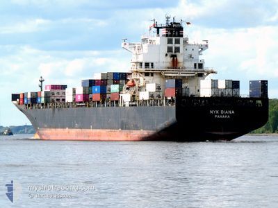
NYK DIANA
Container Ship
Current Trip
| Time Travelled | 3 days |
|---|---|
| Remaining Time | 7 days |
| Distance Travelled | 1564.14 nm |
| Remaining Distance | 2838.78 nm |
| AVG Speed | 15.9 Knots |
| MAX Speed | 17.7 Knots |
| AVG Wind | 16.2 knots |
| MAX Wind | 31.1 knots |
| MIN Temp | 15°C / 59°F |
| MAX Temp | 22.6°C / 72.68°F |
| Dybgang | 9.4 m |
| Position Modtaget | 3 h, 56 m siden |
Current Position
| Longitude | -21.33468° |
|---|---|
| Latitude | 15.81013° |
| Status | Under way using engine |
| Fart | 15.8 Knots |
| Kurs | 204.2° |
| Område | North Atlantic Ocean |
| Station | T-AIS |
| Position Modtaget | 3 h, 56 m siden |
Info
Information
The current position of NYK DIANA is in North Atlantic Ocean with coordinates 15.81013° / -21.33468° as reported on 2024-05-12 22:21 by AIS to our vessel tracker app. The vessel's current speed is 15.8 Knots and is heading at the port of SANTOS. The estimated time of arrival as calculated by MyShipTracking vessel tracking app is 2024-05-20 11:18 LT
The vessel NYK DIANA (IMO: 9337688, MMSI: 372319000) is a Container Ship that was built in 2008 ( 16 år gamle ). It's sailing under the flag of [PA] Panama.
In this page you can find informations about the vessels current position, last detected port calls, and current voyage information. If the vessels is not in coverage by AIS you will find the latest position.
The current position of NYK DIANA is detected by our AIS receivers and we are not responsible for the reliability of the data. The last position was recorded while the vessel was in Coverage by the Ais receivers of our vessel tracking app.
The current draught of NYK DIANA as reported by AIS is 9.4 meters
Weather
| Temperature | 22.7°C / 72.86°F |
|---|---|
| Wind Speed | 14 knots |
| Direction | 4° N |
| Pressure | 1012 hPa |
| Humidity | 86.2 % |
| Cloud Coverage | 81 % |
Featured Company
Last Port Calls
| Port | Arrival | Departure | Time In Port |
|---|---|---|---|
| 2024-05-08 17:45 | 2024-05-09 02:28 | 8 h | |
| 2024-05-06 07:01 | 2024-05-06 17:36 | 10 h | |
| 2024-05-02 16:33 | 2024-05-03 08:42 | 16 h | |
| 2024-05-01 07:06 | 2024-05-01 22:53 | 15 h | |
| 2024-04-28 12:15 | 2024-04-29 12:33 | 1 d | |
| 2024-04-27 00:25 | 2024-04-27 11:12 | 10 h | |
| 2024-04-20 18:08 | 2024-04-21 02:19 | 8 h | |
| 2024-04-09 07:30 | 2024-04-09 07:38 | 7 m | |
| 2024-04-07 07:45 | 2024-04-08 07:20 | 23 h | |
| 2024-04-03 23:26 | 2024-04-04 04:46 | 5 h |
Most Visited Ports (Last year)
| Port | Arrivals | |
|---|---|---|
| 12 | ||
| 8 | ||
| 8 | ||
| 7 | ||
| 5 | ||
| 4 |
Last Trips
| Origin | Departure | Destination | Arrival | Distance | |
|---|---|---|---|---|---|
| 2024-05-06 18:36 | 2024-05-08 19:45 | 413.68 nm | |||
| 2024-05-03 10:42 | 2024-05-06 08:01 | 1184.70 nm | |||
| 2024-05-02 00:53 | 2024-05-02 18:33 | 144.11 nm | |||
| 2024-04-29 14:33 | 2024-05-01 09:06 | 338.92 nm | |||
| 2024-04-27 12:12 | 2024-04-28 14:15 | 412.11 nm | |||
| 2024-04-21 04:19 | 2024-04-27 01:25 | 1453.99 nm | |||
| 2024-04-09 04:38 | 2024-04-20 20:08 | 4264.58 nm | |||
| 2024-04-08 04:20 | 2024-04-09 04:30 | 246.47 nm | |||
| 2024-04-04 01:46 | 2024-04-07 04:45 | 299.25 nm | |||
| 2024-03-30 08:38 | 2024-04-03 20:26 | 206.02 nm |
Events
| Tid | Hændelsen | Detaljer | Position / Dest | Info |
|---|---|---|---|---|
| 2024-05-12 22:24 | Status er ændret | Default Under way using engine |
15.79647 / -21.34137
BRSSZ
|
Fart: 15.8 kn Kurs: 204.2° |
| 2024-05-12 22:21 | Udenfor Dækning |
15.81013 / -21.33468
North Atlantic Ocean
BRSSZ
|
Fart: 15.8 kn Kurs: 204.2° |
|
| 2024-05-12 22:07 | Ændre havområde | Cape Verdean part of the North Atlantic Ocean Western Saharan part of the North Atlantic Ocean |
15.86284 / -21.30954
North Atlantic Ocean
BRSSZ
|
Fart: 16 kn Kurs: 205.5° |
| 2024-05-12 22:06 | Status er ændret | Under way using engine Default |
15.86948 / -21.30642
BRSSZ
|
Fart: 16.1 kn Kurs: 204° |
| 2024-05-12 21:55 | Indenfor Dækning |
15.86284 / -21.30954
North Atlantic Ocean
BRSSZ
|
Fart: 16 kn Kurs: 205.5° |
|
| 2024-05-11 00:40 | Status er ændret | Default Under way using engine |
26.64539 / -14.82919
BRSSZ
|
Fart: 16.4 kn Kurs: 222° |
| 2024-05-11 00:37 | Status er ændret | Under way using engine Default |
26.65687 / -14.81827
BRSSZ
|
Fart: 16.4 kn Kurs: 222° |
| 2024-05-11 00:37 | Udenfor Dækning |
26.65687 / -14.81827
North Atlantic Ocean
BRSSZ
|
Fart: 16.4 kn Kurs: 222° |
|
| 2024-05-11 00:25 | Status er ændret | Default Under way using engine |
26.69874 / -14.77860
BRSSZ
|
Fart: 16.3 kn Kurs: 221.2° |
| 2024-05-11 00:12 | Status er ændret | Under way using engine Default |
26.74271 / -14.73717
BRSSZ
|
Fart: 16.1 kn Kurs: 219° |