
NY SUNRISE
Cargo
Current Trip
| Time Travelled | 6 days |
|---|---|
| Remaining Time | --- |
| Distance Travelled | 604.19 nm |
| Remaining Distance | --- |
| AVG Speed | 12.2 Knopen |
| MAX Speed | 13.8 Knopen |
| AVG Wind | 9 knots |
| MAX Wind | 17.8 knots |
| MIN Temp | 27.2°C / 80.96°F |
| MAX Temp | 29.8°C / 85.64°F |
| Diepgang | 6.6 M |
| Positie ontvangen | 1 d geleden |
Current Position
| Lengtegraad | -87.50298° |
|---|---|
| Breedtegraat | 29.50440° |
| Status | Under way using engine |
| Snelheid | 11.6 Knopen |
| Koers | 323.5° |
| Gebied | Gulf of Mexico |
| Station | T-AIS |
| Positie ontvangen | 1 d geleden |
Info
Information
The current position of NY SUNRISE is in Gulf of Mexico with coordinates 29.50440° / -87.50298° as reported on 2024-06-30 12:32 by AIS to our vessel tracker app. The vessel's current speed is 11.6 Knopen
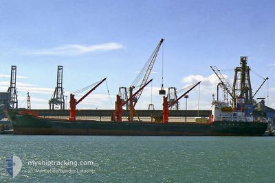
The vessel NY SUNRISE (IMO: 9934814, MMSI: 548743000) is a Cargo It's sailing under the flag of [PH] Philippines.
In this page you can find informations about the vessels current position, last detected port calls, and current voyage information. If the vessels is not in coverage by AIS you will find the latest position.
The current position of NY SUNRISE is detected by our AIS receivers and we are not responsible for the reliability of the data. The last position was recorded while the vessel was in Coverage by the Ais receivers of our vessel tracking app.
The current draught of NY SUNRISE as reported by AIS is 6.6 meters
Weather
| Temperature | 28.7°C / 83.66°F |
|---|---|
| Wind Speed | 13 knots |
| Direction | 15° NNE |
| Pressure | 1015.9 hPa |
| Humidity | 78 % |
| Cloud Coverage | --- |
Featured Company
Most Visited Ports (Last year)
| Port | Arrivals | |
|---|---|---|
| 2 | ||
| 1 | ||
| 1 | ||
| 1 | ||
| 1 | ||
| 1 |
Events
| Tijd | Evenement | Details | Positie / Bestemming | Info |
|---|---|---|---|---|
| 2024-06-30 17:23 | Stop beweging | 10.11 nm, South of DAUPHIN ISLAND |
30.08303 / -88.08619
USHOU>USMOB
|
Snelheid: 0.2 kn Koers: 315° |
| 2024-06-30 12:36 | Status Changed | Default Under way using engine |
29.51531 / -87.51229
USHOU>USMOB
|
Snelheid: 11.6 kn Koers: 323.5° |
| 2024-06-30 12:32 | Buitenbereik |
29.50440 / -87.50298
Gulf of Mexico
USHOU>USMOB
|
Snelheid: 11.6 kn Koers: 323.5° |
|
| 2024-06-30 12:31 | Status Changed | Under way using engine Default |
29.50317 / -87.50193
USHOU>USMOB
|
Snelheid: 11.5 kn Koers: 330° |
| 2024-06-30 12:31 | Binnenbereik |
29.50440 / -87.50298
Gulf of Mexico
USHOU>USMOB
|
Snelheid: 11.6 kn Koers: 323.5° |
|
| 2024-06-29 21:19 | Status Changed | Default Under way using engine |
27.67382 / -89.77176
USHOU>USMOB
|
Snelheid: 12.2 kn Koers: 77.4° |
| 2024-06-29 21:18 | Buitenbereik |
27.67331 / -89.77425
Gulf of Mexico
USHOU>USMOB
|
Snelheid: 12.2 kn Koers: 77.4° |
|
| 2024-06-29 19:01 | Status Changed | Under way using engine Default |
27.53291 / -90.27267
USHOU>USMOB
|
Snelheid: 12.6 kn Koers: 45° |
| 2024-06-29 18:59 | Status Changed | Default Under way using engine |
27.52923 / -90.27679
USHOU>USMOB
|
Snelheid: 12.6 kn Koers: 45° |
| 2024-06-29 18:50 | Status Changed | Under way using engine Default |
27.50742 / -90.30153
USHOU>USMOB
|
Snelheid: 12.7 kn Koers: 46° |