
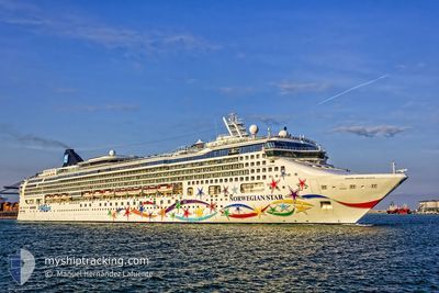
NORWEGIAN STAR
Passengers Ship
Current Trip
| Time Travelled | 10 h, 49 mins |
|---|---|
| Remaining Time | 14 h, 38 mins |
| Distance Travelled | 143.37 nm |
| Remaining Distance | 279.65 nm |
| AVG Speed | 13.4 Knopen |
| MAX Speed | 14.8 Knopen |
| AVG Wind | 6.1 knots |
| MAX Wind | 14.6 knots |
| MIN Temp | 13.3°C / 55.94°F |
| MAX Temp | 14.1°C / 57.38°F |
| Diepgang | 8.6 M |
| Positie ontvangen | 5 h, 22 m geleden |
Current Position
| Lengtegraad | -7.50130° |
|---|---|
| Breedtegraat | 50.71862° |
| Status | Under way using engine |
| Snelheid | 13.5 Knopen |
| Koers | 165.2° |
| Gebied | Celtic Sea |
| Station | T-AIS |
| Positie ontvangen | 5 h, 22 m geleden |
Info
Information
The current position of NORWEGIAN STAR is in Celtic Sea with coordinates 50.71862° / -7.50130° as reported on 2024-05-16 23:33 by AIS to our vessel tracker app. The vessel's current speed is 13.5 Knopen and is heading at the port of SOUTHAMPTON. The estimated time of arrival as calculated by MyShipTracking vessel tracking app is 2024-05-17 20:33 LT
The vessel NORWEGIAN STAR (IMO: 9195157, MMSI: 311082000) is a Passengers Ship that was built in 2001 ( 23 Jaar oud ). It's sailing under the flag of [BS] Bahamas.
In this page you can find informations about the vessels current position, last detected port calls, and current voyage information. If the vessels is not in coverage by AIS you will find the latest position.
The current position of NORWEGIAN STAR is detected by our AIS receivers and we are not responsible for the reliability of the data. The last position was recorded while the vessel was in Coverage by the Ais receivers of our vessel tracking app.
The current draught of NORWEGIAN STAR as reported by AIS is 8.6 meters
Weather
| Temperature | 13.9°C / 57.02°F |
|---|---|
| Wind Speed | 12 knots |
| Direction | 345° NNW |
| Pressure | 1006.5 hPa |
| Humidity | 83.1 % |
| Cloud Coverage | 86 % |
Featured Company
Last Port Calls
| Port | Arrival | Departure | Time In Port |
|---|---|---|---|
| 2024-05-16 06:01 | 2024-05-16 19:06 | 13 h | |
| 2024-05-16 05:50 | 2024-05-16 05:58 | 7 m | |
| 2024-05-15 15:04 | 2024-05-15 15:14 | 9 m | |
| 2024-05-15 09:42 | 2024-05-15 09:47 | 5 m | |
| 2024-05-12 18:59 | 2024-05-12 19:16 | 16 m | |
| 2024-05-12 18:26 | 2024-05-12 18:37 | 10 m | |
| 2024-05-12 18:06 | 2024-05-12 18:14 | 8 m | |
| 2024-05-12 17:25 | 2024-05-12 17:30 | 5 m | |
| 2024-05-12 15:32 | 2024-05-12 15:36 | 4 m | |
| 2024-05-12 13:56 | 2024-05-12 14:03 | 7 m |
Most Visited Ports (Last year)
| Port | Arrivals | |
|---|---|---|
| 15 | ||
| 12 | ||
| 9 | ||
| 8 | ||
| 7 | ||
| 7 |
Last Trips
| Origin | Departure | Destination | Arrival | Distance | |
|---|---|---|---|---|---|
| 2024-05-16 05:58 | 2024-05-16 06:01 | 0.92 nm | |||
| 2024-05-15 15:14 | 2024-05-16 05:50 | 189.91 nm | |||
| 2024-05-15 09:47 | 2024-05-15 15:04 | 23.80 nm | |||
| 2024-05-12 19:16 | 2024-05-15 09:42 | 564.18 nm | |||
| 2024-05-12 18:37 | 2024-05-12 18:59 | 1.94 nm | |||
| 2024-05-12 18:14 | 2024-05-12 18:26 | 1.34 nm | |||
| 2024-05-12 17:30 | 2024-05-12 18:06 | 3.90 nm | |||
| 2024-05-12 15:36 | 2024-05-12 17:25 | 7.57 nm | |||
| 2024-05-12 14:03 | 2024-05-12 15:32 | 7.23 nm | |||
| 2024-05-12 12:47 | 2024-05-12 13:56 | 7.28 nm |
Events
| Tijd | Evenement | Details | Positie / Bestemming | Info |
|---|---|---|---|---|
| 2024-05-16 23:38 | Status Changed | Default Under way using engine |
50.69805 / -7.49261
IE COB -> GB SOU
|
Snelheid: 13.5 kn Koers: 165.2° |
| 2024-05-16 23:33 | Buitenbereik |
50.71862 / -7.50130
Celtic Sea
IE COB -> GB SOU
|
Snelheid: 13.5 kn Koers: 165.2° |
|
| 2024-05-16 23:32 | Wijzig zee gebeid | United Kingdom part of the Celtic Sea Irish part of the Celtic Sea |
50.72224 / -7.50285
Celtic Sea
IE COB -> GB SOU
|
Snelheid: 13.5 kn Koers: 164.2° |
| 2024-05-16 23:31 | Status Changed | Under way using engine Default |
50.72344 / -7.50340
IE COB -> GB SOU
|
Snelheid: 14 kn Koers: 160° |
| 2024-05-16 23:26 | Status Changed | Default Under way using engine |
50.74221 / -7.51377
IE COB -> GB SOU
|
Snelheid: 13.5 kn Koers: 160.4° |
| 2024-05-16 23:20 | Status Changed | Under way using engine Default |
50.76342 / -7.52571
IE COB -> GB SOU
|
Snelheid: 13.4 kn Koers: 160° |
| 2024-05-16 22:58 | Status Changed | Default Under way using engine |
50.84030 / -7.56916
IE COB -> GB SOU
|
Snelheid: 13.4 kn Koers: 160.5° |
| 2024-05-16 18:06 | Vertrekhaven |
|
51.84230 / -8.26184
IE COB -> GB SOU
|
Snelheid: 9.8 kn Koers: 172° |
| 2024-05-16 17:55 | Start beweging |
51.84754 / -8.29621
[IE] CORK
|
Snelheid: 3.1 kn Koers: 82° |
|
| 2024-05-16 17:48 | Status Changed | Under way using engine Moored |
51.84834 / -8.29859
[IE] CORK
|
Snelheid: Koers: 76° |