
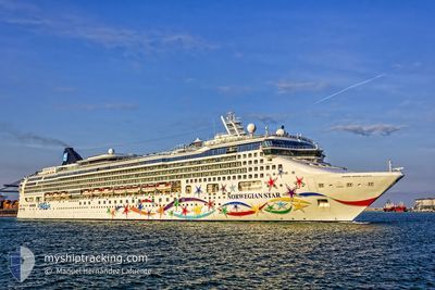
NORWEGIAN STAR
Passengers Ship
Current Trip
| Trip Time | 1 day |
|---|---|
| Trip Distance | 429.61 nm |
| AVG Speed | 13.2 Noeuds |
| MAX Speed | 16.3 Noeuds |
| Tirant d eau | 8.6 m |
| AVG Wind | 5.1 knots |
| MAX Wind | 14.6 knots |
| MIN Temp | 12.8°C / 55.04°F |
| MAX Temp | 14.4°C / 57.92°F |
| Position reçue | 5 m depuis |
Current Position
| Longitude | -1.41595° |
|---|---|
| Latitude | 50.90014° |
| Etat | Moored |
| Vitesse | |
| Parcours | 298° |
| Zone | English Channel |
| Station | T-AIS |
| Position reçue | 5 m depuis |
Info
Information
The current position of NORWEGIAN STAR is in English Channel with coordinates 50.90014° / -1.41595° as reported on 2024-05-18 03:44 by AIS to our vessel tracker app. The vessel's current speed is 0 Noeuds and is currently inside the port of SOUTHAMPTON.
The vessel NORWEGIAN STAR (IMO: 9195157, MMSI: 311082000) is a Passengers Ship that was built in 2001 ( 23 Age ). It's sailing under the flag of [BS] Bahamas.
In this page you can find informations about the vessels current position, last detected port calls, and current voyage information. If the vessels is not in coverage by AIS you will find the latest position.
The current position of NORWEGIAN STAR is detected by our AIS receivers and we are not responsible for the reliability of the data. The last position was recorded while the vessel was in Coverage by the Ais receivers of our vessel tracking app.
The current draught of NORWEGIAN STAR as reported by AIS is 8.6 meters
Weather
| Temperature | 12.5°C / 54.5°F |
|---|---|
| Wind Speed | 4 knots |
| Direction | 348° NNW |
| Pressure | 1012.1 hPa |
| Humidity | 90.3 % |
| Cloud Coverage | 100 % |
Featured Company
Last Port Calls
| Port | Arrival | Departure | Time In Port |
|---|---|---|---|
| 2024-05-18 03:44 | |||
| 2024-05-16 06:01 | 2024-05-16 19:06 | 13 h | |
| 2024-05-16 05:50 | 2024-05-16 05:58 | 7 m | |
| 2024-05-15 15:04 | 2024-05-15 15:14 | 9 m | |
| 2024-05-15 09:42 | 2024-05-15 09:47 | 5 m | |
| 2024-05-12 18:59 | 2024-05-12 19:16 | 16 m | |
| 2024-05-12 18:26 | 2024-05-12 18:37 | 10 m | |
| 2024-05-12 18:06 | 2024-05-12 18:14 | 8 m | |
| 2024-05-12 17:25 | 2024-05-12 17:30 | 5 m | |
| 2024-05-12 15:32 | 2024-05-12 15:36 | 4 m |
Most Visited Ports (Last year)
| Port | Arrivals | |
|---|---|---|
| 15 | ||
| 12 | ||
| 9 | ||
| 8 | ||
| 8 | ||
| 7 |
Last Trips
| Origin | Departure | Destination | Arrival | Distance | |
|---|---|---|---|---|---|
| 2024-05-16 19:06 | 2024-05-18 03:44 | 429.61 nm | |||
| 2024-05-16 05:58 | 2024-05-16 06:01 | 0.92 nm | |||
| 2024-05-15 15:14 | 2024-05-16 05:50 | 189.91 nm | |||
| 2024-05-15 09:47 | 2024-05-15 15:04 | 23.80 nm | |||
| 2024-05-12 19:16 | 2024-05-15 09:42 | 564.18 nm | |||
| 2024-05-12 18:37 | 2024-05-12 18:59 | 1.94 nm | |||
| 2024-05-12 18:14 | 2024-05-12 18:26 | 1.34 nm | |||
| 2024-05-12 17:30 | 2024-05-12 18:06 | 3.90 nm | |||
| 2024-05-12 15:36 | 2024-05-12 17:25 | 7.57 nm | |||
| 2024-05-12 14:03 | 2024-05-12 15:32 | 7.23 nm |
Events
| Heure | Evenement | Détails | Position/ Destination | Info |
|---|---|---|---|---|
| 2024-05-18 03:24 | Etat Changé | Moored Under way using engine |
50.90014 / -1.41595
[GB] SOUTHAMPTON
|
Vitesse: Parcours: 298° |
| 2024-05-18 03:08 | Arret |
50.89976 / -1.41590
[GB] SOUTHAMPTON
|
Vitesse: 0.3 kn Parcours: 308° |
|
| 2024-05-18 02:44 | Port d'arrivée |
|
50.87043 / -1.37875
[GB] SOUTHAMPTON
|
Vitesse: 12.4 kn Parcours: 310.2° |
| 2024-05-17 21:32 | Changement de zone | United Kingdom part of the English Channel French part of the English Channel |
50.14437 / -1.44886
English Channel
IE COB -> GB SOU
|
Vitesse: 12.1 kn Parcours: 71° |
| 2024-05-17 19:37 | Detecté en mer | French part of the English Channel |
50.02029 / -2.02404
English Channel
IE COB -> GB SOU
|
Vitesse: 12.3 kn Parcours: 73° |
| 2024-05-17 16:41 | Changement de zone | Guernsey part of the English Channel United Kingdom part of the English Channel |
49.83724 / -2.98682
English Channel
IE COB -> GB SOU
|
Vitesse: 13.8 kn Parcours: 71.9° |
| 2024-05-17 16:39 | Etat Changé | Under way using engine Default |
49.83529 / -2.99598
IE COB -> GB SOU
|
Vitesse: 13.8 kn Parcours: 78° |
| 2024-05-17 16:30 | Dans la zone couverte |
49.83724 / -2.98682
English Channel
IE COB -> GB SOU
|
Vitesse: 13.8 kn Parcours: 71.9° |
|
| 2024-05-17 14:51 | Etat Changé | Default Under way using engine |
49.75983 / -3.61876
IE COB -> GB SOU
|
Vitesse: 13.4 kn Parcours: 74.5° |
| 2024-05-17 14:43 | Hors de la zone couverte |
49.75296 / -3.66143
English Channel
IE COB -> GB SOU
|
Vitesse: 13.4 kn Parcours: 74.5° |