
NICHOLAS G.S
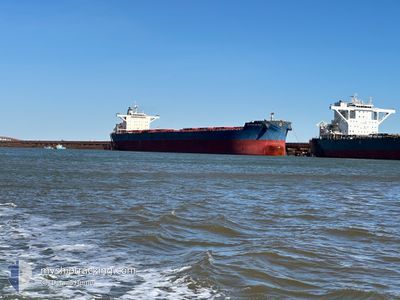
Bulk Carrier
Current Trip
| Time Travelled | --- |
|---|---|
| Remaining Time | --- |
| Distance Travelled | 3271.89 nm |
| Remaining Distance | 21.87 nm |
| AVG Speed | 11.1 Knopen |
| MAX Speed | 15.4 Knopen |
| AVG Wind | 11 knots |
| MAX Wind | 31 knots |
| MIN Temp | 0.1°C / 32.18°F |
| MAX Temp | 31.1°C / 87.98°F |
| Diepgang | 8.5 M |
| Positie ontvangen | 3 m geleden |
Current Position
| Lengtegraad | --- |
|---|---|
| Breedtegraat | --- |
| Status | At anchor |
| Snelheid | |
| Koers | 241° |
| Gebied | Indian Ocean |
| Station | T-AIS |
| Positie ontvangen | 3 m geleden |
Info
Information
The current position of NICHOLAS G.S is in Indian Ocean with coordinates -20.35637° / 116.57007° as reported on 2025-03-02 01:25 by AIS to our vessel tracker app. The vessel's current speed is 0 Knopen and is heading at the port of DAMPIER. The estimated time of arrival as calculated by MyShipTracking vessel tracking app is 2025-03-02 14:00 LT
The vessel NICHOLAS G.S (IMO: 9451264, MMSI: 538010861) is a Bulk Carrier that was built in 2010 ( 15 Jaar oud ). It's sailing under the flag of [MH] Marshall Is.
In this page you can find informations about the vessels current position, last detected port calls, and current voyage information. If the vessels is not in coverage by AIS you will find the latest position.
The current position of NICHOLAS G.S is detected by our AIS receivers and we are not responsible for the reliability of the data. The last position was recorded while the vessel was in Coverage by the Ais receivers of our vessel tracking app.
The current draught of NICHOLAS G.S as reported by AIS is 8.5 meters
Weather
| Temperature | 30.8°C / 87.44°F |
|---|---|
| Wind Speed | 8 knots |
| Direction | 198° SSW |
| Pressure | 1009.3 hPa |
| Humidity | 78.2 % |
| Cloud Coverage | 5 % |
Featured Company
Last Port Calls
Most Visited Ports (Last year)
| Port | Arrivals | |
|---|---|---|
| 4 | ||
| 2 | ||
| 1 | ||
| 1 | ||
| 1 | ||
| 1 |
Last Trips
| Origin | Departure | Destination | Arrival | Distance |
|---|
Events
| Tijd | Evenement | Details | Positie / Bestemming | Info |
|---|---|---|---|---|
| 2025-03-02 01:25 | Status Changed | At anchor Default |
-20.35637 / 116.57007
AUDAM
|
Snelheid: 0.1 kn Koers: 241° |
| 2025-03-02 01:16 | Binnenbereik |
-20.35637 / 116.57007
Indian Ocean
AUDAM
|
Snelheid: Koers: 42.9° |
|
| 2025-03-02 00:07 | Status Changed | Default At anchor |
-20.35654 / 116.57018
AUDAM
|
Snelheid: Koers: 242° |
| 2025-03-02 00:01 | Buitenbereik |
-20.35645 / 116.57014
Indian Ocean
AUDAM
|
Snelheid: Koers: 176.4° |
|
| 2025-03-01 23:58 | Status Changed | At anchor Default |
-20.35644 / 116.57016
AUDAM
|
Snelheid: 0.1 kn Koers: 243° |
| 2025-03-01 23:19 | Status Changed | Default At anchor |
-20.35654 / 116.57020
AUDAM
|
Snelheid: Koers: 245° |
| 2025-03-01 23:16 | Status Changed | At anchor Default |
-20.35652 / 116.57021
AUDAM
|
Snelheid: 0.1 kn Koers: 246° |
| 2025-03-01 23:04 | Status Changed | Default At anchor |
-20.35664 / 116.57020
AUDAM
|
Snelheid: 0.1 kn Koers: 247° |
| 2025-03-01 21:49 | Status Changed | At anchor Under way using engine |
-20.35609 / 116.56847
AUDAM
|
Snelheid: 0.3 kn Koers: 225° |
| 2025-03-01 21:47 | Stop beweging | 18.95 nm, North West of DAMPIER |
-20.35610 / 116.56835
AUDAM
|
Snelheid: 0.3 kn Koers: 225° |