
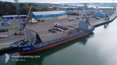
NESTOR
General Cargo
Current Trip
| Time Travelled | 3 days |
|---|---|
| Remaining Time | 12 h, 17 mins |
| Distance Travelled | 413.83 nm |
| Remaining Distance | 359.69 nm |
| AVG Speed | 9.6 Knopen |
| MAX Speed | 11.5 Knopen |
| AVG Wind | 14.7 knots |
| MAX Wind | 22.3 knots |
| MIN Temp | 7.8°C / 46.04°F |
| MAX Temp | 11°C / 51.8°F |
| Diepgang | 3.9 M |
| Positie ontvangen | 1 d geleden |
Current Position
| Lengtegraad | --- |
|---|---|
| Breedtegraat | --- |
| Status | Under way using engine |
| Snelheid | 9.8 Knopen |
| Koers | 216.9° |
| Gebied | Irish Sea and St. George's Channel |
| Station | T-AIS |
| Positie ontvangen | 1 d geleden |
Info
Information
The current position of NESTOR is in Irish Sea and St. George's Channel with coordinates 52.64235° / -4.70853° as reported on 2025-03-23 18:41 by AIS to our vessel tracker app. The vessel's current speed is 9.8 Knopen and is heading at the port of SANTANDER. The estimated time of arrival as calculated by MyShipTracking vessel tracking app is 2025-03-26 07:08 LT
The vessel NESTOR (IMO: 9234305, MMSI: 304011028) is a General Cargo that was built in 2000 ( 25 Jaar oud ). It's sailing under the flag of [AG] Antigua Barbuda.
In this page you can find informations about the vessels current position, last detected port calls, and current voyage information. If the vessels is not in coverage by AIS you will find the latest position.
The current position of NESTOR is detected by our AIS receivers and we are not responsible for the reliability of the data. The last position was recorded while the vessel was in Coverage by the Ais receivers of our vessel tracking app.
The current draught of NESTOR as reported by AIS is 3.9 meters
Weather
| Temperature | 10.7°C / 51.26°F |
|---|---|
| Wind Speed | 8 knots |
| Direction | 350° N |
| Pressure | 1025 hPa |
| Humidity | 76 % |
| Cloud Coverage | 100 % |
Featured Company
Last Port Calls
| Port | Arrival | Departure | Time In Port |
|---|---|---|---|
| 2025-03-21 12:53 | 2025-03-22 07:12 | 18 h | |
| 2025-03-19 15:47 | 2025-03-21 00:20 | 1 d | |
| 2025-03-14 09:29 | 2025-03-15 19:09 | 1 d | |
| 2025-03-08 12:26 | 2025-03-11 16:26 | 3 d | |
| 2025-03-05 17:38 | 2025-03-06 18:55 | 1 d | |
| 2025-02-25 22:37 | 2025-02-26 15:16 | 16 h | |
| 2025-02-25 01:13 | 2025-02-25 14:42 | 13 h | |
| 2025-02-20 20:06 | 2025-02-23 06:06 | 2 d | |
| 2025-02-19 17:59 | 2025-02-20 07:07 | 13 h | |
| 2025-02-09 10:22 | 2025-02-13 04:24 | 3 d |
Most Visited Ports (Last year)
| Port | Arrivals | |
|---|---|---|
| 9 | ||
| 5 | ||
| 3 | ||
| 3 | ||
| 3 | ||
| 3 |
Last Trips
| Origin | Departure | Destination | Arrival | Distance | |
|---|---|---|---|---|---|
| 2025-03-21 00:20 | 2025-03-21 12:53 | 120.50 nm | |||
| 2025-03-15 19:09 | 2025-03-19 15:47 | 838.07 nm | |||
| 2025-03-11 16:26 | 2025-03-14 09:29 | 588.63 nm | |||
| 2025-03-06 18:55 | 2025-03-08 12:26 | 360.21 nm | |||
| 2025-02-26 15:16 | 2025-03-05 17:38 | 1005.25 nm | |||
| 2025-02-25 14:42 | 2025-02-25 22:37 | 76.72 nm | |||
| 2025-02-23 06:06 | 2025-02-25 01:13 | 240.24 nm | |||
| 2025-02-20 07:07 | 2025-02-20 20:06 | 119.90 nm | |||
| 2025-02-13 04:24 | 2025-02-19 17:59 | 1078.46 nm | |||
| 2025-02-05 20:55 | 2025-02-09 10:22 | 662.11 nm |
Events
| Tijd | Evenement | Details | Positie / Bestemming | Info |
|---|---|---|---|---|
| 2025-03-23 18:48 | Status Changed | Default Under way using engine |
52.62757 / -4.72664
ESSDR
|
Snelheid: 9.8 kn Koers: 216.9° |
| 2025-03-23 18:41 | Status Changed | Under way using engine Default |
52.64235 / -4.70853
ESSDR
|
Snelheid: 9.8 kn Koers: 216° |
| 2025-03-23 18:41 | Buitenbereik |
52.64235 / -4.70853
Irish Sea and St. George's Channel
ESSDR
|
Snelheid: 9.8 kn Koers: 216.9° |
|
| 2025-03-23 18:32 | Status Changed | Default Under way using engine |
52.66208 / -4.68466
ESSDR
|
Snelheid: 9.8 kn Koers: 218.4° |
| 2025-03-23 18:25 | Status Changed | Under way using engine Default |
52.67690 / -4.66597
ESSDR
|
Snelheid: 9.9 kn Koers: 218° |
| 2025-03-23 18:24 | Status Changed | Default Under way using engine |
52.67981 / -4.66232
ESSDR
|
Snelheid: 9.9 kn Koers: 216.9° |
| 2025-03-23 18:08 | Status Changed | Under way using engine Default |
52.71379 / -4.61864
ESSDR
|
Snelheid: 9.8 kn Koers: 219° |
| 2025-03-23 18:00 | Start beweging | 11.75 nm, South West of HAFAN PWLLHELI |
52.73137 / -4.59539
ESSDR
|
Snelheid: 8.9 kn Koers: 219° |
| 2025-03-23 17:56 | Binnenbereik |
52.71379 / -4.61864
Irish Sea and St. George's Channel
ESSDR
|
Snelheid: 9.9 kn Koers: 218.5° |
|
| 2025-03-22 20:34 | Buitenbereik |
52.73919 / -4.58725
Irish Sea and St. George's Channel
ESSDR
|
Snelheid: 0.9 kn Koers: 172.7° |