
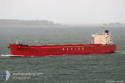
NAVIOS HERAKLES I
Cargo
Current Trip
| Time Travelled | 8 days |
|---|---|
| Remaining Time | --- |
| Distance Travelled | 2201.89 nm |
| Remaining Distance | --- |
| AVG Speed | 10.2 Knopen |
| MAX Speed | 12.9 Knopen |
| AVG Wind | 16.1 knots |
| MAX Wind | 29 knots |
| MIN Temp | 7.1°C / 44.78°F |
| MAX Temp | 18.5°C / 65.3°F |
| Diepgang | 7.9 M |
| Positie ontvangen | 1 d geleden |
Current Position
| Lengtegraad | --- |
|---|---|
| Breedtegraat | --- |
| Status | Under way using engine |
| Snelheid | 10.9 Knopen |
| Koers | 231.5° |
| Gebied | North Atlantic Ocean |
| Station | T-AIS |
| Positie ontvangen | 1 d geleden |
Info
Information
The current position of NAVIOS HERAKLES I is in North Atlantic Ocean with coordinates 34.57630° / -31.60513° as reported on 2025-03-04 04:03 by AIS to our vessel tracker app. The vessel's current speed is 10.9 Knopen and is heading at the port of PUERTO BOLIVAR. The estimated time of arrival as calculated by MyShipTracking vessel tracking app is 2025-03-17 05:00 LT
The vessel NAVIOS HERAKLES I (IMO: 9852937, MMSI: 372011000) is a Cargo It's sailing under the flag of [PA] Panama.
In this page you can find informations about the vessels current position, last detected port calls, and current voyage information. If the vessels is not in coverage by AIS you will find the latest position.
The current position of NAVIOS HERAKLES I is detected by our AIS receivers and we are not responsible for the reliability of the data. The last position was recorded while the vessel was in Coverage by the Ais receivers of our vessel tracking app.
The current draught of NAVIOS HERAKLES I as reported by AIS is 7.9 meters
Weather
| Temperature | 18.5°C / 65.3°F |
|---|---|
| Wind Speed | 9 knots |
| Direction | 235° SW |
| Pressure | 1022.6 hPa |
| Humidity | 68.6 % |
| Cloud Coverage | 100 % |
Featured Company
Last Port Calls
| Port | Arrival | Departure | Time In Port |
|---|---|---|---|
| 2025-02-24 08:31 | 2025-02-24 09:13 | 42 m | |
| 2025-02-20 06:58 | 2025-02-24 07:48 | 4 d | |
| 2025-02-19 16:04 | 2025-02-20 05:33 | 13 h | |
| 2025-01-20 19:16 | 2025-01-23 02:36 | 2 d |
Most Visited Ports (Last year)
| Port | Arrivals | |
|---|---|---|
| 2 | ||
| 2 | ||
| 1 | ||
| 1 | ||
| 1 | ||
| 1 |
Last Trips
| Origin | Departure | Destination | Arrival | Distance | |
|---|---|---|---|---|---|
| 2025-02-24 08:48 | 2025-02-24 09:31 | 4.38 nm | |||
| 2025-02-20 06:33 | 2025-02-20 07:58 | 7.54 nm | |||
| 2025-01-23 04:36 | 2025-02-19 17:04 | 7160.09 nm | |||
| 2024-11-20 09:17 | 2025-01-20 21:16 | 10353.83 nm |
Events
| Tijd | Evenement | Details | Positie / Bestemming | Info |
|---|---|---|---|---|
| 2025-03-04 04:06 | Status Changed | Default Under way using engine |
34.56897 / -31.61602
PUERTO BOLIVAR
|
Snelheid: 10.9 kn Koers: 231.5° |
| 2025-03-04 04:03 | Status Changed | Under way using engine Default |
34.57630 / -31.60513
PUERTO BOLIVAR
|
Snelheid: 10.9 kn Koers: 232° |
| 2025-03-04 04:03 | Buitenbereik |
34.57630 / -31.60513
North Atlantic Ocean
PUERTO BOLIVAR
|
Snelheid: 10.9 kn Koers: 231.5° |
|
| 2025-03-04 03:58 | Status Changed | Default Under way using engine |
34.58443 / -31.59272
PUERTO BOLIVAR
|
Snelheid: 11 kn Koers: 230.7° |
| 2025-03-04 03:52 | Status Changed | Under way using engine Default |
34.59544 / -31.57597
PUERTO BOLIVAR
|
Snelheid: 10.9 kn Koers: 232° |
| 2025-03-04 03:23 | Status Changed | Default Under way using engine |
34.65089 / -31.49056
PUERTO BOLIVAR
|
Snelheid: 10.9 kn Koers: 233.4° |
| 2025-03-04 03:10 | Status Changed | Under way using engine Default |
34.67427 / -31.45363
PUERTO BOLIVAR
|
Snelheid: 10.9 kn Koers: 233° |
| 2025-03-04 03:05 | Status Changed | Default Under way using engine |
34.68407 / -31.43808
PUERTO BOLIVAR
|
Snelheid: 10.9 kn Koers: 232.7° |
| 2025-03-04 02:13 | Status Changed | Under way using engine Default |
34.77289 / -31.28313
PUERTO BOLIVAR
|
Snelheid: 10.7 kn Koers: 235° |
| 2025-03-04 02:11 | Status Changed | Default Under way using engine |
34.77649 / -31.27654
PUERTO BOLIVAR
|
Snelheid: 10.5 kn Koers: 238.8° |