
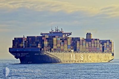
MSC TOPAZ
Container Ship
Current Trip
| Time Travelled | 18 days |
|---|---|
| Remaining Time | --- |
| Distance Travelled | 5717.67 nm |
| Remaining Distance | 17.08 nm |
| AVG Speed | 13.6 Knopen |
| MAX Speed | 18.9 Knopen |
| AVG Wind | 14.7 knots |
| MAX Wind | 34 knots |
| MIN Temp | 7.6°C / 45.68°F |
| MAX Temp | 28.7°C / 83.66°F |
| Diepgang | 11 M |
| Positie ontvangen | 9 d geleden |
Current Position
| Lengtegraad | --- |
|---|---|
| Breedtegraat | --- |
| Status | Under way using engine |
| Snelheid | 14.4 Knopen |
| Koers | 82.4° |
| Gebied | Singapore Strait |
| Station | T-AIS |
| Positie ontvangen | 9 d geleden |
Info
Information
The current position of MSC TOPAZ is in Singapore Strait with coordinates 1.25170° / 104.15146° as reported on 2024-12-17 21:39 by AIS to our vessel tracker app. The vessel's current speed is 14.4 Knopen and is heading at the port of NINGBO. The estimated time of arrival as calculated by MyShipTracking vessel tracking app is 2024-12-22 15:00 LT
The vessel MSC TOPAZ (IMO: 9502908, MMSI: 636017916) is a Container Ship that was built in 2012 ( 12 Jaar oud ). It's sailing under the flag of [LR] Liberia.
In this page you can find informations about the vessels current position, last detected port calls, and current voyage information. If the vessels is not in coverage by AIS you will find the latest position.
The current position of MSC TOPAZ is detected by our AIS receivers and we are not responsible for the reliability of the data. The last position was recorded while the vessel was in Coverage by the Ais receivers of our vessel tracking app.
The current draught of MSC TOPAZ as reported by AIS is 11 meters
Weather
| Temperature | 8.9°C / 48.02°F |
|---|---|
| Wind Speed | 13 knots |
| Direction | 348° NNW |
| Pressure | 1031 hPa |
| Humidity | 70.1 % |
| Cloud Coverage | 73 % |
Featured Company
Last Port Calls
| Port | Arrival | Departure | Time In Port |
|---|---|---|---|
| 2024-12-07 08:20 | 2024-12-08 19:35 | 1 d | |
| 2024-11-28 03:18 | 2024-11-28 21:24 | 18 h | |
| 2024-11-24 13:28 | 2024-11-25 06:42 | 17 h | |
| 2024-11-17 01:00 | 2024-11-19 13:44 | 2 d | |
| 2024-11-12 10:32 | 2024-11-14 06:46 | 1 d | |
| 2024-11-08 13:43 | 2024-11-10 22:28 | 2 d | |
| 2024-11-03 00:40 | 2024-11-04 12:48 | 1 d | |
| 2024-10-23 05:52 | 2024-10-24 21:00 | 1 d | |
| 2024-10-18 15:12 | 2024-10-19 16:06 | 1 d | |
| 2024-10-13 04:01 | 2024-10-17 16:57 | 4 d |
Last Trips
| Origin | Departure | Destination | Arrival | Distance | |
|---|---|---|---|---|---|
| 2024-11-29 01:24 | 2024-12-07 12:20 | 1225.19 nm | |||
| 2024-11-25 12:12 | 2024-11-28 07:18 | 973.55 nm | |||
| 2024-11-19 19:14 | 2024-11-24 18:58 | 1228.68 nm | |||
| 2024-11-14 12:16 | 2024-11-17 06:30 | 963.30 nm | |||
| 2024-11-11 03:58 | 2024-11-12 16:02 | 338.33 nm | |||
| 2024-11-04 18:18 | 2024-11-08 19:13 | 776.44 nm | |||
| 2024-10-25 01:00 | 2024-11-03 06:10 | 2008.44 nm | |||
| 2024-10-19 19:06 | 2024-10-23 09:52 | 336.56 nm | |||
| 2024-10-17 19:57 | 2024-10-18 18:12 | 240.52 nm | |||
| 2024-10-09 08:47 | 2024-10-13 07:01 | 671.57 nm |
Events
| Tijd | Evenement | Details | Positie / Bestemming | Info |
|---|---|---|---|---|
| 2024-12-26 23:49 | Start beweging | 9.03 nm, South West of ZHOUSHAN |
29.89406 / 122.04837
NINGBO
|
Snelheid: 5.1 kn Koers: 69° |
| 2024-12-25 06:23 | Stop beweging | 9.46 nm, South West of ZHOUSHAN |
29.89167 / 122.04028
NINGBO
|
Snelheid: Koers: 108° |
| 2024-12-17 21:45 | Status Changed | Default Under way using engine |
1.25482 / 104.17432
NINGBO
|
Snelheid: 14.4 kn Koers: 82.4° |
| 2024-12-17 21:39 | Buitenbereik |
1.25170 / 104.15146
Singapore Strait
NINGBO
|
Snelheid: 14.4 kn Koers: 82.4° |
|
| 2024-12-17 20:16 | Wijzig zee gebeid | Indonesian part of the Singapore Strait Singaporean part of the Singapore Strait |
1.18618 / 103.84001
Singapore Strait
NINGBO
|
Snelheid: 13.1 kn Koers: 72.1° |
| 2024-12-17 19:58 | Wijzig zee gebeid | Singaporean part of the Singapore Strait Indonesian part of the Singapore Strait |
1.15874 / 103.78457
Singapore Strait
NINGBO
|
Snelheid: 11.7 kn Koers: 38.5° |
| 2024-12-17 18:39 | ETA Changed | 2024/12/22 15:00 2024/12/23 08:00 |
1.08331 / 103.57053
NINGBO
|
Snelheid: 14.3 kn Koers: 128.6° |
| 2024-12-17 18:01 | Wijzig zee gebeid | Indonesian part of the Singapore Strait Indonesian part of the Malacca Strait |
1.17441 / 103.42363
Singapore Strait
NINGBO
|
Snelheid: 16.7 kn Koers: 122.4° |
| 2024-12-17 17:37 | Gevonden in zee | Indonesian part of the Malacca Strait |
1.23995 / 103.33637
Malacca Strait
NINGBO
|
Snelheid: 16.7 kn Koers: 128.3° |
| 2024-12-17 17:35 | Status Changed | Under way using engine Default |
1.24647 / 103.32841
NINGBO
|
Snelheid: 16.9 kn Koers: 132° |