

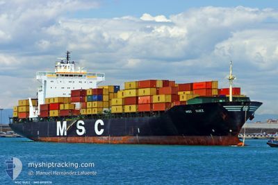
MSC SUEZ
Container Ship

Current Trip
| Time Travelled | 1 day |
|---|---|
| Remaining Time | 1 day |
| Distance Travelled | 508.91 nm |
| Remaining Distance | 812.82 nm |
| AVG Speed | 17.4 Knopen |
| MAX Speed | 20.8 Knopen |
| AVG Wind | 11.4 knots |
| MAX Wind | 18.9 knots |
| MIN Temp | 6.1°C / 42.98°F |
| MAX Temp | 13.3°C / 55.94°F |
| Diepgang | 11.3 M |
| Positie ontvangen | 15 h, 56 m geleden |
Current Position
| Lengtegraad | --- |
|---|---|
| Breedtegraat | --- |
| Status | Under way using engine |
| Snelheid | 18.7 Knopen |
| Koers | 241.1° |
| Gebied | Celtic Sea |
| Station | T-AIS |
| Positie ontvangen | 15 h, 56 m geleden |
Information
The current position of MSC SUEZ is in Celtic Sea with coordinates 49.20760° / -5.20315° as reported on 2025-02-12 10:54 by AIS to our vessel tracker app. The vessel's current speed is 18.7 Knopen and is heading at the port of CASABLANCA. The estimated time of arrival as calculated by MyShipTracking vessel tracking app is 2025-02-14 20:29 LT
The vessel MSC SUEZ (IMO: 8918978, MMSI: 355289000) is a Container Ship that was built in 1993 ( 32 Jaar oud ). It's sailing under the flag of [PA] Panama.
In this page you can find informations about the vessels current position, last detected port calls, and current voyage information. If the vessels is not in coverage by AIS you will find the latest position.
The current position of MSC SUEZ is detected by our AIS receivers and we are not responsible for the reliability of the data. The last position was recorded while the vessel was in Coverage by the Ais receivers of our vessel tracking app.
The current draught of MSC SUEZ as reported by AIS is 11.3 meters
Weather
| Temperature | 13.3°C / 55.94°F |
|---|---|
| Wind Speed | 17 knots |
| Direction | 214° SW |
| Pressure | 1015.7 hPa |
| Humidity | 96.7 % |
| Cloud Coverage | 100 % |


Featured Company
Last Port Calls
| Port | Arrival | Departure | Time In Port |
|---|---|---|---|
| 2025-02-11 08:41 | 2025-02-11 21:29 | 12 h | |
| 2025-02-08 03:22 | 2025-02-09 01:56 | 22 h | |
| 2025-02-04 12:34 | 2025-02-05 04:14 | 15 h | |
| 2025-01-10 19:48 | 2025-01-12 02:12 | 1 d | |
| 2025-01-04 19:31 | 2025-01-06 08:12 | 1 d | |
| 2024-12-30 03:20 | 2024-12-31 14:50 | 1 d | |
| 2024-12-28 10:28 | 2024-12-29 07:48 | 21 h | |
| 2024-12-22 12:41 | 2024-12-23 19:13 | 1 d | |
| 2024-12-17 17:46 | 2024-12-18 13:33 | 19 h | |
| 2024-12-15 09:18 | 2024-12-16 08:59 | 23 h |
Most Visited Ports (Last year)
| Port | Arrivals | |
|---|---|---|
| 10 | ||
| 9 | ||
| 7 | ||
| 6 | ||
| 6 | ||
| 5 |
Last Trips
| Origin | Departure | Destination | Arrival | Distance | |
|---|---|---|---|---|---|
| 2025-02-09 02:56 | 2025-02-11 09:41 | 309.49 nm | |||
| 2025-02-05 05:14 | 2025-02-08 04:22 | 313.81 nm | |||
| 2025-01-12 04:12 | 2025-02-04 13:34 | 6797.26 nm | |||
| 2025-01-06 10:12 | 2025-01-10 21:48 | 1140.58 nm | |||
| 2024-12-31 15:50 | 2025-01-04 21:31 | 930.01 nm | |||
| 2024-12-29 08:48 | 2024-12-30 04:20 | 298.87 nm | |||
| 2024-12-23 19:13 | 2024-12-28 11:28 | 1011.56 nm | |||
| 2024-12-18 13:33 | 2024-12-22 12:41 | 1153.30 nm | |||
| 2024-12-16 08:59 | 2024-12-17 17:46 | 484.50 nm | |||
| 2024-12-08 23:50 | 2024-12-15 09:18 | 867.74 nm |
Events
| Tijd | Evenement | Details | Positie / Bestemming | Info |
|---|---|---|---|---|
| 2025-02-12 10:59 | Status Changed | Default Under way using engine |
49.19318 / -5.24296
MACAS
|
Snelheid: 18.7 kn Koers: 241.1° |
| 2025-02-12 10:54 | Wijzig zee gebeid | French part of the Celtic Sea United Kingdom part of the English Channel |
49.20760 / -5.20315
Celtic Sea
MACAS
|
Snelheid: 18.7 kn Koers: 241.1° |
| 2025-02-12 10:54 | Buitenbereik |
49.20760 / -5.20315
Celtic Sea
MACAS
|
Snelheid: 18.7 kn Koers: 241.1° |
|
| 2025-02-12 10:53 | Status Changed | Under way using engine Default |
49.20837 / -5.20106
MACAS
|
Snelheid: 18.8 kn Koers: 241° |
| 2025-02-12 09:55 | Status Changed | Default Under way using engine |
49.36299 / -4.80320
MACAS
|
Snelheid: 18.8 kn Koers: 243.6° |
| 2025-02-12 09:55 | Status Changed | Under way using engine Default |
49.36444 / -4.79878
MACAS
|
Snelheid: 18.6 kn Koers: 243° |
| 2025-02-12 09:39 | Status Changed | Default Under way using engine |
49.39749 / -4.68705
MACAS
|
Snelheid: 18.6 kn Koers: 241.1° |
| 2025-02-12 09:28 | Status Changed | Under way using engine Default |
49.42330 / -4.60358
MACAS
|
Snelheid: 18.5 kn Koers: 241° |
| 2025-02-12 09:23 | Status Changed | Default Under way using engine |
49.43389 / -4.57363
MACAS
|
Snelheid: 18.4 kn Koers: 241.1° |
| 2025-02-12 09:12 | Status Changed | Under way using engine Default |
49.46128 / -4.49620
MACAS
|
Snelheid: 18.3 kn Koers: 241° |