

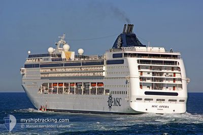
MSC OPERA
Passengers Ship

Current Trip
| Time Travelled | 1 day |
|---|---|
| Remaining Time | 35 mins |
| Distance Travelled | 381.81 nm |
| Remaining Distance | 133.01 nm |
| AVG Speed | 11.5 Knopen |
| MAX Speed | 20.1 Knopen |
| AVG Wind | 10.8 knots |
| MAX Wind | 16.7 knots |
| MIN Temp | 16.7°C / 62.06°F |
| MAX Temp | 17.9°C / 64.22°F |
| Diepgang | 7 M |
| Positie ontvangen | 1 d geleden |
Current Position
| Lengtegraad | --- |
|---|---|
| Breedtegraat | --- |
| Status | Under way using engine |
| Snelheid | 9.1 Knopen |
| Koers | 8.5° |
| Gebied | North Atlantic Ocean |
| Station | T-AIS |
| Positie ontvangen | 1 d geleden |
Information
The current position of MSC OPERA is in North Atlantic Ocean with coordinates 28.52283° / -13.78724° as reported on 2025-03-04 20:35 by AIS to our vessel tracker app. The vessel's current speed is 9.1 Knopen and is heading at the port of FUNCHAL. The estimated time of arrival as calculated by MyShipTracking vessel tracking app is 2025-03-06 05:59 LT
The vessel MSC OPERA (IMO: 9250464, MMSI: 357627000) is a Passengers Ship that was built in 2004 ( 21 Jaar oud ). It's sailing under the flag of [PA] Panama.
In this page you can find informations about the vessels current position, last detected port calls, and current voyage information. If the vessels is not in coverage by AIS you will find the latest position.
The current position of MSC OPERA is detected by our AIS receivers and we are not responsible for the reliability of the data. The last position was recorded while the vessel was in Coverage by the Ais receivers of our vessel tracking app.
The current draught of MSC OPERA as reported by AIS is 7 meters
Weather
| Temperature | 16.9°C / 62.42°F |
|---|---|
| Wind Speed | 2 knots |
| Direction | 170° S |
| Pressure | 1013.3 hPa |
| Humidity | 61.7 % |
| Cloud Coverage | --- |


Featured Company
Last Port Calls
| Port | Arrival | Departure | Time In Port |
|---|---|---|---|
| 2025-03-04 07:58 | 2025-03-04 20:07 | 12 h | |
| 2025-03-03 05:14 | 2025-03-03 22:04 | 16 h | |
| 2025-03-02 04:28 | 2025-03-02 23:14 | 18 h | |
| 2025-03-01 10:32 | 2025-03-01 18:44 | 8 h | |
| 2025-02-27 06:42 | 2025-02-27 15:57 | 9 h | |
| 2025-02-25 07:54 | 2025-02-25 20:10 | 12 h | |
| 2025-02-24 05:08 | 2025-02-24 21:53 | 16 h | |
| 2025-02-23 04:33 | 2025-02-23 22:07 | 17 h | |
| 2025-02-22 08:20 | 2025-02-22 17:53 | 9 h | |
| 2025-02-21 10:10 | 2025-02-21 18:00 | 7 h |
Last Trips
| Origin | Departure | Destination | Arrival | Distance | |
|---|---|---|---|---|---|
| 2025-03-03 22:04 | 2025-03-04 07:58 | 116.30 nm | |||
| 2025-03-02 23:14 | 2025-03-03 05:14 | 69.01 nm | |||
| 2025-03-01 18:44 | 2025-03-02 04:28 | 147.72 nm | |||
| 2025-02-27 15:57 | 2025-03-01 10:32 | 538.18 nm | |||
| 2025-02-25 20:10 | 2025-02-27 06:42 | 234.16 nm | |||
| 2025-02-24 21:53 | 2025-02-25 07:54 | 115.58 nm | |||
| 2025-02-23 22:07 | 2025-02-24 05:08 | 68.02 nm | |||
| 2025-02-22 17:53 | 2025-02-23 04:33 | 148.21 nm | |||
| 2025-02-21 18:00 | 2025-02-22 08:20 | 225.54 nm | |||
| 2025-02-20 17:51 | 2025-02-21 10:10 | 243.38 nm |
Events
| Tijd | Evenement | Details | Positie / Bestemming | Info |
|---|---|---|---|---|
| 2025-03-04 20:43 | Status Changed | Default Under way using engine |
28.54334 / -13.78402
PTFNC
|
Snelheid: 9.1 kn Koers: 8.5° |
| 2025-03-04 20:35 | Buitenbereik |
28.52283 / -13.78724
North Atlantic Ocean
PTFNC
|
Snelheid: 9.1 kn Koers: 8.5° |
|
| 2025-03-04 20:07 | Vertrekhaven |
|
28.48430 / -13.84205
PTFNC
|
Snelheid: 9.3 kn Koers: 79° |
| 2025-03-04 19:57 | Start beweging |
28.49123 / -13.85696
[ES] PUERTO DEL ROSARIO
|
Snelheid: 3.7 kn Koers: 167° |
|
| 2025-03-04 19:51 | Status Changed | Under way using engine Moored |
28.49298 / -13.85797
[ES] PUERTO DEL ROSARIO
|
Snelheid: Koers: 175° |
| 2025-03-04 18:19 | Destination Changed | PTFNC ESFUE |
28.49300 / -13.85796
[ES] PUERTO DEL ROSARIO
|
Snelheid: Koers: 175° |
| 2025-03-04 18:19 | ETA Changed | 2025/03/06 06:00 2025/03/04 08:00 |
28.49300 / -13.85796
[ES] PUERTO DEL ROSARIO
|
Snelheid: Koers: 175° |
| 2025-03-04 17:29 | Status Changed | Moored Default |
28.49295 / -13.85795
[ES] PUERTO DEL ROSARIO
|
Snelheid: Koers: 175° |
| 2025-03-04 17:26 | Status Changed | Default Moored |
28.49295 / -13.85795
[ES] PUERTO DEL ROSARIO
|
Snelheid: Koers: 175° |
| 2025-03-04 16:29 | Status Changed | Moored Default |
28.49298 / -13.85793
[ES] PUERTO DEL ROSARIO
|
Snelheid: Koers: 175° |