

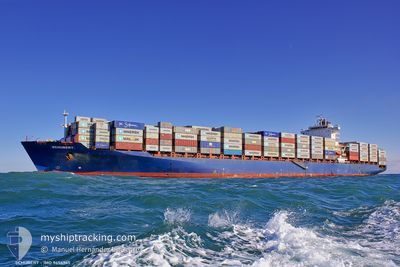
MSC ODESSA V
Container Ship

Current Trip
| Time Travelled | 21 days |
|---|---|
| Remaining Time | --- |
| Distance Travelled | 9032.86 nm |
| Remaining Distance | --- |
| AVG Speed | 17.1 Knopen |
| MAX Speed | 21.3 Knopen |
| AVG Wind | 14.7 knots |
| MAX Wind | 32 knots |
| MIN Temp | 17.8°C / 64.04°F |
| MAX Temp | 29.7°C / 85.46°F |
| Diepgang | 12.4 M |
| Positie ontvangen | 3 d geleden |
Current Position
| Lengtegraad | --- |
|---|---|
| Breedtegraat | --- |
| Status | Under way using engine |
| Snelheid | 14.3 Knopen |
| Koers | 46.4° |
| Gebied | Indian Ocean |
| Station | T-AIS |
| Positie ontvangen | 3 d geleden |
Information
The current position of MSC ODESSA V is in Indian Ocean with coordinates -29.59089° / 31.74024° as reported on 2025-03-04 13:04 by AIS to our vessel tracker app. The vessel's current speed is 14.3 Knopen and is heading at the port of ABU DHABI. The estimated time of arrival as calculated by MyShipTracking vessel tracking app is 2025-03-15 15:00 LT
The vessel MSC ODESSA V (IMO: 9456965, MMSI: 255805661) is a Container Ship that was built in 2010 ( 15 Jaar oud ). It's sailing under the flag of [PT] Portugal.
In this page you can find informations about the vessels current position, last detected port calls, and current voyage information. If the vessels is not in coverage by AIS you will find the latest position.
The current position of MSC ODESSA V is detected by our AIS receivers and we are not responsible for the reliability of the data. The last position was recorded while the vessel was in Coverage by the Ais receivers of our vessel tracking app.
The current draught of MSC ODESSA V as reported by AIS is 12.4 meters
Weather
| Temperature | 28.6°C / 83.48°F |
|---|---|
| Wind Speed | 12 knots |
| Direction | 333° NNW |
| Pressure | 1007 hPa |
| Humidity | 75.1 % |
| Cloud Coverage | 90 % |


Featured Company
Last Port Calls
| Port | Arrival | Departure | Time In Port |
|---|---|---|---|
| 2025-02-12 15:13 | 2025-02-14 12:47 | 1 d | |
| 2025-01-29 09:35 | 2025-01-31 01:08 | 1 d | |
| 2025-01-22 19:39 | 2025-01-24 00:55 | 1 d |
Last Trips
| Origin | Departure | Destination | Arrival | Distance | |
|---|---|---|---|---|---|
| 2025-01-30 19:08 | 2025-02-12 10:13 | 2404.65 nm | |||
| 2025-01-23 19:55 | 2025-01-29 03:35 | 1104.77 nm | |||
| 2024-12-27 21:59 | 2025-01-22 14:39 | 11488.85 nm |
Events
| Tijd | Evenement | Details | Positie / Bestemming | Info |
|---|---|---|---|---|
| 2025-03-04 13:10 | Status Changed | Default Under way using engine |
-29.57359 / 31.76010
ABU DHABI
|
Snelheid: 14.3 kn Koers: 46.4° |
| 2025-03-04 13:04 | Buitenbereik |
-29.59089 / 31.74024
Indian Ocean
ABU DHABI
|
Snelheid: 14.3 kn Koers: 46.4° |
|
| 2025-03-04 09:03 | Wijzig zee gebeid | South African part of the Indian Ocean South African part of the South Atlantic Ocean |
-30.42734 / 30.93410
Indian Ocean
ABU DHABI
|
Snelheid: 18.1 kn Koers: 47° |
| 2025-03-04 09:03 | Status Changed | Under way using engine Default |
-30.42734 / 30.93410
ABU DHABI
|
Snelheid: 18.4 kn Koers: 46° |
| 2025-03-04 08:56 | Binnenbereik |
-30.42734 / 30.93410
Indian Ocean
ABU DHABI
|
Snelheid: 18.1 kn Koers: 47° |
|
| 2025-03-02 11:10 | Status Changed | Default Under way using engine |
-34.51698 / 18.40433
ABU DHABI
|
Snelheid: 17.4 kn Koers: 118° |
| 2025-03-02 11:06 | Buitenbereik |
-34.50768 / 18.38294
South Atlantic Ocean
ABU DHABI
|
Snelheid: 17.4 kn Koers: 118° |
|
| 2025-03-02 10:36 | Status Changed | Under way using engine Default |
-34.44079 / 18.22714
ABU DHABI
|
Snelheid: 17.3 kn Koers: 117° |
| 2025-03-02 10:32 | Status Changed | Default Under way using engine |
-34.43211 / 18.20697
ABU DHABI
|
Snelheid: 17.3 kn Koers: 117.4° |
| 2025-03-02 10:27 | Status Changed | Under way using engine Default |
-34.42277 / 18.18524
ABU DHABI
|
Snelheid: 17.2 kn Koers: 118° |