
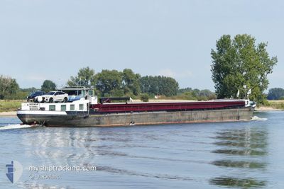
MISONDA
Cargo
Current Trip
MAASBRACHT
| Time Travelled | 4 days |
|---|---|
| Remaining Time | --- |
| Distance Travelled | 119.48 nm |
| Remaining Distance | --- |
| AVG Speed | 7.3 Knopen |
| MAX Speed | 10 Knopen |
| AVG Wind | 7 knots |
| MAX Wind | 11 knots |
| MIN Temp | -2.9°C / 26.78°F |
| MAX Temp | 3.1°C / 37.58°F |
| Diepgang | 2.6 M |
| Positie ontvangen | 1 m geleden |
Current Position
| Lengtegraad | --- |
|---|---|
| Breedtegraat | --- |
| Status | SART - Nav Aid - MOB |
| Snelheid | |
| Koers | --- |
| Gebied | North Sea |
| Station | T-AIS |
| Positie ontvangen | 1 m geleden |
Info
Information
The current position of MISONDA is in North Sea with coordinates 51.05151° / 5.80140° as reported on 2025-02-17 08:49 by AIS to our vessel tracker app. The vessel's current speed is 0 Knopen
The vessel MISONDA (IMO: 244660584, MMSI: 244660584) is a Cargo It's sailing under the flag of [NL] Netherlands.
In this page you can find informations about the vessels current position, last detected port calls, and current voyage information. If the vessels is not in coverage by AIS you will find the latest position.
The current position of MISONDA is detected by our AIS receivers and we are not responsible for the reliability of the data. The last position was recorded while the vessel was in Coverage by the Ais receivers of our vessel tracking app.
The current draught of MISONDA as reported by AIS is 2.6 meters
Weather
| Temperature | -1.6°C / 29.12°F |
|---|---|
| Wind Speed | 6 knots |
| Direction | 94° E |
| Pressure | 1024.1 hPa |
| Humidity | 69.3 % |
| Cloud Coverage | 22 % |
Featured Company
Last Port Calls
| Port | Arrival | Departure | Time In Port |
|---|---|---|---|
| 2025-02-13 00:08 | 2025-02-13 06:38 | 6 h | |
| 2025-02-12 11:09 | 2025-02-12 16:34 | 5 h | |
| 2025-02-10 22:46 | 2025-02-11 09:24 | 10 h | |
| 2025-02-10 07:16 | 2025-02-10 07:41 | 25 m | |
| 2025-02-06 21:46 | 2025-02-06 22:12 | 25 m | |
| 2025-02-04 17:04 | 2025-02-04 17:25 | 21 m | |
| 2025-02-03 21:52 | 2025-02-04 09:27 | 11 h | |
| 2025-01-31 14:48 | 2025-02-03 11:29 | 2 d | |
| 2025-01-30 15:46 | 2025-01-30 18:20 | 2 h | |
| 2025-01-29 15:56 | 2025-01-29 16:54 | 57 m |
Most Visited Ports (Last year)
| Port | Arrivals | |
|---|---|---|
| 26 | ||
| 21 | ||
| 19 | ||
| 10 | ||
| 6 | ||
| 5 |
Last Trips
| Origin | Departure | Destination | Arrival | Distance | |
|---|---|---|---|---|---|
| 2025-02-12 16:34 | 2025-02-13 00:08 | 56.47 nm | |||
| 2025-02-11 09:24 | 2025-02-12 11:09 | 73.83 nm | |||
| 2025-02-10 07:41 | 2025-02-10 22:46 | 85.33 nm | |||
| 2025-02-06 22:12 | 2025-02-10 07:16 | 15.78 nm | |||
| 2025-02-04 17:25 | 2025-02-06 21:46 | 168.51 nm | |||
| 2025-02-04 09:27 | 2025-02-04 17:04 | 16.01 nm | |||
| 2025-02-03 11:29 | 2025-02-03 21:52 | 59.46 nm | |||
| 2025-01-30 18:20 | 2025-01-31 14:48 | 72.30 nm | |||
| 2025-01-29 16:54 | 2025-01-30 15:46 | 44.11 nm | |||
| 2025-01-28 12:26 | 2025-01-29 15:56 | 112.61 nm |
Events
| Tijd | Evenement | Details | Positie / Bestemming | Info |
|---|---|---|---|---|
| 2025-02-17 07:48 | Stop beweging | 0.72 nm, South West of BARGE TERMINAL BORN |
51.05140 / 5.80143
MAASBRACHT
|
Snelheid: 0.2 kn Koers: 511° |
| 2025-02-17 06:51 | Start beweging | 0.57 nm, South West of MAASBRACHT |
51.13940 / 5.87571
MAASBRACHT
|
Snelheid: 7.9 kn Koers: 209.7° |
| 2025-02-17 06:46 | Stop beweging | 0.42 nm, South West of MAASBRACHT |
51.14169 / 5.87786
MAASBRACHT
|
Snelheid: Koers: 511° |
| 2025-02-17 06:10 | Start beweging | 0.74 nm, North of WESSEM |
51.16869 / 5.88064
MAASBRACHT
|
Snelheid: 5.7 kn Koers: 117° |
| 2025-02-16 23:13 | Status Changed | SART - Nav Aid - MOB Default |
51.17301 / 5.86451
MAASBRACHT
|
Snelheid: Koers: -1° |
| 2025-02-16 22:54 | Status Changed | Default SART - Nav Aid - MOB |
51.17305 / 5.86450
MAASBRACHT
|
Snelheid: Koers: 511° |
| 2025-02-16 22:48 | Status Changed | SART - Nav Aid - MOB Default |
51.17305 / 5.86449
MAASBRACHT
|
Snelheid: Koers: -1° |
| 2025-02-16 22:42 | Status Changed | Default SART - Nav Aid - MOB |
51.17306 / 5.86447
MAASBRACHT
|
Snelheid: Koers: 511° |
| 2025-02-16 22:03 | Binnenbereik |
51.17304 / 5.86447
North Sea
|
Snelheid: Koers: 30.1° |
|
| 2025-02-16 19:37 | Buitenbereik |
51.17306 / 5.86442
North Sea
|
Snelheid: Koers: 26.8° |