
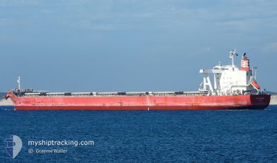
MG KRONOS
Cargo
Current Trip
| Time Travelled | 5 days |
|---|---|
| Remaining Time | --- |
| Distance Travelled | 1537.54 nm |
| Remaining Distance | --- |
| AVG Speed | 12 Knopen |
| MAX Speed | 15.3 Knopen |
| AVG Wind | 16.3 knots |
| MAX Wind | 30.1 knots |
| MIN Temp | 2°C / 35.6°F |
| MAX Temp | 15.9°C / 60.62°F |
| Diepgang | 7.5 M |
| Positie ontvangen | 2 d geleden |
Current Position
| Lengtegraad | 141.83196° |
|---|---|
| Breedtegraat | 41.69359° |
| Status | Under way using engine |
| Snelheid | 12.4 Knopen |
| Koers | 83.6° |
| Gebied | North Pacific Ocean |
| Station | T-AIS |
| Positie ontvangen | 2 d geleden |
Info
Information
The current position of MG KRONOS is in North Pacific Ocean with coordinates 41.69359° / 141.83196° as reported on 2024-04-25 20:40 by AIS to our vessel tracker app. The vessel's current speed is 12.4 Knopen and is heading at the port of TSAWWASSEN. The estimated time of arrival as calculated by MyShipTracking vessel tracking app is 2024-05-09 12:00 LT
The vessel MG KRONOS (IMO: 9774288, MMSI: 371207000) is a Cargo It's sailing under the flag of [PA] Panama.
In this page you can find informations about the vessels current position, last detected port calls, and current voyage information. If the vessels is not in coverage by AIS you will find the latest position.
The current position of MG KRONOS is detected by our AIS receivers and we are not responsible for the reliability of the data. The last position was recorded while the vessel was in Coverage by the Ais receivers of our vessel tracking app.
The current draught of MG KRONOS as reported by AIS is 7.5 meters
Weather
| Temperature | 2°C / 35.6°F |
|---|---|
| Wind Speed | 15 knots |
| Direction | 267° W |
| Pressure | 1004.9 hPa |
| Humidity | 97.9 % |
| Cloud Coverage | 100 % |
Featured Company
Last Port Calls
| Port | Arrival | Departure | Time In Port |
|---|---|---|---|
| 2024-04-20 02:20 | 2024-04-23 01:56 | 2 d | |
| 2024-03-24 04:39 | 2024-03-25 01:41 | 21 h | |
| 2024-03-11 04:41 | 2024-03-12 18:55 | 1 d | |
| 2024-02-12 21:42 | 2024-02-18 10:03 | 5 d |
Most Visited Ports (Last year)
| Port | Arrivals | |
|---|---|---|
| 2 | ||
| 2 | ||
| 1 | ||
| 1 | ||
| 1 | ||
| 1 |
Last Trips
| Origin | Departure | Destination | Arrival | Distance | |
|---|---|---|---|---|---|
| 2024-03-25 11:41 | 2024-04-20 11:20 | 4301.92 nm | |||
| 2024-03-13 07:55 | 2024-03-24 14:39 | 1989.38 nm | |||
| 2024-02-18 18:03 | 2024-03-11 17:41 | 6006.74 nm | |||
| 2023-12-23 00:44 | 2024-02-13 05:42 | 10136.40 nm |
Events
| Tijd | Evenement | Details | Positie / Bestemming | Info |
|---|---|---|---|---|
| 2024-04-25 20:41 | Status Changed | Default Under way using engine |
41.69429 / 141.84044
CA RTB
|
Snelheid: 12.4 kn Koers: 83.6° |
| 2024-04-25 20:40 | Buitenbereik |
41.69359 / 141.83196
North Pacific Ocean
CA RTB
|
Snelheid: 12.4 kn Koers: 83.6° |
|
| 2024-04-25 18:40 | Wijzig zee gebeid | Japanese part of the North Pacific Ocean Japanese part of the Japan Sea |
41.65203 / 141.28062
North Pacific Ocean
CA RTB
|
Snelheid: 12.2 kn Koers: 84.4° |
| 2024-04-25 17:57 | Status Changed | Under way using engine Default |
41.63153 / 141.08647
CA RTB
|
Snelheid: 13 kn Koers: 81° |
| 2024-04-25 17:56 | Status Changed | Default Under way using engine |
41.63103 / 141.08168
CA RTB
|
Snelheid: 13.9 kn Koers: 85.2° |
| 2024-04-25 17:30 | Status Changed | Under way using engine Default |
41.62492 / 140.94708
CA RTB
|
Snelheid: 14.5 kn Koers: 84° |
| 2024-04-25 17:28 | Status Changed | Default Under way using engine |
41.62404 / 140.93539
CA RTB
|
Snelheid: 14.5 kn Koers: 83° |
| 2024-04-25 17:10 | Status Changed | Under way using engine Default |
41.60971 / 140.84038
CA RTB
|
Snelheid: 14.6 kn Koers: 62° |
| 2024-04-25 17:01 | Status Changed | Default Under way using engine |
41.59141 / 140.79868
CA RTB
|
Snelheid: 14.1 kn Koers: 58.4° |
| 2024-04-25 15:39 | Draught Changed | 7.5 12.2 |
41.42220 / 140.42010
CA RTB
|
Snelheid: 14.5 kn Koers: 59.6° |