
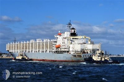
MAYSORA
Livestock Carrier
Current Trip
| Time Travelled | 14 days |
|---|---|
| Remaining Time | 3 days |
| Distance Travelled | 4173.47 nm |
| Remaining Distance | 1091.81 nm |
| AVG Speed | 11.6 Knopen |
| MAX Speed | 15.9 Knopen |
| AVG Wind | 12.2 knots |
| MAX Wind | 22 knots |
| MIN Temp | 13.2°C / 55.76°F |
| MAX Temp | 29°C / 84.2°F |
| Diepgang | 9.6 M |
| Positie ontvangen | 1 d geleden |
Current Position
| Lengtegraad | --- |
|---|---|
| Breedtegraat | --- |
| Status | Under way using engine |
| Snelheid | 12.9 Knopen |
| Koers | 78.3° |
| Gebied | Mediterranean Sea - Western Basin |
| Station | T-AIS |
| Positie ontvangen | 1 d geleden |
Info
Information
The current position of MAYSORA is in Mediterranean Sea - Western Basin with coordinates 36.73645° / 0.63844° as reported on 2025-12-10 19:59 by AIS to our vessel tracker app. The vessel's current speed is 12.9 Knopen and is heading at the port of PORT SAID. The estimated time of arrival as calculated by MyShipTracking vessel tracking app is 2025-12-15 23:21 LT
The vessel MAYSORA (IMO: 8310542, MMSI: 511100869) is a Livestock Carrier that was built in 1989 ( 36 Jaar oud ). It's sailing under the flag of [PW] Palau.
In this page you can find informations about the vessels current position, last detected port calls, and current voyage information. If the vessels is not in coverage by AIS you will find the latest position.
The current position of MAYSORA is detected by our AIS receivers and we are not responsible for the reliability of the data. The last position was recorded while the vessel was in Coverage by the Ais receivers of our vessel tracking app.
The current draught of MAYSORA as reported by AIS is 9.6 meters
Weather
| Temperature | 16.5°C / 61.7°F |
|---|---|
| Wind Speed | 10 knots |
| Direction | 101° E |
| Pressure | 1020 hPa |
| Humidity | 81.7 % |
| Cloud Coverage | 100 % |
Featured Company
Last Port Calls
| Port | Arrival | Departure | Time In Port |
|---|---|---|---|
| 2025-11-23 22:31 | 2025-11-27 14:52 | 3 d |
Most Visited Ports (Last year)
| Port | Arrivals | |
|---|---|---|
| 3 | ||
| 3 | ||
| 3 | ||
| 3 | ||
| 2 | ||
| 2 |
Last Trips
| Origin | Departure | Destination | Arrival | Distance | |
|---|---|---|---|---|---|
| 2025-08-31 19:37 | 2025-11-23 22:31 | 336.75 nm |
Events
| Tijd | Evenement | Details | Positie / Bestemming | Info |
|---|---|---|---|---|
| 2025-12-10 20:05 | Status Changed | Default Under way using engine |
36.74110 / .66577
EG PORT SAID
|
Snelheid: 12.9 kn Koers: 78.3° |
| 2025-12-10 19:59 | Buitenbereik |
36.73645 / .63844
Mediterranean Sea - Western Basin
EG PORT SAID
|
Snelheid: 12.9 kn Koers: 78.3° |
|
| 2025-12-10 19:51 | Status Changed | Under way using engine Default |
36.72999 / .60288
EG PORT SAID
|
Snelheid: 12.7 kn Koers: 74° |
| 2025-12-10 19:37 | Binnenbereik |
36.73152 / .61153
Mediterranean Sea - Western Basin
EG PORT SAID
|
Snelheid: 12.7 kn Koers: 78.1° |
|
| 2025-12-10 18:57 | Status Changed | Default Under way using engine |
36.68590 / .37133
EG PORT SAID
|
Snelheid: 12.5 kn Koers: 76.8° |
| 2025-12-10 18:50 | Buitenbereik |
36.68076 / .34270
Mediterranean Sea - Western Basin
EG PORT SAID
|
Snelheid: 12.5 kn Koers: 76.8° |
|
| 2025-12-10 18:44 | Status Changed | Under way using engine Default |
36.67620 / .31881
EG PORT SAID
|
Snelheid: 12.3 kn Koers: 77° |
| 2025-12-10 18:29 | Status Changed | Default Under way using engine |
36.66384 / .25170
EG PORT SAID
|
Snelheid: 12.5 kn Koers: 78.9° |
| 2025-12-10 18:19 | Status Changed | Under way using engine Default |
36.65704 / .21114
EG PORT SAID
|
Snelheid: 12.6 kn Koers: 78° |
| 2025-12-10 18:05 | Binnenbereik |
36.65754 / .21399
Mediterranean Sea - Western Basin
EG PORT SAID
|
Snelheid: 12.5 kn Koers: 77.3° |