
MARIGOULA
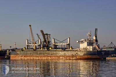
Bulk Carrier
Current Trip
| Time Travelled | 5 days |
|---|---|
| Remaining Time | --- |
| Distance Travelled | 1439.61 nm |
| Remaining Distance | --- |
| AVG Speed | 11 Knopen |
| MAX Speed | 13.6 Knopen |
| AVG Wind | 14.8 knots |
| MAX Wind | 29 knots |
| MIN Temp | 9.5°C / 49.1°F |
| MAX Temp | 24.3°C / 75.74°F |
| Diepgang | 12.8 M |
| Positie ontvangen | 2 m geleden |
Current Position
| Lengtegraad | 114.10843° |
|---|---|
| Breedtegraat | 22.25860° |
| Status | At anchor |
| Snelheid | 0.1 Knopen |
| Koers | 171° |
| Gebied | South China Sea |
| Station | T-AIS |
| Positie ontvangen | 2 m geleden |
Info
Information
The current position of MARIGOULA is in South China Sea with coordinates 22.25860° / 114.10843° as reported on 2024-05-10 02:34 by AIS to our vessel tracker app. The vessel's current speed is 0.1 Knopen
The vessel MARIGOULA (IMO: 9617662, MMSI: 538005001) is a Bulk Carrier that was built in 2013 ( 11 Jaar oud ). It's sailing under the flag of [MH] Marshall Is.
In this page you can find informations about the vessels current position, last detected port calls, and current voyage information. If the vessels is not in coverage by AIS you will find the latest position.
The current position of MARIGOULA is detected by our AIS receivers and we are not responsible for the reliability of the data. The last position was recorded while the vessel was in Coverage by the Ais receivers of our vessel tracking app.
The current draught of MARIGOULA as reported by AIS is 12.8 meters
Weather
| Temperature | 24.2°C / 75.56°F |
|---|---|
| Wind Speed | 19 knots |
| Direction | 87° E |
| Pressure | 1016.4 hPa |
| Humidity | 81.3 % |
| Cloud Coverage | 72 % |
Featured Company
Last Port Calls
| Port | Arrival | Departure | Time In Port |
|---|---|---|---|
| 2024-04-26 19:27 | 2024-05-04 09:08 | 7 d | |
| 2024-04-20 16:43 | 2024-04-22 12:03 | 1 d | |
| 2024-04-15 08:05 | |||
| 2024-03-13 05:20 |
Most Visited Ports (Last year)
| Port | Arrivals | |
|---|---|---|
| 3 | ||
| 2 | ||
| 2 | ||
| 1 | ||
| 1 | ||
| 1 |
Last Trips
| Origin | Departure | Destination | Arrival | Distance | |
|---|---|---|---|---|---|
| 2024-04-22 20:03 | 2024-04-27 03:27 | 201.31 nm | |||
| 2024-03-13 08:20 | 2024-04-15 16:05 | 8396.92 nm |
Events
| Tijd | Evenement | Details | Positie / Bestemming | Info |
|---|---|---|---|---|
| 2024-05-09 22:10 | Status Changed | At anchor Default |
22.25817 / 114.10744
HONG KONG
|
Snelheid: 0.1 kn Koers: 125° |
| 2024-05-09 22:07 | Status Changed | Default At anchor |
22.25808 / 114.10748
HONG KONG
|
Snelheid: 0.1 kn Koers: 127° |
| 2024-05-09 21:07 | Status Changed | At anchor Default |
22.25602 / 114.10699
HONG KONG
|
Snelheid: 0.3 kn Koers: 47° |
| 2024-05-09 21:00 | Status Changed | Default At anchor |
22.25563 / 114.10721
HONG KONG
|
Snelheid: 0.3 kn Koers: 41° |
| 2024-05-09 14:10 | Status Changed | At anchor Under way using engine |
22.25834 / 114.10679
HONG KONG
|
Snelheid: 0.1 kn Koers: 131° |
| 2024-05-09 13:50 | Stop beweging | 4.49 nm, South West of HONG KONG |
22.25675 / 114.10772
HONG KONG
|
Snelheid: 0.2 kn Koers: 119° |
| 2024-05-09 09:45 | Status Changed | Under way using engine Default |
22.13186 / 114.60426
HONG KONG
|
Snelheid: 12.2 kn Koers: 266° |
| 2024-05-09 09:44 | Status Changed | Default Under way using engine |
22.13199 / 114.60794
HONG KONG
|
Snelheid: 12.1 kn Koers: 266.5° |
| 2024-05-09 09:39 | Status Changed | Under way using engine Default |
22.13286 / 114.62665
HONG KONG
|
Snelheid: 12.1 kn Koers: 267° |
| 2024-05-09 09:28 | Status Changed | Default Under way using engine |
22.13448 / 114.66574
HONG KONG
|
Snelheid: 12.1 kn Koers: 267.4° |