

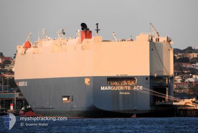
MARGUERITE ACE
Vehicles Carrier

Current Trip
| Time Travelled | 19 h, 1 mins |
|---|---|
| Remaining Time | --- |
| Distance Travelled | 185.75 nm |
| Remaining Distance | --- |
| AVG Speed | 15.9 Knopen |
| MAX Speed | 17.9 Knopen |
| AVG Wind | 5.2 knots |
| MAX Wind | 7.3 knots |
| MIN Temp | 6.2°C / 43.16°F |
| MAX Temp | 9.2°C / 48.56°F |
| Diepgang | 8.1 M |
| Positie ontvangen | 15 d geleden |
Current Position
| Lengtegraad | --- |
|---|---|
| Breedtegraat | --- |
| Status | Under way using engine |
| Snelheid | 15.4 Knopen |
| Koers | 84.5° |
| Gebied | Singapore Strait |
| Station | T-AIS |
| Positie ontvangen | 15 d geleden |
Information
The current position of MARGUERITE ACE is in Singapore Strait with coordinates 1.25342° / 104.18645° as reported on 2025-02-12 12:32 by AIS to our vessel tracker app. The vessel's current speed is 15.4 Knopen and is heading at the port of BATANGAS.
The vessel MARGUERITE ACE (IMO: 9426386, MMSI: 372158000) is a Vehicles Carrier that was built in 2009 ( 16 Jaar oud ). It's sailing under the flag of [PA] Panama.
In this page you can find informations about the vessels current position, last detected port calls, and current voyage information. If the vessels is not in coverage by AIS you will find the latest position.
The current position of MARGUERITE ACE is detected by our AIS receivers and we are not responsible for the reliability of the data. The last position was recorded while the vessel was in Coverage by the Ais receivers of our vessel tracking app.
The current draught of MARGUERITE ACE as reported by AIS is 8.1 meters
Weather
| Temperature | 9.6°C / 49.28°F |
|---|---|
| Wind Speed | 7 knots |
| Direction | 75° ENE |
| Pressure | 1019.4 hPa |
| Humidity | 94.6 % |
| Cloud Coverage | 84 % |

Featured Company
Last Port Calls
| Port | Arrival | Departure | Time In Port |
|---|---|---|---|
| 2025-02-26 20:05 | 2025-02-27 13:57 | 17 h | |
| 2025-02-24 23:29 | 2025-02-25 14:37 | 15 h | |
| 2025-02-18 20:29 | 2025-02-19 11:18 | 14 h | |
| 2025-02-11 22:57 | 2025-02-12 10:54 | 11 h | |
| 2025-02-07 21:00 | 2025-02-08 13:27 | 16 h | |
| 2025-01-31 14:20 | 2025-02-01 23:48 | 1 d | |
| 2025-01-29 20:54 | 2025-01-30 23:36 | 1 d | |
| 2025-01-20 16:55 | 2025-01-21 03:24 | 10 h | |
| 2025-01-18 05:21 | 2025-01-19 13:43 | 1 d | |
| 2025-01-05 01:33 | 2025-01-05 17:41 | 16 h |
Last Trips
| Origin | Departure | Destination | Arrival | Distance | |
|---|---|---|---|---|---|
| 2025-02-25 22:37 | 2025-02-27 04:05 | 390.91 nm | |||
| 2025-02-19 19:18 | 2025-02-25 07:29 | 1740.97 nm | |||
| 2025-02-12 18:54 | 2025-02-19 04:29 | 1397.37 nm | |||
| 2025-02-08 18:57 | 2025-02-12 06:57 | 1472.95 nm | |||
| 2025-02-02 02:48 | 2025-02-08 02:30 | 2618.26 nm | |||
| 2025-01-31 02:36 | 2025-01-31 17:20 | 198.29 nm | |||
| 2025-01-21 05:24 | 2025-01-29 23:54 | 1763.89 nm | |||
| 2025-01-19 15:43 | 2025-01-20 18:55 | 339.29 nm | |||
| 2025-01-06 01:41 | 2025-01-18 07:21 | 5003.66 nm | |||
| 2024-12-29 22:18 | 2025-01-05 09:33 | 2911.20 nm |
Events
| Tijd | Evenement | Details | Positie / Bestemming | Info |
|---|---|---|---|---|
| 2025-02-27 13:57 | Vertrekhaven |
|
34.74813 / 119.53292
PH BTG
|
Snelheid: 11.1 kn Koers: 63° |
| 2025-02-27 13:13 | Start beweging |
34.75191 / 119.38470
[CN] LIANYUNGANG
|
Snelheid: 4.2 kn Koers: 89° |
|
| 2025-02-26 20:06 | Stop beweging |
34.75160 / 119.37975
[CN] LIANYUNGANG
|
Snelheid: 0.2 kn Koers: 99° |
|
| 2025-02-26 20:05 | Aankomsthaven |
|
34.75160 / 119.37975
[CN] LIANYUNGANG
|
Snelheid: 0.7 kn Koers: 229° |
| 2025-02-25 14:37 | Vertrekhaven |
|
37.58145 / 121.42964
PH BTG
|
Snelheid: 11.5 kn Koers: 64° |
| 2025-02-25 14:25 | Start beweging |
37.56677 / 121.39484
[CN] YANTAI
|
Snelheid: 6.3 kn Koers: 62° |
|
| 2025-02-25 00:01 | Stop beweging |
37.56302 / 121.37579
[CN] YANTAI
|
Snelheid: 0.3 kn Koers: 178° |
|
| 2025-02-24 23:29 | Aankomsthaven |
|
37.57868 / 121.41983
[CN] YANTAI
|
Snelheid: 11 kn Koers: 251° |
| 2025-02-24 18:09 | Start beweging |
38.19748 / 122.11717
PH BTG
|
Snelheid: 6.3 kn Koers: 149° |
|
| 2025-02-24 10:25 | Stop beweging |
38.19413 / 122.01461
PH BTG
|
Snelheid: Koers: 198° |