
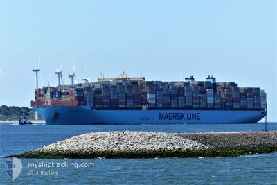
MAREN MAERSK
Cargo A
Current Trip
| Time Travelled | 11 days |
|---|---|
| Remaining Time | 12 days |
| Distance Travelled | 5281.80 nm |
| Remaining Distance | 5613.05 nm |
| AVG Speed | 19.3 Knopen |
| MAX Speed | 21 Knopen |
| AVG Wind | 12 knots |
| MAX Wind | 21.3 knots |
| MIN Temp | 16.8°C / 62.24°F |
| MAX Temp | 28.9°C / 84.02°F |
| Diepgang | 16 M |
| Positie ontvangen | 5 m geleden |
Current Position
| Lengtegraad | 18.30858° |
|---|---|
| Breedtegraat | -35.00657° |
| Status | Under way using engine |
| Snelheid | 19.6 Knopen |
| Koers | 131.6° |
| Gebied | South Atlantic Ocean |
| Station | T-AIS |
| Positie ontvangen | 5 m geleden |
Info
Information
The current position of MAREN MAERSK is in South Atlantic Ocean with coordinates -35.00657° / 18.30858° as reported on 2024-04-28 18:24 by AIS to our vessel tracker app. The vessel's current speed is 19.6 Knopen and is heading at the port of SINGAPORE. The estimated time of arrival as calculated by MyShipTracking vessel tracking app is 2024-05-10 22:02 LT
The vessel MAREN MAERSK (IMO: 9632129, MMSI: 219620000) is a Cargo A It's sailing under the flag of [DK] Denmark.
In this page you can find informations about the vessels current position, last detected port calls, and current voyage information. If the vessels is not in coverage by AIS you will find the latest position.
The current position of MAREN MAERSK is detected by our AIS receivers and we are not responsible for the reliability of the data. The last position was recorded while the vessel was in Coverage by the Ais receivers of our vessel tracking app.
The current draught of MAREN MAERSK as reported by AIS is 16 meters
Weather
| Temperature | 17.3°C / 63.14°F |
|---|---|
| Wind Speed | 19 knots |
| Direction | 345° NNW |
| Pressure | 1012.2 hPa |
| Humidity | 92.7 % |
| Cloud Coverage | 96 % |
Featured Company
Last Port Calls
| Port | Arrival | Departure | Time In Port |
|---|---|---|---|
| 2024-04-16 15:04 | 2024-04-17 11:51 | 20 h | |
| 2024-04-10 11:42 | 2024-04-13 15:09 | 3 d | |
| 2024-04-05 03:10 | 2024-04-06 06:14 | 1 d | |
| 2024-04-03 02:33 | 2024-04-03 21:21 | 18 h | |
| 2024-03-30 16:07 | 2024-04-02 15:41 | 2 d | |
| 2024-03-27 11:14 | 2024-03-29 03:52 | 1 d | |
| 2024-03-25 01:57 | 2024-03-26 15:11 | 1 d | |
| 2024-02-26 23:10 | 2024-02-28 17:20 | 1 d | |
| 2024-02-20 15:39 | 2024-02-22 05:20 | 1 d | |
| 2024-02-10 04:14 | 2024-02-11 21:35 | 1 d |
Most Visited Ports (Last year)
| Port | Arrivals | |
|---|---|---|
| 8 | ||
| 7 | ||
| 4 | ||
| 4 | ||
| 4 | ||
| 4 |
Last Trips
| Origin | Departure | Destination | Arrival | Distance | |
|---|---|---|---|---|---|
| 2024-04-13 16:09 | 2024-04-16 16:04 | 1371.24 nm | |||
| 2024-04-06 08:14 | 2024-04-10 12:42 | 383.29 nm | |||
| 2024-04-03 23:21 | 2024-04-05 05:10 | 507.71 nm | |||
| 2024-04-02 17:41 | 2024-04-03 04:33 | 139.05 nm | |||
| 2024-03-29 04:52 | 2024-03-30 17:07 | 391.11 nm | |||
| 2024-03-26 16:11 | 2024-03-27 12:14 | 275.07 nm | |||
| 2024-02-29 01:20 | 2024-03-25 02:57 | 11835.83 nm | |||
| 2024-02-22 13:20 | 2024-02-27 07:10 | 2190.61 nm | |||
| 2024-02-12 05:35 | 2024-02-20 23:39 | 2282.73 nm | |||
| 2023-12-24 18:53 | 2024-02-10 12:14 | 13544.64 nm |
Events
| Tijd | Evenement | Details | Positie / Bestemming | Info |
|---|---|---|---|---|
| 2024-04-28 18:24 | Status Changed | Under way using engine Default |
-35.00657 / 18.30858
MAPTM > SGSIN
|
Snelheid: 20 kn Koers: 132° |
| 2024-04-28 17:39 | Status Changed | Default Under way using engine |
-34.82881 / 18.10318
MAPTM > SGSIN
|
Snelheid: 19.4 kn Koers: 138.4° |
| 2024-04-28 17:17 | Status Changed | Under way using engine Default |
-34.73923 / 18.01167
MAPTM > SGSIN
|
Snelheid: 19.2 kn Koers: 147° |
| 2024-04-28 17:02 | Status Changed | Default Under way using engine |
-34.67166 / 17.96167
MAPTM > SGSIN
|
Snelheid: 19.2 kn Koers: 145.4° |
| 2024-04-28 16:12 | Status Changed | Under way using engine Default |
-34.48612 / 17.73552
MAPTM > SGSIN
|
Snelheid: 19 kn Koers: 131° |
| 2024-04-28 16:04 | Status Changed | Default Under way using engine |
-34.45542 / 17.69495
MAPTM > SGSIN
|
Snelheid: 19.6 kn Koers: 132.5° |
| 2024-04-28 15:54 | Status Changed | Under way using engine Default |
-34.41953 / 17.64835
MAPTM > SGSIN
|
Snelheid: 19 kn Koers: 132° |
| 2024-04-28 15:43 | Status Changed | Default Under way using engine |
-34.37800 / 17.59318
MAPTM > SGSIN
|
Snelheid: 19.1 kn Koers: 127.3° |
| 2024-04-28 15:34 | Status Changed | Under way using engine Default |
-34.35222 / 17.55182
MAPTM > SGSIN
|
Snelheid: 19 kn Koers: 125° |
| 2024-04-28 14:53 | Status Changed | Default Under way using engine |
-34.21667 / 17.34333
MAPTM > SGSIN
|
Snelheid: 19.1 kn Koers: 134.5° |